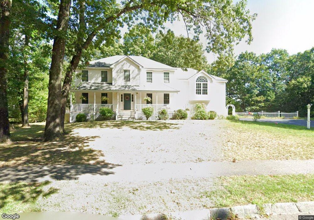
128 Adams St Dunstable, MA 01827
Estimated Value: $832,000 - $886,000
4
Beds
3
Baths
2,742
Sq Ft
$309/Sq Ft
Est. Value
About This Home
This home is located at 128 Adams St, Dunstable, MA 01827 and is currently estimated at $848,497, approximately $309 per square foot. 128 Adams St is a home located in Middlesex County with nearby schools including Groton Dunstable Regional High School and Maple Dene & Moppet School.
Ownership History
Date
Name
Owned For
Owner Type
Purchase Details
Closed on
Nov 27, 2023
Sold by
Wetmore Patrick J and Wetmore Michelle M
Bought by
Darnell Amanda
Current Estimated Value
Home Financials for this Owner
Home Financials are based on the most recent Mortgage that was taken out on this home.
Original Mortgage
$100,000
Outstanding Balance
$98,025
Interest Rate
7.57%
Mortgage Type
Purchase Money Mortgage
Estimated Equity
$750,472
Purchase Details
Closed on
Dec 12, 2003
Sold by
Nadolski David T and Nadolski Linda H
Bought by
Wetmore Michelle M and Wetmore Patrick J
Home Financials for this Owner
Home Financials are based on the most recent Mortgage that was taken out on this home.
Original Mortgage
$322,700
Interest Rate
5.9%
Mortgage Type
Purchase Money Mortgage
Purchase Details
Closed on
Nov 16, 2000
Sold by
Lot 35 Adams St Rt and Bushnell
Bought by
Nadolski David T and Nadolski Linda H
Purchase Details
Closed on
Apr 26, 2000
Sold by
Unkety Brook Inc
Bought by
Lot 35 Adams St Rt and Bushnell
Create a Home Valuation Report for This Property
The Home Valuation Report is an in-depth analysis detailing your home's value as well as a comparison with similar homes in the area
Home Values in the Area
Average Home Value in this Area
Purchase History
| Date | Buyer | Sale Price | Title Company |
|---|---|---|---|
| Darnell Amanda | $735,000 | None Available | |
| Wetmore Michelle M | $504,750 | -- | |
| Wetmore Michelle M | $504,750 | -- | |
| Nadolski David T | $400,000 | -- | |
| Lot 35 Adams St Rt | $104,900 | -- |
Source: Public Records
Mortgage History
| Date | Status | Borrower | Loan Amount |
|---|---|---|---|
| Open | Darnell Amanda | $100,000 | |
| Previous Owner | Lot 35 Adams St Rt | $300,000 | |
| Previous Owner | Wetmore Michelle M | $322,700 | |
| Previous Owner | Lot 35 Adams St Rt | $303,750 |
Source: Public Records
Tax History
| Year | Tax Paid | Tax Assessment Tax Assessment Total Assessment is a certain percentage of the fair market value that is determined by local assessors to be the total taxable value of land and additions on the property. | Land | Improvement |
|---|---|---|---|---|
| 2025 | $10,490 | $762,900 | $206,900 | $556,000 |
| 2024 | $10,208 | $731,200 | $203,400 | $527,800 |
| 2023 | $10,115 | $675,700 | $203,400 | $472,300 |
| 2022 | $9,240 | $605,900 | $203,400 | $402,500 |
| 2021 | $15,573 | $552,800 | $180,400 | $372,400 |
| 2020 | $8,918 | $529,600 | $172,200 | $357,400 |
| 2019 | $8,675 | $508,500 | $172,200 | $336,300 |
| 2018 | $8,553 | $487,600 | $172,100 | $315,500 |
| 2017 | $8,234 | $483,800 | $172,100 | $311,700 |
| 2016 | $7,611 | $459,900 | $147,600 | $312,300 |
| 2015 | $7,779 | $465,000 | $144,400 | $320,600 |
| 2014 | $7,333 | $465,000 | $144,400 | $320,600 |
Source: Public Records
Map
Nearby Homes
- 179 Wyman Rd
- 208 North St
- 319 Pleasant St
- 33 Overlook Dr
- 62 Brook St
- 24 Unkety Brook Way
- 153 Off Pond St
- 660 Old Dunstable Rd
- 114 Groton St
- 29 Tarbell St
- 38 Tarbell St Unit 5B
- 38 Tarbell St Unit 1D
- 91 Chicopee Row
- 2 Wildflower Ln
- 10 Bennett St
- 28-30 Groton St
- 0 Old Dunstable Rd
- 1 Nashua Rd
- 21 High St
- 38 River Rd Unit 11