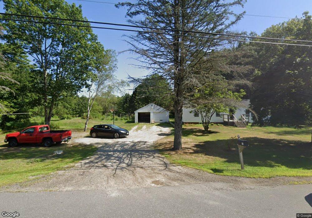
128 Beech Rd Eliot, ME 03903
South Eliot NeighborhoodEstimated Value: $497,000 - $716,896
4
Beds
2
Baths
1,386
Sq Ft
$446/Sq Ft
Est. Value
About This Home
This home is located at 128 Beech Rd, Eliot, ME 03903 and is currently estimated at $617,474, approximately $445 per square foot. 128 Beech Rd is a home located in York County with nearby schools including Marshwood High School and Seacoast Waldorf School.
Ownership History
Date
Name
Owned For
Owner Type
Purchase Details
Closed on
Apr 19, 2023
Sold by
Sullivan Lula A
Bought by
R B
Current Estimated Value
Purchase Details
Closed on
Jun 1, 2015
Sold by
Byron R & Lula Sullivan Ret and Sullivan Lula A
Bought by
Sullivan Byron R and Sullivan Lula A
Purchase Details
Closed on
Oct 13, 2009
Sold by
Sullivan Lula A and Sullivan Byron R
Bought by
Byron & Lula Sullivan Ret and Sullivan Byron R
Create a Home Valuation Report for This Property
The Home Valuation Report is an in-depth analysis detailing your home's value as well as a comparison with similar homes in the area
Home Values in the Area
Average Home Value in this Area
Purchase History
| Date | Buyer | Sale Price | Title Company |
|---|---|---|---|
| R B | -- | None Available | |
| Sullivan Byron R | -- | -- | |
| Byron & Lula Sullivan Ret | -- | -- |
Source: Public Records
Tax History Compared to Growth
Tax History
| Year | Tax Paid | Tax Assessment Tax Assessment Total Assessment is a certain percentage of the fair market value that is determined by local assessors to be the total taxable value of land and additions on the property. | Land | Improvement |
|---|---|---|---|---|
| 2024 | $7,018 | $592,200 | $133,100 | $459,100 |
| 2023 | $6,734 | $549,700 | $126,700 | $423,000 |
| 2022 | $6,216 | $513,700 | $126,700 | $387,000 |
| 2021 | $6,170 | $457,000 | $116,100 | $340,900 |
| 2020 | $3,132 | $395,700 | $110,700 | $285,000 |
| 2019 | $5,817 | $395,700 | $110,700 | $285,000 |
| 2018 | $5,817 | $395,700 | $110,700 | $285,000 |
| 2017 | $2,881 | $395,700 | $110,700 | $285,000 |
| 2016 | $2,742 | $395,700 | $110,700 | $285,000 |
| 2015 | $5,583 | $398,800 | $110,700 | $288,100 |
| 2014 | $5,503 | $398,800 | $110,700 | $288,100 |
| 2013 | $5,252 | $398,800 | $110,700 | $288,100 |
Source: Public Records
Map
Nearby Homes
- 8 Caslyn Dr
- 46 Littlebrook Ln
- 1094 State Rd
- 18 Shipping Ln
- 0 Franks Fort Island Unit 1631886
- 493 Main St
- 92 Wilson Rd
- 18 Governor Hill Rd
- 1708 State Rd
- 0 Goodwin Rd Unit 1646628
- 5 Spinney Way Unit 9
- 197 State Rd
- 10 Pasture Hill Dr
- 32 Regency Cir Unit 2
- Lot 2 Cedar Tbd
- 10 Shipwright Way
- 100 Shepard's Cove Rd Unit F204
- 100 Shepards Cove Rd Unit F204
- 100 Shepards Cove Rd Unit G204
- 36 Shipwright Way