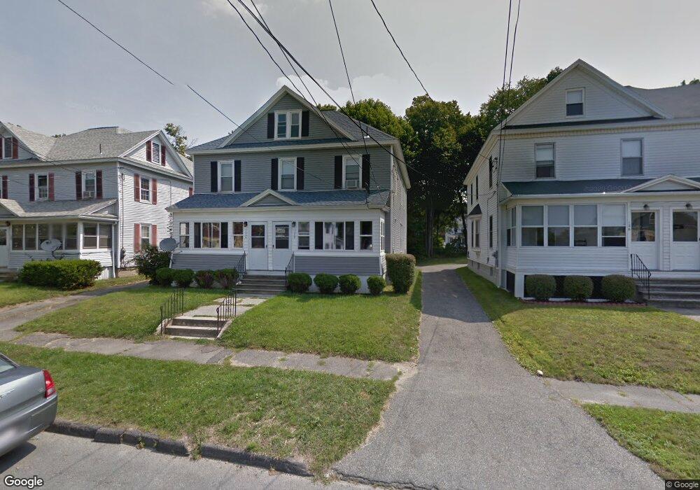
128 Brown St Pittsfield, MA 01201
Estimated Value: $187,000 - $280,000
7
Beds
2
Baths
2,270
Sq Ft
$103/Sq Ft
Est. Value
About This Home
This home is located at 128 Brown St, Pittsfield, MA 01201 and is currently estimated at $234,574, approximately $103 per square foot. 128 Brown St is a home located in Berkshire County with nearby schools including Morningside Community School, Theodore Herberg Middle School, and Pittsfield High School.
Ownership History
Date
Name
Owned For
Owner Type
Purchase Details
Closed on
Nov 15, 1999
Sold by
Department Of Housing & Urban Dev
Bought by
Atiemo George A and Atiemo George Asare
Current Estimated Value
Home Financials for this Owner
Home Financials are based on the most recent Mortgage that was taken out on this home.
Original Mortgage
$47,440
Outstanding Balance
$14,405
Interest Rate
7.68%
Mortgage Type
Purchase Money Mortgage
Estimated Equity
$220,169
Purchase Details
Closed on
May 21, 1999
Sold by
Manderville Arnold
Bought by
Homeside Lending
Purchase Details
Closed on
Aug 1, 1997
Sold by
Coffey Henrietta A and Coffey Patricia A
Bought by
Maderville Andrea and Manderville Arnold R
Create a Home Valuation Report for This Property
The Home Valuation Report is an in-depth analysis detailing your home's value as well as a comparison with similar homes in the area
Home Values in the Area
Average Home Value in this Area
Purchase History
| Date | Buyer | Sale Price | Title Company |
|---|---|---|---|
| Atiemo George A | $59,300 | -- | |
| Atiemo George A | $59,300 | -- | |
| Homeside Lending | $99,409 | -- | |
| Homeside Lending | $99,409 | -- | |
| Maderville Andrea | $47,000 | -- | |
| Maderville Andrea | $47,000 | -- |
Source: Public Records
Mortgage History
| Date | Status | Borrower | Loan Amount |
|---|---|---|---|
| Open | Maderville Andrea | $47,440 | |
| Closed | Maderville Andrea | $47,440 | |
| Previous Owner | Maderville Andrea | $86,450 |
Source: Public Records
Tax History Compared to Growth
Tax History
| Year | Tax Paid | Tax Assessment Tax Assessment Total Assessment is a certain percentage of the fair market value that is determined by local assessors to be the total taxable value of land and additions on the property. | Land | Improvement |
|---|---|---|---|---|
| 2025 | $4,123 | $229,800 | $32,600 | $197,200 |
| 2024 | $3,773 | $204,500 | $32,600 | $171,900 |
| 2023 | $3,473 | $189,600 | $32,600 | $157,000 |
| 2022 | $3,335 | $179,700 | $32,600 | $147,100 |
| 2021 | $3,055 | $158,700 | $32,600 | $126,100 |
| 2020 | $3,045 | $154,500 | $32,600 | $121,900 |
| 2019 | $2,837 | $146,100 | $30,800 | $115,300 |
| 2018 | $2,817 | $140,800 | $30,800 | $110,000 |
| 2017 | $2,801 | $142,700 | $35,400 | $107,300 |
| 2016 | $2,730 | $145,500 | $35,400 | $110,100 |
| 2015 | $2,628 | $145,500 | $35,400 | $110,100 |
Source: Public Records
Map
Nearby Homes
- LOT 20 Plunkett St
- 24 Glenwood Ave
- 52 Brown St
- 48 Brown St
- 29 Glenwood Ave
- 41 Perrine Ave
- 40 Roland St
- 11 Stanley Ave
- 156 Draper Ave
- 81 Dartmouth St Unit 205
- 81 Dartmouth St Unit 102
- 26 Springside Ave
- 98 Lincoln St
- 9 Myrtle St
- 68 Orchard St
- 71 Maplewood Ave
- 762 East St
- 51 Adam St
- 34 Lenox Ave
- 33 Maplewood Ave Unit 305