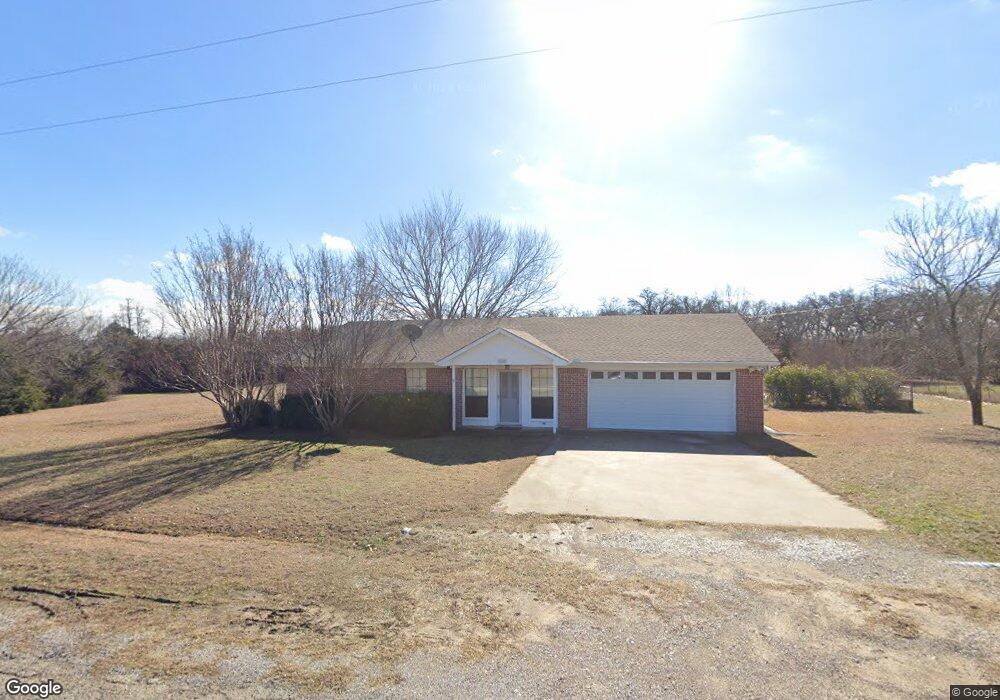
128 Christopher Ct Weatherford, TX 76088
Estimated Value: $340,962 - $390,000
--
Bed
--
Bath
1,552
Sq Ft
$237/Sq Ft
Est. Value
About This Home
This home is located at 128 Christopher Ct, Weatherford, TX 76088 and is currently estimated at $367,241, approximately $236 per square foot. 128 Christopher Ct is a home located in Parker County with nearby schools including Seguin Elementary School, Tison Middle School, and Weatherford High School.
Ownership History
Date
Name
Owned For
Owner Type
Purchase Details
Closed on
Sep 11, 2015
Sold by
Perott Beverly E
Bought by
Mclaughlin Jana J and Perott Beverly E
Current Estimated Value
Purchase Details
Closed on
Dec 2, 2014
Sold by
Perott Joseph W and Perott Beverly E
Bought by
Perott Beverly E Life Estate
Purchase Details
Closed on
Jun 15, 2000
Sold by
Hein David and Hein Stefanie E
Bought by
Perott Beverly E Life Estate
Purchase Details
Closed on
Jan 13, 1997
Bought by
Perott Beverly E Life Estate
Purchase Details
Closed on
Aug 15, 1996
Bought by
Perott Beverly E Life Estate
Purchase Details
Closed on
Jan 1, 1901
Bought by
Perott Beverly E Life Estate
Create a Home Valuation Report for This Property
The Home Valuation Report is an in-depth analysis detailing your home's value as well as a comparison with similar homes in the area
Home Values in the Area
Average Home Value in this Area
Purchase History
| Date | Buyer | Sale Price | Title Company |
|---|---|---|---|
| Mclaughlin Jana J | -- | None Available | |
| Perott Beverly E Life Estate | -- | -- | |
| Perott Beverly E Life Estate | -- | -- | |
| Perott Beverly E Life Estate | -- | -- | |
| Perott Beverly E Life Estate | -- | -- | |
| Perott Beverly E Life Estate | -- | -- |
Source: Public Records
Tax History Compared to Growth
Tax History
| Year | Tax Paid | Tax Assessment Tax Assessment Total Assessment is a certain percentage of the fair market value that is determined by local assessors to be the total taxable value of land and additions on the property. | Land | Improvement |
|---|---|---|---|---|
| 2025 | $883 | $256,000 | -- | -- |
| 2024 | $883 | $232,727 | -- | -- |
| 2023 | $883 | $211,570 | $0 | $0 |
| 2022 | $3,581 | $259,010 | $62,930 | $196,080 |
| 2021 | $3,529 | $259,010 | $62,930 | $196,080 |
| 2020 | $3,224 | $180,620 | $39,320 | $141,300 |
| 2019 | $3,127 | $180,620 | $39,320 | $141,300 |
| 2018 | $2,858 | $131,370 | $21,200 | $110,170 |
| 2017 | $2,916 | $131,370 | $21,200 | $110,170 |
| 2016 | $2,730 | $122,990 | $21,200 | $101,790 |
| 2015 | $1,225 | $122,990 | $21,200 | $101,790 |
| 2014 | $1,239 | $102,090 | $21,200 | $80,890 |
Source: Public Records
Map
Nearby Homes
- 2124 Pepperdine Dr
- Lot 11 Pepperdine Dr
- Lot 12 Pepperdine Dr
- Lot 10 Pepperdine Dr
- 2117 Pepperdine Dr
- 105 Oxford Ct
- 125 Odel Dr
- 2000 Vanderbilt Dr
- 905 Zion Hill Rd
- 2016 Vanderbilt Dr
- 2020 Vanderbilt Dr
- 109 Odel Dr
- 104 Lagrange Ct
- 3004 Greg Allen Dr
- 1835 N Main St
- 107 Hall St
- 1301 Zion Hill Loop
- 1813 Roadrunner Dr
- 1829 N Main St
- 3004 Parker Meadows Ct
- 120 Christopher Ct
- 136 Christopher Ct
- 116 Christopher Ct
- 129 Christopher Ct
- 112 Christopher Ct
- 137 Christopher Ct
- 140 Christopher Ct
- 108 Christopher Ct
- 156 Eaton Ct
- 109 Christopher Ct
- 520 Mcfarland Ln
- 458 Mcfarland Ln
- 500 Mcfarland Ln
- 544 Mcfarland Ln
- 406 Mcfarland Ln
- 552 Mcfarland Ln
- 113 Christopher Ct
- 000 Mcfarland Ln
- 0000 Mcfarland Ln
- 384 Mcfarland Ln