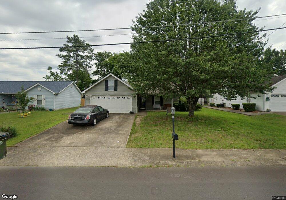
128 Colony Cir Fort Oglethorpe, GA 30742
Estimated Value: $245,305 - $280,000
--
Bed
--
Bath
1,208
Sq Ft
$218/Sq Ft
Est. Value
About This Home
This home is located at 128 Colony Cir, Fort Oglethorpe, GA 30742 and is currently estimated at $263,826, approximately $218 per square foot. 128 Colony Cir is a home with nearby schools including Battlefield Primary School, Battlefield Elementary School, and Lakeview Middle School.
Ownership History
Date
Name
Owned For
Owner Type
Purchase Details
Closed on
Oct 30, 2017
Sold by
Moss Ted C
Bought by
Northwest Mountain Investments
Current Estimated Value
Purchase Details
Closed on
Apr 18, 2013
Sold by
Volunteer Llc
Bought by
Moss Ted C
Purchase Details
Closed on
Dec 30, 2011
Sold by
Colony L P A Tennessee
Bought by
Volunteer Llc
Purchase Details
Closed on
Jun 30, 2000
Bought by
Colony L P A Tennessee
Create a Home Valuation Report for This Property
The Home Valuation Report is an in-depth analysis detailing your home's value as well as a comparison with similar homes in the area
Home Values in the Area
Average Home Value in this Area
Purchase History
| Date | Buyer | Sale Price | Title Company |
|---|---|---|---|
| Northwest Mountain Investments | $879,710 | -- | |
| Moss Ted C | -- | -- | |
| Volunteer Llc | -- | -- | |
| Colony L P A Tennessee | $477,000 | -- |
Source: Public Records
Tax History Compared to Growth
Tax History
| Year | Tax Paid | Tax Assessment Tax Assessment Total Assessment is a certain percentage of the fair market value that is determined by local assessors to be the total taxable value of land and additions on the property. | Land | Improvement |
|---|---|---|---|---|
| 2024 | $2,348 | $89,260 | $11,000 | $78,260 |
| 2023 | $1,847 | $70,186 | $11,000 | $59,186 |
| 2022 | $1,513 | $53,879 | $11,000 | $42,879 |
| 2021 | $1,435 | $53,879 | $11,000 | $42,879 |
| 2020 | $1,426 | $48,309 | $11,000 | $37,309 |
| 2019 | $1,381 | $46,309 | $9,000 | $37,309 |
| 2018 | $1,451 | $46,309 | $9,000 | $37,309 |
| 2017 | $1,362 | $43,454 | $7,200 | $36,254 |
| 2016 | $1,335 | $40,762 | $7,200 | $33,562 |
| 2015 | -- | $40,762 | $7,200 | $33,562 |
| 2014 | -- | $40,762 | $7,200 | $33,562 |
| 2013 | -- | $36,240 | $7,200 | $29,885 |
Source: Public Records
Map
Nearby Homes
- 124 Colony Cir
- 351 Franklin Cir
- 183 McDonald Dr
- 6 Rocky Ford Rd
- 17 Southshore Dr
- 180 Gem Dr
- 1305 Park Forrest Dr
- 1002 Cedar Creek Dr
- 129 Cedar Grove Ln
- 17 Evergreen Cir
- 64 Yellow Brick Rd
- 325 Mockingbird Ln
- 15 Evelyn Dr
- 18 Evergreen Cir
- 300 Dogwood Ln
- 301 Dogwood Ln
- 2237 Cloud Springs Rd
- 64 Stovall St
- 544 Neal Dr
- 14 Evergreen Cir
- 214 Colony Cir
- 126 Colony Cir
- 226 Colony Cir
- 268 Franklin Cir
- 268 Franklin Cir
- 129 Colony Cir
- 280 Franklin Cir
- 127 Colony Cir
- 215 Colony Cir
- 125 Colony Cir
- 122 Colony Cir
- 233 Colony Cir
- 236 Colony Cir
- 257 Colony Cir
- 123 Colony Cir
- 290 Franklin Circle Dr
- 250 Colony Cir
- 120 Colony Cir
- 121 Colony Cir
- 304 Franklin Cir