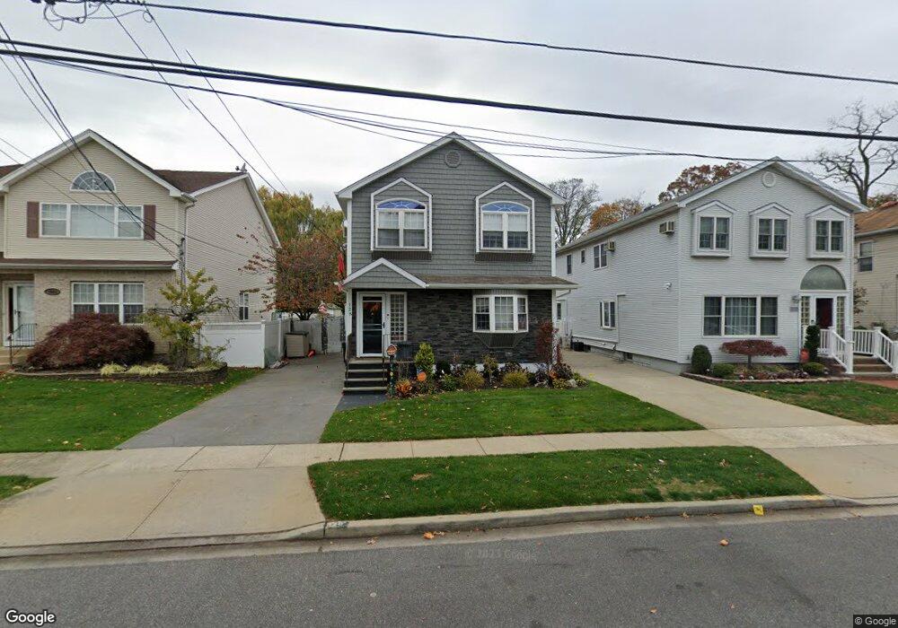
128 Commonwealth Ave Merrick, NY 11566
Estimated Value: $734,737
--
Bed
2
Baths
1,936
Sq Ft
$380/Sq Ft
Est. Value
About This Home
This home is located at 128 Commonwealth Ave, Merrick, NY 11566 and is currently estimated at $734,737, approximately $379 per square foot. 128 Commonwealth Ave is a home located in Nassau County with nearby schools including Merrick Avenue Middle School, Sanford H Calhoun High School, and Grace Christian Academy.
Ownership History
Date
Name
Owned For
Owner Type
Purchase Details
Closed on
Sep 1, 2021
Sold by
Algarin Nilda
Bought by
Alcantara Luis Francisco
Current Estimated Value
Home Financials for this Owner
Home Financials are based on the most recent Mortgage that was taken out on this home.
Original Mortgage
$548,000
Interest Rate
2.8%
Mortgage Type
VA
Purchase Details
Closed on
Jun 12, 2003
Sold by
Winterfeldt Robert
Bought by
Algarin Nilda
Purchase Details
Closed on
Oct 17, 1996
Sold by
Savino Joseph Mary
Bought by
Winterfeldt Robert and Winterfeldt Penny
Create a Home Valuation Report for This Property
The Home Valuation Report is an in-depth analysis detailing your home's value as well as a comparison with similar homes in the area
Home Values in the Area
Average Home Value in this Area
Purchase History
| Date | Buyer | Sale Price | Title Company |
|---|---|---|---|
| Alcantara Luis Francisco | -- | None Available | |
| Algarin Nilda | $499,900 | -- | |
| Winterfeldt Robert | $227,000 | -- |
Source: Public Records
Mortgage History
| Date | Status | Borrower | Loan Amount |
|---|---|---|---|
| Previous Owner | Alcantara Luis Francisco | $548,000 |
Source: Public Records
Tax History Compared to Growth
Tax History
| Year | Tax Paid | Tax Assessment Tax Assessment Total Assessment is a certain percentage of the fair market value that is determined by local assessors to be the total taxable value of land and additions on the property. | Land | Improvement |
|---|---|---|---|---|
| 2025 | $11,372 | $521 | $209 | $312 |
| 2024 | $2,770 | $524 | $211 | $313 |
| 2023 | $11,773 | $550 | $221 | $329 |
| 2022 | $11,773 | $547 | $195 | $352 |
| 2021 | $24,278 | $525 | $187 | $338 |
| 2020 | $18,699 | $983 | $500 | $483 |
| 2019 | $4,571 | $983 | $500 | $483 |
| 2018 | $4,362 | $983 | $0 | $0 |
| 2017 | $11,345 | $986 | $500 | $486 |
| 2016 | $15,565 | $986 | $500 | $486 |
| 2015 | $3,913 | $986 | $500 | $486 |
| 2014 | $3,913 | $986 | $500 | $486 |
| 2013 | $3,702 | $986 | $500 | $486 |
Source: Public Records
Map
Nearby Homes
- 179 Commonwealth Ave
- 25 Babylon Turnpike
- 1931 Miller Place
- 2291 Girard Place
- 96 Thelma Ave
- 2991 Girard Place
- 1818 Gormley Ave
- 1690 Argyle Rd
- 10 Central Pkwy
- 131 Gregory Ave
- 1729 Gormley Ave
- 49 Princeton Place
- 1674 Birch Dr
- 1707 Carroll Ave
- 1938 Meadowbrook Rd
- 138 Hewlett Ave
- 1922 Horatio Ave
- 19 Margaret Blvd
- 78 Jesse St
- 45 Lakeview Ave
- 126 Commonwealth Ave
- 1823 Commonwealth Ave
- 122 Commonwealth Ave
- 1817 Commonwealth Ave
- 120 Commonwealth Ave
- 165 Smith St
- 161 Smith St
- 1811 Commonwealth Ave
- 169 Smith St
- 157 Smith St
- 69 Washington St
- 1824 Commonwealth Ave
- 133 Commonwealth Ave
- 1832 Commonwealth Ave
- 129 Commonwealth Ave
- 127 Commonwealth Ave
- 2146 Washington St
- 119 Commonwealth Ave
- 1818 Commonwealth Ave
- 179 Smith St