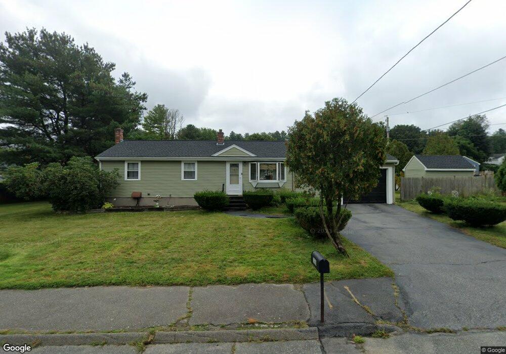
128 Conrad Rd Marlborough, MA 01752
Estimated Value: $548,000 - $573,338
3
Beds
2
Baths
1,224
Sq Ft
$458/Sq Ft
Est. Value
About This Home
This home is located at 128 Conrad Rd, Marlborough, MA 01752 and is currently estimated at $560,335, approximately $457 per square foot. 128 Conrad Rd is a home located in Middlesex County with nearby schools including Marlborough High School, Advanced Math & Science Academy, and St. Bernadette School.
Ownership History
Date
Name
Owned For
Owner Type
Purchase Details
Closed on
May 15, 2008
Sold by
Maida David J and Maida Gladys
Bought by
Maida David J
Current Estimated Value
Purchase Details
Closed on
Jun 25, 2001
Sold by
Wilcox Ft and Leduc Sandra Jean
Bought by
Maida David J and Maida Gladys
Home Financials for this Owner
Home Financials are based on the most recent Mortgage that was taken out on this home.
Original Mortgage
$241,070
Interest Rate
7.09%
Mortgage Type
Purchase Money Mortgage
Create a Home Valuation Report for This Property
The Home Valuation Report is an in-depth analysis detailing your home's value as well as a comparison with similar homes in the area
Home Values in the Area
Average Home Value in this Area
Purchase History
| Date | Buyer | Sale Price | Title Company |
|---|---|---|---|
| Maida David J | $243,000 | -- | |
| Maida David J | $243,000 | -- |
Source: Public Records
Mortgage History
| Date | Status | Borrower | Loan Amount |
|---|---|---|---|
| Previous Owner | Maida David J | $241,070 |
Source: Public Records
Tax History Compared to Growth
Tax History
| Year | Tax Paid | Tax Assessment Tax Assessment Total Assessment is a certain percentage of the fair market value that is determined by local assessors to be the total taxable value of land and additions on the property. | Land | Improvement |
|---|---|---|---|---|
| 2025 | $4,677 | $474,300 | $235,000 | $239,300 |
| 2024 | $4,729 | $461,800 | $213,600 | $248,200 |
| 2023 | $5,005 | $433,700 | $173,300 | $260,400 |
| 2022 | $4,879 | $371,900 | $165,000 | $206,900 |
| 2021 | $4,880 | $353,600 | $137,500 | $216,100 |
| 2020 | $4,834 | $340,900 | $130,900 | $210,000 |
| 2019 | $4,436 | $315,300 | $128,300 | $187,000 |
| 2018 | $4,074 | $278,500 | $105,900 | $172,600 |
| 2017 | $3,775 | $246,400 | $104,100 | $142,300 |
| 2016 | $3,649 | $237,900 | $104,100 | $133,800 |
| 2015 | $3,644 | $231,200 | $112,200 | $119,000 |
Source: Public Records
Map
Nearby Homes
- 28 Sandini Rd
- 55 Hurley Cir
- 72 Foley Rd
- 120 Airport Blvd
- 10 Masciarelli Dr
- 0 Dudley St
- 5 Damico Dr
- 206 Millham St
- 149 Clover Hill St
- 115 Winter St
- 237 Millham St
- 490 Main St Unit 210
- 490 Main St Unit 101
- 280 Elm St Unit A6
- 30A Winter Ave
- 76 Broad St
- 30 Broad St Unit 104
- 28 Broad St Unit 203
- 287 Elm St
- 38 Gleason Street Extension