Estimated Value: $115,450 - $199,000
3
Beds
1
Bath
1,244
Sq Ft
$117/Sq Ft
Est. Value
About This Home
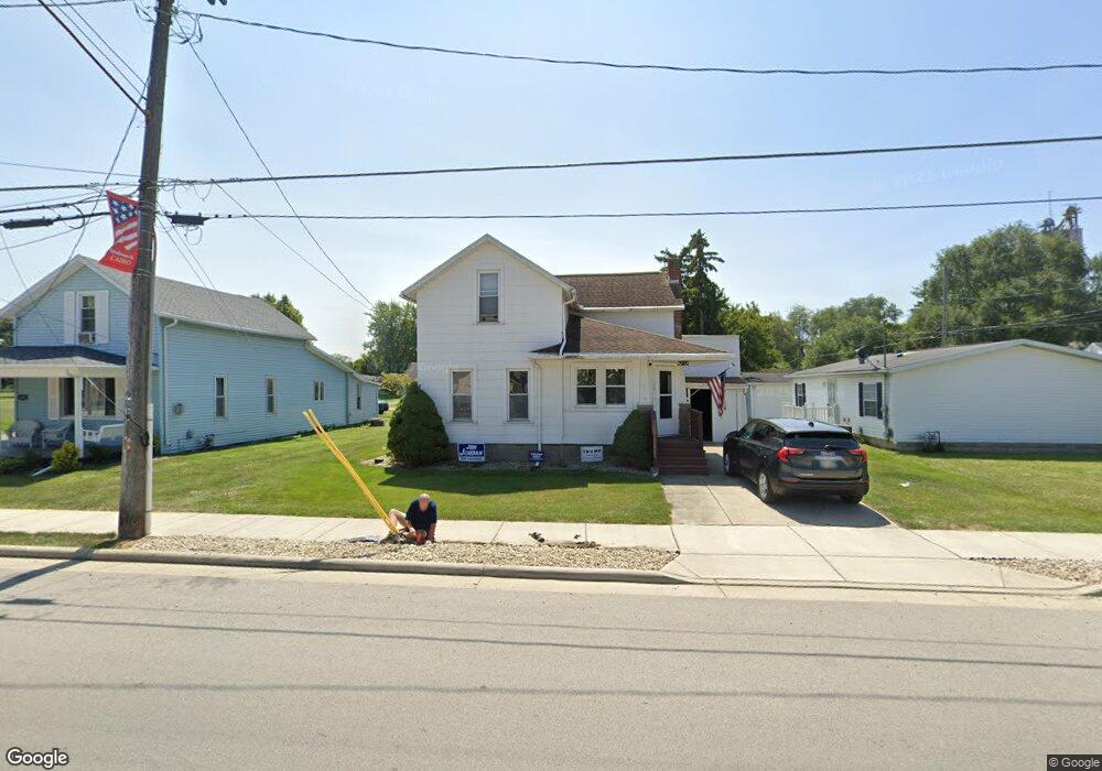
This home is located at 128 E Main St, Cairo, OH 45820 and is currently estimated at $145,613, approximately $117 per square foot. 128 E Main St is a home with nearby schools including Bath Elementary School, Bath Middle School, and Bath High School.
Ownership History
Date
Name
Owned For
Owner Type
Purchase Details
Closed on
May 7, 2013
Sold by
Hirsch Dennis B
Bought by
Maag Kelly J
Current Estimated Value
Purchase Details
Closed on
Sep 21, 2012
Sold by
Estate Of Molly E Hirsch
Bought by
Hirsch Dennis B
Purchase Details
Closed on
Feb 22, 1994
Sold by
Dunlap Doris
Bought by
Hirsch Molly E
Purchase Details
Closed on
Oct 27, 1993
Sold by
Best Luella
Bought by
Dunlap Doris
Purchase Details
Closed on
Jan 1, 1990
Bought by
Best Luella
Create a Home Valuation Report for This Property
The Home Valuation Report is an in-depth analysis detailing your home's value as well as a comparison with similar homes in the area
Purchase History
| Date | Buyer | Sale Price | Title Company |
|---|---|---|---|
| Maag Kelly J | -- | None Available | |
| Hirsch Dennis B | -- | None Available | |
| Hirsch Molly E | $30,000 | -- | |
| Dunlap Doris | -- | -- | |
| Best Luella | -- | -- |
Source: Public Records
Tax History
| Year | Tax Paid | Tax Assessment Tax Assessment Total Assessment is a certain percentage of the fair market value that is determined by local assessors to be the total taxable value of land and additions on the property. | Land | Improvement |
|---|---|---|---|---|
| 2024 | $1,329 | $31,010 | $3,570 | $27,440 |
| 2023 | $1,070 | $21,980 | $2,520 | $19,460 |
| 2022 | $1,075 | $21,980 | $2,520 | $19,460 |
| 2021 | $1,070 | $21,980 | $2,520 | $19,460 |
| 2020 | $998 | $18,770 | $2,420 | $16,350 |
| 2019 | $998 | $18,770 | $2,420 | $16,350 |
| 2018 | $919 | $18,770 | $2,420 | $16,350 |
| 2017 | $862 | $16,420 | $2,420 | $14,000 |
| 2016 | $848 | $16,420 | $2,420 | $14,000 |
| 2015 | $777 | $14,080 | $2,420 | $11,660 |
| 2014 | $777 | $14,640 | $2,280 | $12,360 |
| 2013 | $778 | $14,640 | $2,280 | $12,360 |
Source: Public Records
Map
Nearby Homes
- 102 W Main St
- 201 Wall St
- 513 W Main St
- 634 W Main St
- 1085 Lutz Rd
- 4387 N West St
- 3263 Shiloh Dr
- 0 Fraunfelter Unit 307817
- 0 N Eastown Rd Unit 1034495
- 0 Thorndyke Dr
- 3137 Thorndyke Dr
- 2878 Autumn Lake Dr
- 0 N Dixie Hwy Unit 300253
- 475 Kenmore St
- 520 Kenmore St
- 5025 N Cool Rd
- 11059 Ottawa Rd
- 2718 Carolyn Dr
- 2230 N Dixie Hwy
- 2145 N Dixie Hwy Unit 80
Your Personal Tour Guide
Ask me questions while you tour the home.