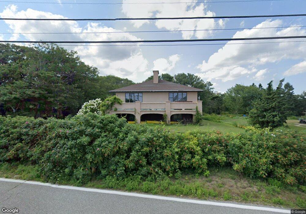
128 Fortunes Rocks Rd Biddeford, ME 04005
Fortunes Rocks NeighborhoodEstimated Value: $1,384,000 - $1,818,000
2
Beds
2
Baths
2,304
Sq Ft
$702/Sq Ft
Est. Value
About This Home
This home is located at 128 Fortunes Rocks Rd, Biddeford, ME 04005 and is currently estimated at $1,617,328, approximately $701 per square foot. 128 Fortunes Rocks Rd is a home located in York County with nearby schools including John F Kennedy Memorial School, Biddeford Primary School, and Biddeford Intermediate School.
Ownership History
Date
Name
Owned For
Owner Type
Purchase Details
Closed on
Apr 22, 2008
Sold by
Mininni Jane R
Bought by
Robinson Mark D and Robinson Wendy E
Current Estimated Value
Home Financials for this Owner
Home Financials are based on the most recent Mortgage that was taken out on this home.
Original Mortgage
$227,000
Interest Rate
6.1%
Mortgage Type
Unknown
Create a Home Valuation Report for This Property
The Home Valuation Report is an in-depth analysis detailing your home's value as well as a comparison with similar homes in the area
Home Values in the Area
Average Home Value in this Area
Purchase History
| Date | Buyer | Sale Price | Title Company |
|---|---|---|---|
| Robinson Mark D | -- | -- |
Source: Public Records
Mortgage History
| Date | Status | Borrower | Loan Amount |
|---|---|---|---|
| Open | Robinson Mark D | $325,000 | |
| Closed | Robinson Mark D | $227,000 |
Source: Public Records
Tax History Compared to Growth
Tax History
| Year | Tax Paid | Tax Assessment Tax Assessment Total Assessment is a certain percentage of the fair market value that is determined by local assessors to be the total taxable value of land and additions on the property. | Land | Improvement |
|---|---|---|---|---|
| 2024 | $17,299 | $1,216,500 | $783,400 | $433,100 |
| 2023 | $15,903 | $1,212,100 | $779,000 | $433,100 |
| 2022 | $14,451 | $880,600 | $494,300 | $386,300 |
| 2021 | $13,736 | $753,500 | $422,900 | $330,600 |
| 2020 | $1,584 | $716,300 | $411,900 | $304,400 |
| 2019 | $1,575 | $716,300 | $411,900 | $304,400 |
| 2018 | $14,111 | $716,300 | $411,900 | $304,400 |
| 2017 | $5,071 | $677,000 | $411,900 | $265,100 |
| 2016 | $1,520 | $677,000 | $411,900 | $265,100 |
| 2015 | $13,181 | $677,000 | $411,900 | $265,100 |
| 2014 | $12,856 | $677,000 | $411,900 | $265,100 |
| 2013 | -- | $743,000 | $465,200 | $277,800 |
Source: Public Records
Map
Nearby Homes
- 129 Fortunes Rocks Rd
- 1 Moore Ln
- 96 Fortunes Rocks Rd
- 2 Maddox Pond Rd
- 8 Shore Rd
- Lot 6 Longboard Ln
- Lot 7 Longboard Ln
- Lot 4 Longboard Ln
- Lot 3 Longboard Ln
- Lot 2 Longboard Ln
- Lot 1 Longboard Ln
- 3 Fortunes Rocks Rd
- 700 Pool St
- 4 Windward Ridge
- 4 Kings Ln
- 6 Days Landing
- 1081 Kings Hwy
- 8 Days Landing
- 66 Old Pool Rd
- 111 Mile Stretch Rd
- 127 Fortunes Rocks Rd
- 126 Fortunes Rocks Rd
- 124 Fortunes Rocks Rd
- 131 Fortunes Rocks Rd
- 1 Neptune Ln
- 1 Moore Ave
- 2 Moore Ave
- 2 Neptune Ln
- 122 Fortunes Rocks Rd
- 134 Fortunes Rocks Rd
- 1 Oceanspray Ave
- 132 Fortunes Rocks Rd
- 4 Neptune Ln
- 24 Lily Pond Ave Unit 26
- 4 Moore Ave
- 2 Oceanspray Ave
- 3 Oceanspray Ave
- 3 Ocean Spray Fortunes Rocks Ave
- 6 Neptune Ln
- 3 Neptune Ln