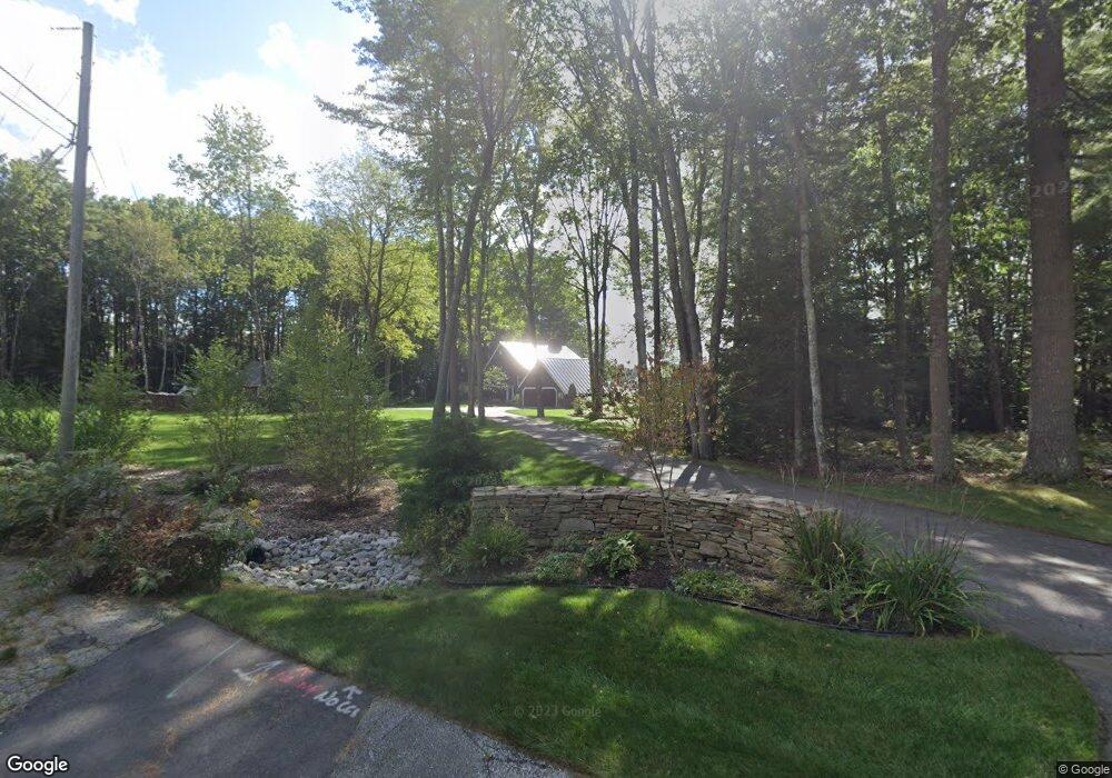
128 Harborview Dr Yarmouth, ME 04096
Estimated Value: $611,000 - $1,051,000
4
Beds
3
Baths
2,408
Sq Ft
$364/Sq Ft
Est. Value
About This Home
This home is located at 128 Harborview Dr, Yarmouth, ME 04096 and is currently estimated at $876,627, approximately $364 per square foot. 128 Harborview Dr is a home located in Cumberland County with nearby schools including William H. Rowe School, Yarmouth Elementary School, and Frank H. Harrison Middle School.
Ownership History
Date
Name
Owned For
Owner Type
Purchase Details
Closed on
Jan 13, 2011
Sold by
Wood Barbara L
Bought by
Breton Jennifer L and Lebel Michael A
Current Estimated Value
Home Financials for this Owner
Home Financials are based on the most recent Mortgage that was taken out on this home.
Original Mortgage
$338,000
Outstanding Balance
$226,883
Interest Rate
4.46%
Mortgage Type
Purchase Money Mortgage
Estimated Equity
$649,744
Create a Home Valuation Report for This Property
The Home Valuation Report is an in-depth analysis detailing your home's value as well as a comparison with similar homes in the area
Home Values in the Area
Average Home Value in this Area
Purchase History
| Date | Buyer | Sale Price | Title Company |
|---|---|---|---|
| Breton Jennifer L | -- | -- |
Source: Public Records
Mortgage History
| Date | Status | Borrower | Loan Amount |
|---|---|---|---|
| Open | Breton Jennifer L | $338,000 |
Source: Public Records
Tax History Compared to Growth
Tax History
| Year | Tax Paid | Tax Assessment Tax Assessment Total Assessment is a certain percentage of the fair market value that is determined by local assessors to be the total taxable value of land and additions on the property. | Land | Improvement |
|---|---|---|---|---|
| 2024 | $10,874 | $423,600 | $206,600 | $217,000 |
| 2023 | $9,972 | $423,600 | $206,600 | $217,000 |
| 2022 | $9,158 | $423,600 | $206,600 | $217,000 |
| 2021 | $7,942 | $423,600 | $206,600 | $217,000 |
| 2020 | $7,827 | $423,600 | $206,600 | $217,000 |
| 2019 | $7,989 | $423,600 | $206,600 | $217,000 |
| 2018 | $7,540 | $423,600 | $206,600 | $217,000 |
| 2017 | $7,269 | $423,600 | $206,600 | $217,000 |
| 2016 | $7,227 | $423,600 | $206,600 | $217,000 |
| 2015 | $7,041 | $326,600 | $131,800 | $194,800 |
| 2014 | $7,055 | $326,600 | $131,800 | $194,800 |
| 2013 | $7,185 | $326,600 | $0 | $0 |
Source: Public Records
Map
Nearby Homes
- 62 Blueberry Cove Rd Unit 62
- 52 Blueberry Cove Rd Unit 52
- 30 Blueberry Cove
- 149 E Main St Unit 7
- 51 Pleasant St
- 86 Pleasant St
- 0 Bayview St
- 70 Main St
- 69 Rand Rd
- 393 E Main St
- 69 Gail Ln
- 203 Bluff Rd Unit 13
- 1 Railroad Square Unit Townhome C
- 1 Railroad Square Unit 103
- 1 Railroad Square Unit 205
- 1 Railroad Square Unit 305
- 1 Railroad Square Unit 403
- 1 Railroad Square Unit 101
- 44 Ellen Cir
- 309 Main St Unit A
- 125 Harborview Dr
- 126 Harborview Dr
- 65 Blueberry Cove
- 63 Blueberry Cove
- 64 Blueberry Cove
- 62 Blueberry Cove
- 61 Blueberry Cove
- 60 Blueberry Cove Unit 30
- 60 Blueberry Cove Unit 60D
- 50 Blueberry Cove
- 50 Blueberry Cove Rd Unit 50
- 49 Blueberry Cove
- 113 Harborview Dr
- 119 Harborview Dr
- 51 Blueberry Cove
- 48 Blueberry Cove Rd Unit 48
- 47 Blueberry Cove
- 47 Blueberry Cove Unit 47
- 46 Blueberry Cove
- 46 Blueberry Cove Unit 46B