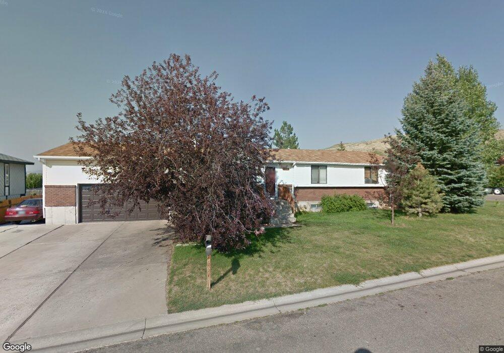
128 Hopi Ct Evanston, WY 82930
Estimated Value: $332,000 - $439,000
3
Beds
3
Baths
1,216
Sq Ft
$304/Sq Ft
Est. Value
About This Home
This home is located at 128 Hopi Ct, Evanston, WY 82930 and is currently estimated at $369,967, approximately $304 per square foot. 128 Hopi Ct is a home located in Uinta County with nearby schools including Evanston High School and Evanston Child Development Center.
Ownership History
Date
Name
Owned For
Owner Type
Purchase Details
Closed on
Jan 22, 2013
Sold by
Misrasi Lisa
Bought by
Richmond Robert J
Current Estimated Value
Home Financials for this Owner
Home Financials are based on the most recent Mortgage that was taken out on this home.
Original Mortgage
$176,530
Outstanding Balance
$122,569
Interest Rate
3.34%
Mortgage Type
New Conventional
Estimated Equity
$247,398
Purchase Details
Closed on
Aug 21, 2006
Sold by
Lee John R
Bought by
Hartman Lisa
Home Financials for this Owner
Home Financials are based on the most recent Mortgage that was taken out on this home.
Original Mortgage
$38,700
Interest Rate
6.72%
Mortgage Type
Credit Line Revolving
Create a Home Valuation Report for This Property
The Home Valuation Report is an in-depth analysis detailing your home's value as well as a comparison with similar homes in the area
Home Values in the Area
Average Home Value in this Area
Purchase History
| Date | Buyer | Sale Price | Title Company |
|---|---|---|---|
| Richmond Robert J | -- | None Available | |
| Hartman Lisa | -- | None Available |
Source: Public Records
Mortgage History
| Date | Status | Borrower | Loan Amount |
|---|---|---|---|
| Open | Richmond Robert J | $176,530 | |
| Previous Owner | Hartman Lisa | $38,700 | |
| Previous Owner | Hartman Lisa | $154,800 |
Source: Public Records
Tax History Compared to Growth
Tax History
| Year | Tax Paid | Tax Assessment Tax Assessment Total Assessment is a certain percentage of the fair market value that is determined by local assessors to be the total taxable value of land and additions on the property. | Land | Improvement |
|---|---|---|---|---|
| 2025 | $1,860 | $20,085 | $2,795 | $17,290 |
| 2024 | $1,860 | $27,369 | $3,726 | $23,643 |
| 2023 | $1,778 | $26,290 | $3,544 | $22,746 |
| 2022 | $1,646 | $24,178 | $2,036 | $22,142 |
| 2021 | $1,380 | $20,252 | $2,036 | $18,216 |
| 2020 | $1,187 | $17,423 | $1,854 | $15,569 |
| 2019 | $1,212 | $17,816 | $1,734 | $16,082 |
| 2018 | $797 | $16,433 | $1,829 | $14,604 |
| 2017 | $1,101 | $16,209 | $1,829 | $14,380 |
| 2016 | $1,171 | $17,219 | $1,605 | $15,614 |
| 2015 | -- | $17,021 | $1,391 | $15,630 |
| 2014 | -- | $15,971 | $0 | $0 |
Source: Public Records
Map
Nearby Homes
- 126 Hopi Ct
- 116 Hopi Ct
- 124 Hopi Ct
- 132 Arapahoe Cir
- 118 Hopi Ct
- 399 Cheyenne Dr
- 399 Cheyenne Dr Unit Apache
- 121 Arapahoe Cir
- 122 Hopi Ct
- 123 Arapahoe Cir
- 120 Hopi Ct
- 119 Arapahoe Cir
- 117 Arapahoe Cir
- 110 Arapahoe Cir
- 102 Arapahoe Cir
- 100 Arapahoe Cir
- 104 Arapahoe Cir
- 98 Arapahoe Cir
- 96 Arapahoe Cir
- 148 Apache Dr