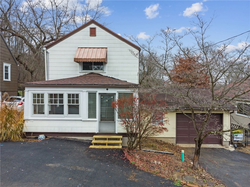
128 Lily St Apollo, PA 15613
Washington Township NeighborhoodEstimated payment $950/month
Highlights
- Vaulted Ceiling
- 2 Car Attached Garage
- Walk-Up Access
- Wood Flooring
- Forced Air Heating and Cooling System
- Wood Burning Fireplace
About This Home
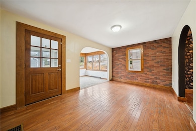
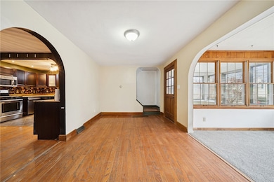
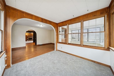
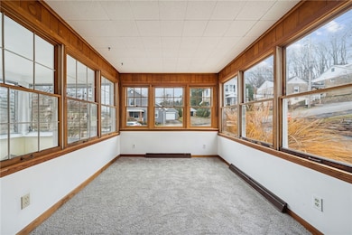
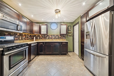
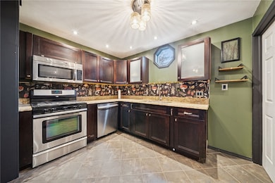
Welcome to this inviting 2-bedroom home featuring all of the cozy charm! Beautiful brick accent wall and thoughtful updates throughout. greeted by a bright front sunroom, perfect for morning coffee, additional living space, or convert to a 3rd bedroom! Continue into the charming dining room and well-appointed kitchen, soft close cabinets, and beautifully finished countertops. The layout flows effortlessly into the expansive living room, where vaulted ceilings amplify the sense of space. A cozy wood-burning fireplace and fresh, new carpeting create a warm and inviting atmosphere you’ll love coming home to.
The home sits on a large, fully fenced backyard—ideal for pets, gardening, and outdoor entertaining. Located on a quiet street, with recreational playground, basketball court, baseballl and more within walking distance! Whether you're a first-time buyer or looking to downsize, this home offers comfort, character, and an unbeatable location!
Listing Agent
REALTY ONE GROUP LANDMARK License #RS355738 Listed on: 11/23/2025
Home Details
Home Type
- Single Family
Est. Annual Taxes
- $1,647
Lot Details
- 6,625 Sq Ft Lot
Parking
- 2 Car Attached Garage
Home Design
- Asphalt Roof
Interior Spaces
- 2-Story Property
- Vaulted Ceiling
- Wood Burning Fireplace
- Basement
- Walk-Up Access
Kitchen
- Stove
- Cooktop
- Microwave
- Dishwasher
Flooring
- Wood
- Carpet
- Ceramic Tile
Bedrooms and Bathrooms
- 2 Bedrooms
Utilities
- Forced Air Heating and Cooling System
- Heating System Uses Gas
Map
Home Values in the Area
Average Home Value in this Area
Tax History
| Year | Tax Paid | Tax Assessment Tax Assessment Total Assessment is a certain percentage of the fair market value that is determined by local assessors to be the total taxable value of land and additions on the property. | Land | Improvement |
|---|---|---|---|---|
| 2025 | $1,603 | $10,750 | $750 | $10,000 |
| 2024 | $1,520 | $10,750 | $750 | $10,000 |
| 2023 | $1,388 | $10,750 | $750 | $10,000 |
| 2022 | $1,345 | $10,750 | $750 | $10,000 |
| 2021 | $1,345 | $10,750 | $750 | $10,000 |
| 2020 | $1,341 | $10,750 | $750 | $10,000 |
| 2019 | $1,325 | $10,750 | $750 | $10,000 |
| 2018 | $1,304 | $10,750 | $750 | $10,000 |
| 2017 | $1,272 | $10,750 | $750 | $10,000 |
| 2016 | $1,252 | $10,750 | $750 | $10,000 |
| 2015 | $1,252 | $10,750 | $750 | $10,000 |
| 2014 | $1,245 | $10,750 | $750 | $10,000 |
Property History
| Date | Event | Price | List to Sale | Price per Sq Ft |
|---|---|---|---|---|
| 11/24/2025 11/24/25 | Pending | -- | -- | -- |
| 11/23/2025 11/23/25 | For Sale | $155,000 | -- | -- |
Purchase History
| Date | Type | Sale Price | Title Company |
|---|---|---|---|
| Special Warranty Deed | $68,800 | None Available | |
| Special Warranty Deed | $54,000 | -- |
Mortgage History
| Date | Status | Loan Amount | Loan Type |
|---|---|---|---|
| Open | $70,800 | New Conventional | |
| Previous Owner | $51,300 | No Value Available |
Source: West Penn Multi-List
MLS Number: 1731689
APN: 63-03-09-0-004
Disclaimer: Certain information contained herein is derived from information provided by parties other than Homes.com. All information provided is deemed reliable, but is not guaranteed to be accurate and should be independently verified.
![]() IDX information is provided exclusively for personal, non-commercial use, and may not be used for any purpose other than to identify prospective properties consumers may be interested in purchasing.
IDX information is provided exclusively for personal, non-commercial use, and may not be used for any purpose other than to identify prospective properties consumers may be interested in purchasing.
Information is deemed reliable but not guaranteed.
- 4792 State Route 66
- 185 Thorn St
- 223 Old Mill Rd
- 115 Acadia Ln
- 211 Old Mill Rd
- 1316 Hancock Ave
- 127 Martin Dr
- 404 N Pennsylvania Ave
- 519 Dogwood Ct
- 322 N 4th St
- 307 Wilson Way
- 625 Rose St Unit 276
- 411a N Pennsylvania Ave
- 334 State Route 356
- 501 State Route 356
- 212 Terrace Ave
- 715 1/2 Armstrong Ave Unit 1/2
- 726 N 4th St
- 620 Cedar Ridge Dr
- 311 & 313 N 2nd St
