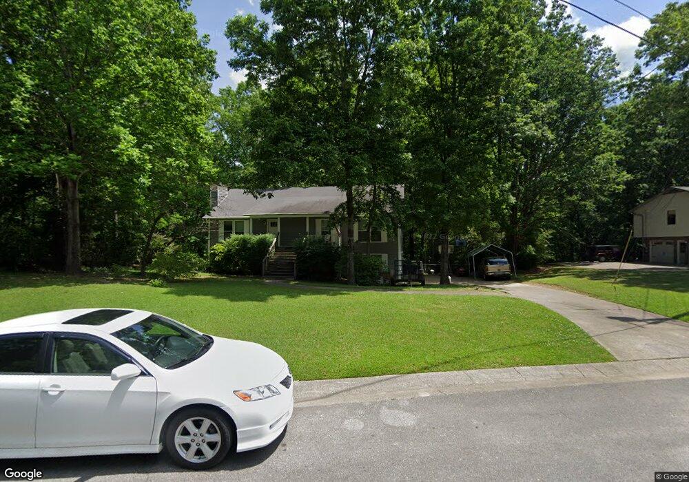
128 Mountain Pkwy Maylene, AL 35114
Estimated Value: $206,000 - $292,000
Studio
1
Bath
1,978
Sq Ft
$131/Sq Ft
Est. Value
About This Home
This home is located at 128 Mountain Pkwy, Maylene, AL 35114 and is currently estimated at $259,367, approximately $131 per square foot. 128 Mountain Pkwy is a home located in Shelby County with nearby schools including Thompson Intermediate School, Thompson Middle School, and Thompson High School.
Ownership History
Date
Name
Owned For
Owner Type
Purchase Details
Closed on
Oct 8, 2003
Sold by
Little Tracey A and Little Jody M
Bought by
Rogers Barry F and Rogers Mary C
Current Estimated Value
Home Financials for this Owner
Home Financials are based on the most recent Mortgage that was taken out on this home.
Original Mortgage
$138,000
Outstanding Balance
$62,634
Interest Rate
6.16%
Mortgage Type
Unknown
Estimated Equity
$196,733
Purchase Details
Closed on
Jun 29, 1998
Sold by
Myers Dennis C
Bought by
Little Tracey A and Little Jody M
Home Financials for this Owner
Home Financials are based on the most recent Mortgage that was taken out on this home.
Original Mortgage
$86,000
Interest Rate
7.1%
Create a Home Valuation Report for This Property
The Home Valuation Report is an in-depth analysis detailing your home's value as well as a comparison with similar homes in the area
Home Values in the Area
Average Home Value in this Area
Purchase History
| Date | Buyer | Sale Price | Title Company |
|---|---|---|---|
| Rogers Barry F | $129,000 | -- | |
| Little Tracey A | $107,500 | -- |
Source: Public Records
Mortgage History
| Date | Status | Borrower | Loan Amount |
|---|---|---|---|
| Open | Rogers Barry F | $138,000 | |
| Closed | Little Tracey A | $86,000 |
Source: Public Records
Tax History
| Year | Tax Paid | Tax Assessment Tax Assessment Total Assessment is a certain percentage of the fair market value that is determined by local assessors to be the total taxable value of land and additions on the property. | Land | Improvement |
|---|---|---|---|---|
| 2024 | $1,260 | $23,340 | $0 | $0 |
| 2023 | $1,131 | $21,700 | $0 | $0 |
| 2022 | $1,048 | $20,160 | $0 | $0 |
| 2021 | $934 | $18,060 | $0 | $0 |
| 2020 | $874 | $16,940 | $0 | $0 |
| 2019 | $822 | $15,980 | $0 | $0 |
| 2017 | $724 | $14,160 | $0 | $0 |
| 2015 | $704 | $13,800 | $0 | $0 |
| 2014 | $686 | $13,460 | $0 | $0 |
Source: Public Records
Map
Nearby Homes
- 125 Mountain Pkwy
- 1315 Yellowleaf Cir
- 217 Kensington Ln
- 120 Sterling Gate Dr
- 549 Ramsgate Dr
- 545 Ramsgate Dr
- 328 Sweet Leaf Dr
- 305 Cedar Grove Ct
- 544 Ramsgate Dr
- 309 Cedar Grove Ct
- 174 Cedar Grove Pkwy
- 316 Sterling Manor Cir
- 280 Cedar Grove Pkwy
- 312 Cornwall Dr
- 537 Ramsgate Dr
- 1143 Eagle Dr
- 236 Queens Gate
- 144 Palm Dr
- 1138 Eagle Dr
- 116 Palm Dr
- 124 Mountain Pkwy
- 132 Mountain Pkwy
- 120 Mountain Pkwy
- 129 Mountain Pkwy
- 121 Mountain Pkwy
- 116 Mountain Pkwy
- 117 Mountain Pkwy
- 101 Hillside Dr
- 223 Redwood Dr
- 105 Hillside Dr
- 112 Mountain Pkwy
- 113 Mountain Pkwy
- 109 Hillside Dr
- 221 Redwood Dr
- 108 Mountain Pkwy
- 100 Hillside Dr
- 224 Redwood Dr
- 109 Mountain Pkwy
- 276 Kensington Ln
- 280 Kensington Ln
Your Personal Tour Guide
Ask me questions while you tour the home.