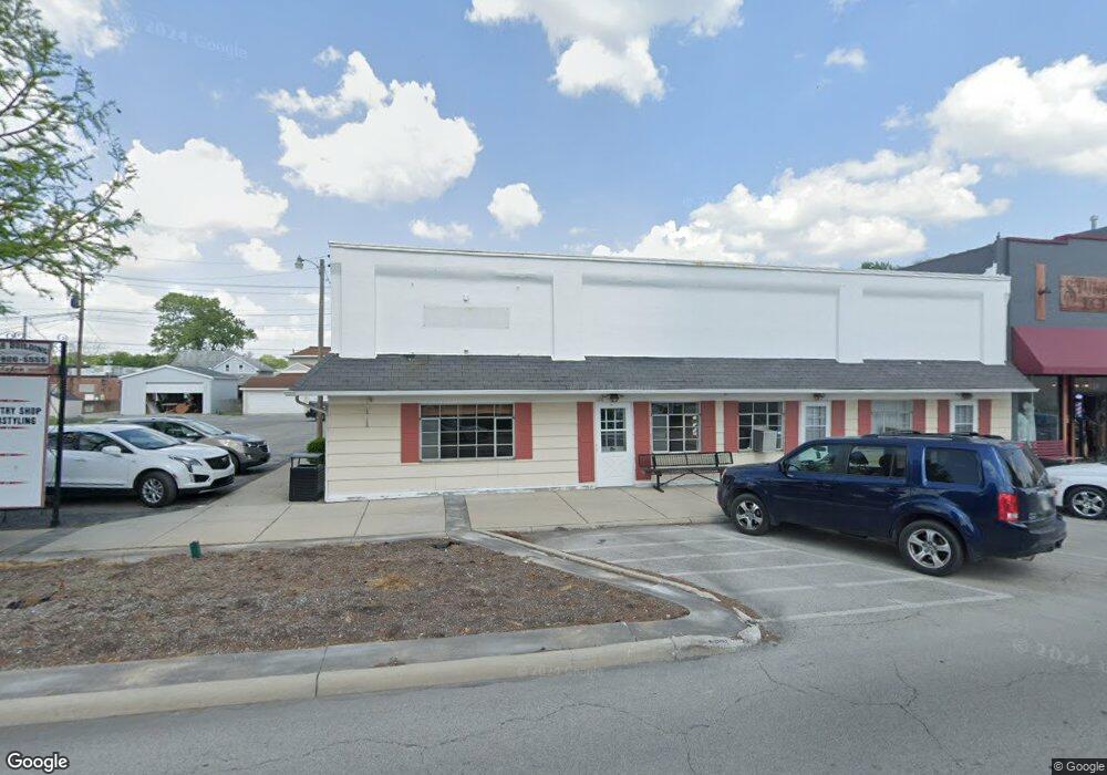
128 N Main St Swanton, OH 43558
Estimated Value: $140,293
--
Bed
3
Baths
7,200
Sq Ft
$19/Sq Ft
Est. Value
About This Home
This home is located at 128 N Main St, Swanton, OH 43558 and is currently priced at $140,293, approximately $19 per square foot. 128 N Main St is a home located in Fulton County with nearby schools including Swanton High School, Swanton Middle School, and St. Richard School.
Ownership History
Date
Name
Owned For
Owner Type
Purchase Details
Closed on
Aug 1, 2023
Sold by
Phyllis Z Wells Family Trust and Richard D Wells Family Trust
Bought by
Drummond Scott
Current Estimated Value
Purchase Details
Closed on
Jan 1, 1990
Bought by
Wells Richard D and Wells Phyllis
Create a Home Valuation Report for This Property
The Home Valuation Report is an in-depth analysis detailing your home's value as well as a comparison with similar homes in the area
Home Values in the Area
Average Home Value in this Area
Purchase History
| Date | Buyer | Sale Price | Title Company |
|---|---|---|---|
| Drummond Scott | $140,000 | None Listed On Document | |
| Drummond Scott | $140,000 | None Listed On Document | |
| Wells Richard D | -- | -- |
Source: Public Records
Tax History Compared to Growth
Tax History
| Year | Tax Paid | Tax Assessment Tax Assessment Total Assessment is a certain percentage of the fair market value that is determined by local assessors to be the total taxable value of land and additions on the property. | Land | Improvement |
|---|---|---|---|---|
| 2024 | $2,529 | $47,470 | $1,930 | $45,540 |
| 2023 | $2,576 | $60,210 | $1,930 | $58,280 |
| 2022 | $3,555 | $60,210 | $1,930 | $58,280 |
| 2021 | $3,787 | $60,210 | $1,930 | $58,280 |
| 2020 | $3,927 | $60,210 | $1,930 | $58,280 |
| 2019 | $3,820 | $60,070 | $1,860 | $58,210 |
| 2018 | $3,997 | $60,070 | $1,860 | $58,210 |
| 2017 | $3,960 | $60,070 | $1,860 | $58,210 |
| 2016 | $4,210 | $63,570 | $1,860 | $61,710 |
| 2015 | $4,051 | $63,570 | $1,860 | $61,710 |
| 2014 | $4,017 | $63,570 | $1,860 | $61,710 |
| 2013 | $4,122 | $66,960 | $1,860 | $65,100 |
Source: Public Records
Map
Nearby Homes
- 103 Cherry St
- 227 Kierra Ln
- 229 Woodland Ave
- 407 E Garfield Ave
- 502 Brookside Dr
- 133 Harrison Ave
- 510 S Main St
- 0 Waterwood Dr
- 225 Kierra Ln
- 7893 County Road 2
- 4303 S Berkey Southern Rd
- 13620 Brindley Rd
- 6854 County Road 3
- 9984 State Route 64
- 12922 Airport Hwy
- 6042 County Road 1-1
- 1200 County Road F
- 13560 Old State Line Rd
- 6330 County Road 4
- 12257 Harriet Rd
- 124 N Main St
- 132 N Main St
- 117 Lincoln Ave
- 115 Lincoln Ave
- 121 Lincoln Ave
- 114 N Main St
- 111 Lincoln Ave Unit C
- 111 Lincoln Ave Unit B
- 111 Lincoln Ave
- 138 N Main St
- 110 N Main St
- 131 N Main St
- 88 Dodge St
- 113 N Main St
- 142 N Main St
- 84 W Dodge
- 137 N Main St
- 106 Miller Ave
- 133 N Main St
- 200 Miller Ave