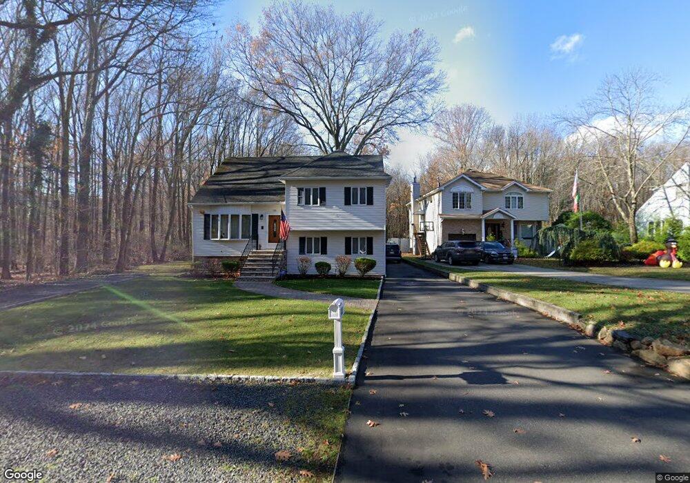
128 Poillon Ave Staten Island, NY 10312
Huguenot NeighborhoodEstimated Value: $871,508 - $1,043,000
--
Bed
4
Baths
1,872
Sq Ft
$509/Sq Ft
Est. Value
About This Home
This home is located at 128 Poillon Ave, Staten Island, NY 10312 and is currently estimated at $953,627, approximately $509 per square foot. 128 Poillon Ave is a home located in Richmond County with nearby schools including P.S. 5 - Huguenot, I.S. 007 Elias Bernstein, and Tottenville High School.
Ownership History
Date
Name
Owned For
Owner Type
Purchase Details
Closed on
Jun 17, 1999
Sold by
Lawson Gary R and Lawson Lois R
Bought by
Lawson Robert
Current Estimated Value
Home Financials for this Owner
Home Financials are based on the most recent Mortgage that was taken out on this home.
Original Mortgage
$180,000
Interest Rate
7.5%
Create a Home Valuation Report for This Property
The Home Valuation Report is an in-depth analysis detailing your home's value as well as a comparison with similar homes in the area
Home Values in the Area
Average Home Value in this Area
Purchase History
| Date | Buyer | Sale Price | Title Company |
|---|---|---|---|
| Lawson Robert | $245,000 | -- |
Source: Public Records
Mortgage History
| Date | Status | Borrower | Loan Amount |
|---|---|---|---|
| Previous Owner | Lawson Robert | $180,000 |
Source: Public Records
Tax History Compared to Growth
Tax History
| Year | Tax Paid | Tax Assessment Tax Assessment Total Assessment is a certain percentage of the fair market value that is determined by local assessors to be the total taxable value of land and additions on the property. | Land | Improvement |
|---|---|---|---|---|
| 2025 | $9,508 | $47,100 | $20,711 | $26,389 |
| 2024 | $9,508 | $47,340 | $20,366 | $26,974 |
| 2023 | $9,868 | $48,590 | $19,222 | $29,368 |
| 2022 | $9,151 | $45,840 | $19,440 | $26,400 |
| 2021 | $8,864 | $43,560 | $19,440 | $24,120 |
| 2020 | $8,863 | $48,120 | $19,440 | $28,680 |
| 2019 | $8,353 | $46,320 | $19,440 | $26,880 |
| 2018 | $8,127 | $41,328 | $15,182 | $26,146 |
| 2017 | $7,960 | $40,516 | $14,900 | $25,616 |
| 2016 | $7,331 | $38,223 | $15,270 | $22,953 |
| 2015 | $6,304 | $36,060 | $16,200 | $19,860 |
| 2014 | $6,304 | $34,440 | $16,200 | $18,240 |
Source: Public Records
Map
Nearby Homes
- 54 Poillon Ave
- 50 Poillon Ave
- 46 Poillon Ave
- 25 Blue Heron Ct
- 151 Lipsett Ave
- 115 Jansen St
- 8 Poillon Ave
- 311 Bertram Ave
- 304 Bertram Ave
- 4969 Amboy Rd
- 314 Bertram Ave
- 10 Arbutus Way
- 59 Newton St
- 46 Hillis St
- 998 Annadale Rd
- 344 Poillon Ave
- 383 Philip Ave
- 970 Annadale Rd
- 350 Poillon Ave
- 389 Philip Ave
- 120 Poillon Ave Unit 122
- 120-122 Poillon Ave
- 112 Poillon Ave
- 108 Poillon Ave
- 100 Poillon Ave
- 94 Poillon Ave
- 88 Poillon Ave
- 82 Poillon Ave
- 222 Poillon Ave
- 78 Poillon Ave
- 70 Poillon Ave
- 264 Tallman St
- 259 Tallman St
- 260 Tallman St
- 457 Poillon Ave
- 0 Poillon Ave
- 256 Tallman St
- 48 Poillon Ave
- 48 Poillon Ave
- 48 Poillon Ave