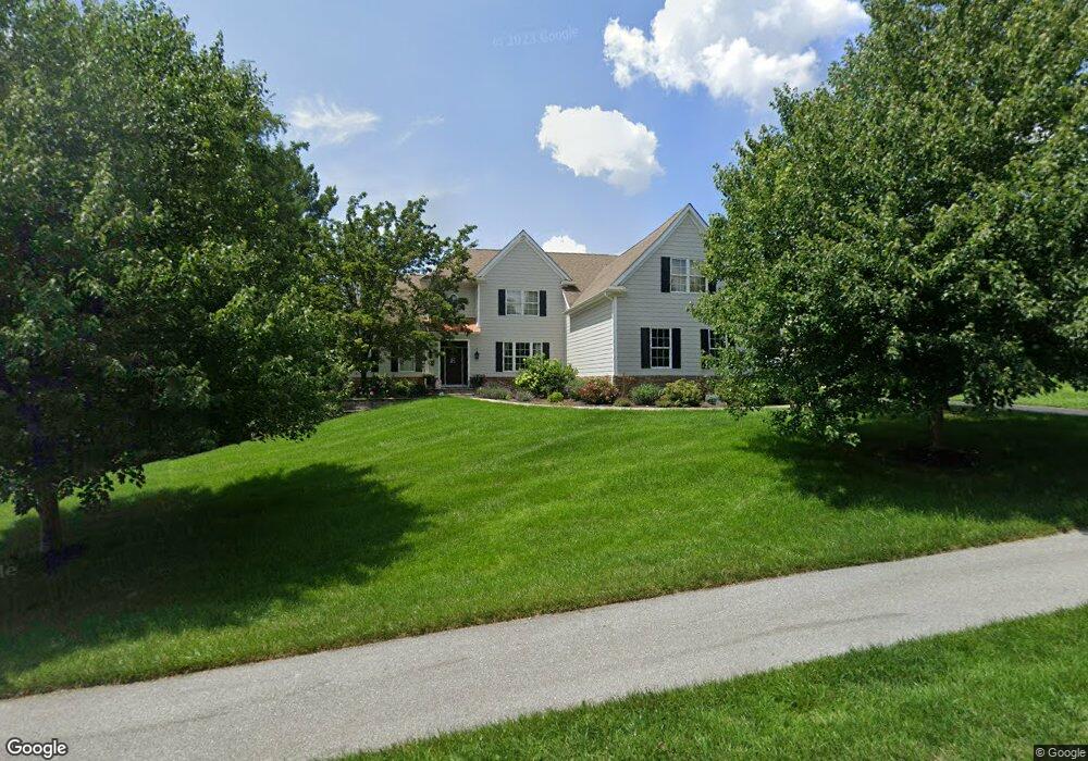
128 Portmarnock Dr Avondale, PA 19311
Estimated Value: $733,000 - $1,012,000
4
Beds
4
Baths
4,029
Sq Ft
$221/Sq Ft
Est. Value
About This Home
This home is located at 128 Portmarnock Dr, Avondale, PA 19311 and is currently estimated at $889,542, approximately $220 per square foot. 128 Portmarnock Dr is a home located in Chester County with nearby schools including Kennett Middle School, Kennett High School, and Sanford School.
Ownership History
Date
Name
Owned For
Owner Type
Purchase Details
Closed on
Nov 30, 2005
Sold by
Bhc Venture Inc
Bought by
Eberle Charles D and Eberle Hilary J
Current Estimated Value
Home Financials for this Owner
Home Financials are based on the most recent Mortgage that was taken out on this home.
Original Mortgage
$275,000
Outstanding Balance
$154,321
Interest Rate
6.34%
Mortgage Type
Fannie Mae Freddie Mac
Estimated Equity
$735,221
Create a Home Valuation Report for This Property
The Home Valuation Report is an in-depth analysis detailing your home's value as well as a comparison with similar homes in the area
Home Values in the Area
Average Home Value in this Area
Purchase History
| Date | Buyer | Sale Price | Title Company |
|---|---|---|---|
| Eberle Charles D | $502,367 | Commonwealth Title |
Source: Public Records
Mortgage History
| Date | Status | Borrower | Loan Amount |
|---|---|---|---|
| Open | Eberle Charles D | $275,000 |
Source: Public Records
Tax History Compared to Growth
Tax History
| Year | Tax Paid | Tax Assessment Tax Assessment Total Assessment is a certain percentage of the fair market value that is determined by local assessors to be the total taxable value of land and additions on the property. | Land | Improvement |
|---|---|---|---|---|
| 2025 | $11,438 | $285,600 | $77,740 | $207,860 |
| 2024 | $11,438 | $285,600 | $77,740 | $207,860 |
| 2023 | $11,055 | $285,600 | $77,740 | $207,860 |
| 2022 | $10,893 | $285,600 | $77,740 | $207,860 |
| 2021 | $10,783 | $285,600 | $77,740 | $207,860 |
| 2020 | $10,578 | $285,600 | $77,740 | $207,860 |
| 2019 | $10,435 | $285,600 | $77,740 | $207,860 |
| 2018 | $10,272 | $285,600 | $77,740 | $207,860 |
| 2017 | $10,062 | $285,600 | $77,740 | $207,860 |
| 2016 | $1,421 | $285,600 | $77,740 | $207,860 |
| 2015 | $1,421 | $285,600 | $77,740 | $207,860 |
| 2014 | $1,421 | $285,600 | $77,740 | $207,860 |
Source: Public Records
Map
Nearby Homes
- 104 Kittanset Ct
- 109 Regency Ct
- 139 Sharp Rd
- 400 Losito Dr
- 346 Carlisle Dr
- 111 Saint Andrews Dr
- 104 Saint Andrews Dr
- 9129 Gap Newport Pike
- 535 Chandler Mill Rd
- 100 Declan Unit HAWTHORNE
- 100 Declan Unit NOTTINGHAM
- 100 Declan Unit MAGNOLIA
- 100 Declan Unit SAVANNAH
- 1003 Newark Rd
- 118 Pleasant Bank Ln
- Augusta Plan at Stonebridge at Longwood
- Woodford Plan at Holly Drive
- 700 Shagbark Dr Unit HAWTHORNE
- Hawthorne Plan at Stonebridge at Longwood
- Augusta Plan at Holly Drive
- 126 Portmarnock Dr
- 124 Portmarnock Dr
- 108 Sandwich Ln
- 130 Portmarnock Dr
- 106 Sandwich Ln
- 122 Portmarnock Dr
- 132 Portmarnock Dr
- 129 Portmarnock Dr
- 104 Sandwich Ln
- 120 Portmarnock Dr
- 103 Five Farms Cir
- 133 Portmarnock Dr
- 134 Portmarnock Dr
- 102 Sandwich Ln
- 105 Five Farms Cir
- 118 Portmarnock Dr
- 135 Portmarnock Dr
- 113 Salasin Dr
- 116 Portmarnock Dr
- 114 Portmarnock Dr