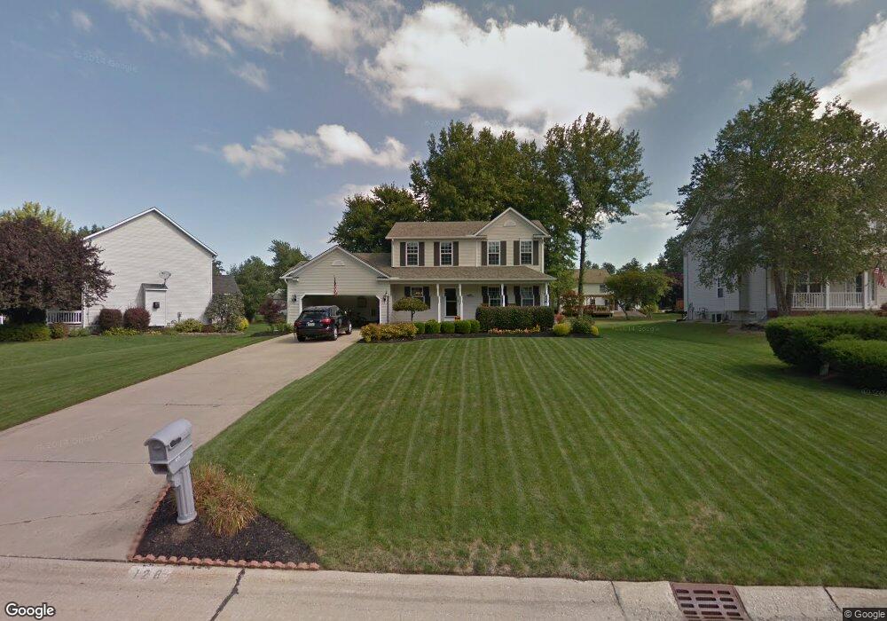
128 Red Pine Dr Painesville, OH 44077
Estimated Value: $302,000 - $332,000
3
Beds
3
Baths
952
Sq Ft
$332/Sq Ft
Est. Value
About This Home
This home is located at 128 Red Pine Dr, Painesville, OH 44077 and is currently estimated at $316,530, approximately $332 per square foot. 128 Red Pine Dr is a home located in Lake County with nearby schools including Henry F. Lamuth Middle School, Riverside Junior/Senior High School, and Summit Academy Community School - Painesville.
Ownership History
Date
Name
Owned For
Owner Type
Purchase Details
Closed on
Jun 20, 1997
Sold by
R L Moore Builders Inc
Bought by
Scullin Michael C and Scullin Marilyn L
Current Estimated Value
Home Financials for this Owner
Home Financials are based on the most recent Mortgage that was taken out on this home.
Original Mortgage
$132,260
Outstanding Balance
$18,959
Interest Rate
8%
Estimated Equity
$297,571
Purchase Details
Closed on
Jan 1, 1990
Bought by
R W Sidley Inc
Create a Home Valuation Report for This Property
The Home Valuation Report is an in-depth analysis detailing your home's value as well as a comparison with similar homes in the area
Home Values in the Area
Average Home Value in this Area
Purchase History
| Date | Buyer | Sale Price | Title Company |
|---|---|---|---|
| Scullin Michael C | $155,600 | Enterprise Title Agency Inc | |
| R W Sidley Inc | -- | -- |
Source: Public Records
Mortgage History
| Date | Status | Borrower | Loan Amount |
|---|---|---|---|
| Open | Scullin Michael C | $132,260 |
Source: Public Records
Tax History Compared to Growth
Tax History
| Year | Tax Paid | Tax Assessment Tax Assessment Total Assessment is a certain percentage of the fair market value that is determined by local assessors to be the total taxable value of land and additions on the property. | Land | Improvement |
|---|---|---|---|---|
| 2024 | -- | $96,490 | $19,590 | $76,900 |
| 2023 | $8,266 | $75,850 | $15,660 | $60,190 |
| 2022 | $4,433 | $75,850 | $15,660 | $60,190 |
| 2021 | $4,449 | $75,850 | $15,660 | $60,190 |
| 2020 | $4,382 | $65,950 | $13,610 | $52,340 |
| 2019 | $695 | $65,950 | $13,610 | $52,340 |
| 2018 | $1,186 | $58,550 | $18,330 | $40,220 |
| 2017 | $4,053 | $58,550 | $18,330 | $40,220 |
| 2016 | $3,568 | $58,550 | $18,330 | $40,220 |
| 2015 | $3,352 | $58,550 | $18,330 | $40,220 |
| 2014 | $3,407 | $58,550 | $18,330 | $40,220 |
| 2013 | $3,329 | $58,550 | $18,330 | $40,220 |
Source: Public Records
Map
Nearby Homes
- 67 Tanners Farm Dr
- 65 Tanners Farm Dr
- 43 Bristol Ave
- 1182 Dalton Dr
- 1172 Dalton Dr
- 396 Park Rd
- 5406 Pebble Creek Ln
- V/L Morgan Dr
- 58 Deerfield Dr
- 44 Grove Ave
- 30 Orton Rd
- 500 Park Rd
- 238 Radley Dr
- 525 Morgan Dr
- 65 Country Ln
- 1104 Fanwood Ct
- 104 Overlook Rd
- 85 Nelmar Dr
- 48 Nelmar Dr
- 0 N Ridge Rd Unit 5110949
- 120 Red Pine Dr
- 136 Red Pine Dr
- 127 Honey Locust Ct
- 110 Red Pine Dr
- 119 Honey Locust Ct
- 135 Honey Locust Ct
- 129 Red Pine Dr
- 137 Red Pine Dr
- 115 Honey Locust Ct
- 111 Red Pine Dr
- 100 Red Pine Dr
- 1471 White Ash Dr
- 1461 White Ash Dr
- 1481 White Ash Dr
- 103 Red Pine Dr
- 1487 White Ash Dr
- 109 Honey Locust Ct
- 1436 Red Maple Dr
- 1451 White Ash Dr
- 94 Red Pine Dr