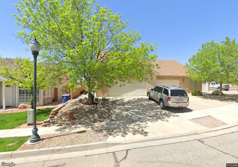
128 S 6250 W Unit 2 Hurricane, UT 84737
Estimated Value: $400,000 - $538,000
4
Beds
3
Baths
1,965
Sq Ft
$237/Sq Ft
Est. Value
About This Home
This home is located at 128 S 6250 W Unit 2, Hurricane, UT 84737 and is currently estimated at $465,830, approximately $237 per square foot. 128 S 6250 W Unit 2 is a home located in Washington County with nearby schools including Coral Canyon School, Pine View Middle School, and Fossil Ridge Intermediate School.
Ownership History
Date
Name
Owned For
Owner Type
Purchase Details
Closed on
Jun 24, 2025
Sold by
Leany Andy P
Bought by
A-Plus Property Of St George Llc
Current Estimated Value
Purchase Details
Closed on
Jun 2, 2022
Sold by
Andy Leany
Bought by
Leany Andy
Home Financials for this Owner
Home Financials are based on the most recent Mortgage that was taken out on this home.
Original Mortgage
$134,500
Interest Rate
4.38%
Mortgage Type
New Conventional
Purchase Details
Closed on
Mar 18, 2009
Sold by
Federal National Mortgage Association
Bought by
Leany Andy and Leany Kristy
Purchase Details
Closed on
Nov 18, 2008
Sold by
Pulsipher Dell R
Bought by
Federal National Mortgage Association
Purchase Details
Closed on
Aug 4, 2005
Sold by
Pulsipher Dell R and Pulsipher Cynthia A
Bought by
Pulsipher Dell R
Purchase Details
Closed on
May 27, 2005
Sold by
Sant Pacific Ii Llc
Bought by
Pulsipher Dell R and Pulsipher Cynthia A
Create a Home Valuation Report for This Property
The Home Valuation Report is an in-depth analysis detailing your home's value as well as a comparison with similar homes in the area
Home Values in the Area
Average Home Value in this Area
Purchase History
| Date | Buyer | Sale Price | Title Company |
|---|---|---|---|
| A-Plus Property Of St George Llc | -- | None Listed On Document | |
| Leany Andy | -- | Rampart Title | |
| Leany Andy | -- | Southern Utah Title | |
| Federal National Mortgage Association | $150,847 | None Available | |
| Pulsipher Dell R | -- | Southern Utah Title Co | |
| Pulsipher Dell R | -- | Sun West Title |
Source: Public Records
Mortgage History
| Date | Status | Borrower | Loan Amount |
|---|---|---|---|
| Previous Owner | Leany Andy | $134,500 |
Source: Public Records
Tax History Compared to Growth
Tax History
| Year | Tax Paid | Tax Assessment Tax Assessment Total Assessment is a certain percentage of the fair market value that is determined by local assessors to be the total taxable value of land and additions on the property. | Land | Improvement |
|---|---|---|---|---|
| 2025 | $1,505 | $384,400 | $88,000 | $296,400 |
| 2023 | $1,636 | $219,505 | $42,350 | $177,155 |
| 2022 | $1,747 | $219,670 | $42,350 | $177,320 |
| 2021 | $1,527 | $283,900 | $55,000 | $228,900 |
| 2020 | $1,471 | $255,500 | $55,000 | $200,500 |
| 2019 | $1,263 | $212,900 | $55,000 | $157,900 |
| 2018 | $1,204 | $104,390 | $0 | $0 |
| 2017 | $1,162 | $96,910 | $0 | $0 |
| 2016 | $1,049 | $154,100 | $0 | $0 |
| 2015 | $1,882 | $146,400 | $0 | $0 |
| 2014 | $1,595 | $129,100 | $0 | $0 |
Source: Public Records
Map
Nearby Homes
- 2020 N Pebble Beach Dr
- 2018 N Pebble Beach Dr
- 182 W Elinor Ln
- 2094 N Coral Ridge Dr
- 2041 N Pebble Beach Dr
- 4205 Torrey Pines Dr
- 6159 Winding Way Unit M106
- 6222 W 135 N Unit 16
- 2076 N Doral Ct
- 228 Lone Rock Dr Unit 201
- 228 Lone Rock Dr Unit 205
- 228 Lone Rock Dr Unit 102
- 228 Lone Rock Dr Unit 202
- 228 Lone Rock Dr Unit 403
- 228 Lone Rock Dr Unit 301
- 228 Lone Rock Dr
- 224 N Chapparral Unit M201
- 226 N Cliff Side Dr Unit L-300
- 226 N Cliff Side Dr Unit L-105
- 226 N Cliff Side Dr Unit K200
- 128 S 6250 W
- 144 S 6250 W
- 112 S 6250 W
- 112 S 6250 W Unit 1
- 475 S 6250 W
- 160 S 6250 W
- 176 S 6250 W
- 6245 W 100 S
- 6246 W 200 S
- 99 S 6250 W Unit 1
- 6150 W 100 S
- 192 S 6250 W
- 6239 W 100 S
- 6239 W 100 S Unit 29
- 6234 W 200 S
- 71 S 6250 W Unit 2
- 6231 W 100 S
- 6231 W 100 S Unit 30
- 6226 W 200 S
- 98 S 6250 W Unit 6