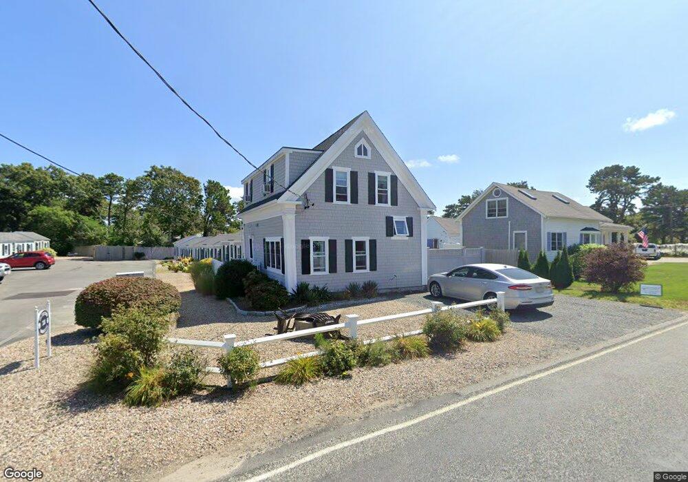
128 Sea St Unit 9 Dennis Port, MA 02639
Dennis Port NeighborhoodEstimated Value: $194,000 - $287,000
1
Bed
1
Bath
324
Sq Ft
$766/Sq Ft
Est. Value
About This Home
This home is located at 128 Sea St Unit 9, Dennis Port, MA 02639 and is currently estimated at $248,199, approximately $766 per square foot. 128 Sea St Unit 9 is a home located in Barnstable County with nearby schools including Dennis-Yarmouth Regional High School and St. Pius X. School.
Ownership History
Date
Name
Owned For
Owner Type
Purchase Details
Closed on
Aug 28, 2023
Sold by
Eisenhardt Joerg P and Eisenhardt Kelly A
Bought by
Eisenhardt Lt and Eisenhardt
Current Estimated Value
Purchase Details
Closed on
Dec 3, 2004
Sold by
Pccl Llc
Bought by
Jarousky Debra L and Jarousky Scott A
Home Financials for this Owner
Home Financials are based on the most recent Mortgage that was taken out on this home.
Original Mortgage
$112,500
Interest Rate
5.69%
Mortgage Type
Purchase Money Mortgage
Create a Home Valuation Report for This Property
The Home Valuation Report is an in-depth analysis detailing your home's value as well as a comparison with similar homes in the area
Home Values in the Area
Average Home Value in this Area
Purchase History
| Date | Buyer | Sale Price | Title Company |
|---|---|---|---|
| Eisenhardt Lt | -- | None Available | |
| Jarousky Debra L | $125,000 | -- |
Source: Public Records
Mortgage History
| Date | Status | Borrower | Loan Amount |
|---|---|---|---|
| Previous Owner | Jarousky Debra L | $112,500 |
Source: Public Records
Tax History Compared to Growth
Tax History
| Year | Tax Paid | Tax Assessment Tax Assessment Total Assessment is a certain percentage of the fair market value that is determined by local assessors to be the total taxable value of land and additions on the property. | Land | Improvement |
|---|---|---|---|---|
| 2025 | $991 | $228,900 | $0 | $228,900 |
| 2024 | $859 | $195,600 | $0 | $195,600 |
| 2023 | $749 | $160,300 | $0 | $160,300 |
| 2022 | $724 | $129,300 | $0 | $129,300 |
| 2021 | $702 | $116,500 | $0 | $116,500 |
| 2020 | $528 | $86,600 | $0 | $86,600 |
| 2019 | $554 | $89,800 | $0 | $89,800 |
| 2018 | $416 | $65,600 | $0 | $65,600 |
| 2017 | $403 | $65,600 | $0 | $65,600 |
| 2016 | $404 | $61,900 | $0 | $61,900 |
| 2015 | $396 | $61,900 | $0 | $61,900 |
| 2014 | $380 | $59,800 | $0 | $59,800 |
Source: Public Records
Map
Nearby Homes
- 102 Sea St
- 402 Old Wharf Rd
- 402 Old Wharf Rd
- 22 Ferncliff Rd
- 405 Old Wharf Rd Unit B204
- 405 Old Wharf Rd Unit B204
- 11 Ocean Park W
- 9 Chase Ave Unit 6
- 12 Cross St
- 26 Manning Rd
- 37-A Beach Hills Rd
- 37 Beach Hills Rd
- 159 Center St Unit 22
- 262 Old Wharf Rd Unit 67
- 262 Old Wharf Rd Unit 5
- 262 Old Wharf Rd Unit 5
- 262 Old Wharf Rd Unit 20
- 262 Old Wharf Rd Unit 87
- 31 Easy St
- 1 E Belmont Unit 630
- 128 Sea St Unit 6
- 128 Sea St Unit 11
- 128 Sea St Unit 10
- 128 Sea St Unit 7
- 128 Sea St Unit 5
- 128 Sea St Unit 4
- 128 Sea St Unit 3
- 128 Sea St Unit 2
- 128 Sea St Unit 1-10
- 128 Sea St
- 128 Sea St Unit 8
- 128 Sea St Unit 1
- 130 Sea St
- 138 Sea St Unit 5
- 138 Sea St Unit 4
- 138 Sea St Unit 3
- 138 Sea St Unit 2B
- 138 Sea St Unit 2A
- 138 Sea St Unit 1
- 138 Sea St