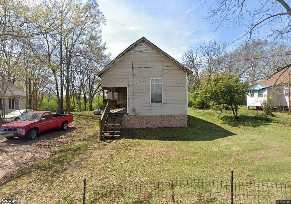
128 Timothy St Lagrange, GA 30240
Estimated Value: $55,000 - $93,000
2
Beds
1
Bath
855
Sq Ft
$87/Sq Ft
Est. Value
About This Home
This home is located at 128 Timothy St, Lagrange, GA 30240 and is currently estimated at $73,958, approximately $86 per square foot. 128 Timothy St is a home located in Troup County with nearby schools including Ethel W. Kight Elementary School, Hollis Hand Elementary School, and Franklin Forest Elementary School.
Ownership History
Date
Name
Owned For
Owner Type
Purchase Details
Closed on
Feb 12, 1999
Sold by
Maseo Davenport
Bought by
Coleman Louneal
Current Estimated Value
Purchase Details
Closed on
Aug 1, 1988
Sold by
Moses Davenport
Bought by
Maseo Davenport
Purchase Details
Closed on
Jan 1, 1988
Sold by
Minnie Davenport
Bought by
Moses Davenport
Purchase Details
Closed on
Jun 1, 1964
Sold by
Henry Davenport
Bought by
Minnie Davenport
Create a Home Valuation Report for This Property
The Home Valuation Report is an in-depth analysis detailing your home's value as well as a comparison with similar homes in the area
Home Values in the Area
Average Home Value in this Area
Purchase History
| Date | Buyer | Sale Price | Title Company |
|---|---|---|---|
| Coleman Louneal | -- | -- | |
| Maseo Davenport | -- | -- | |
| Moses Davenport | -- | -- | |
| Minnie Davenport | -- | -- |
Source: Public Records
Tax History Compared to Growth
Tax History
| Year | Tax Paid | Tax Assessment Tax Assessment Total Assessment is a certain percentage of the fair market value that is determined by local assessors to be the total taxable value of land and additions on the property. | Land | Improvement |
|---|---|---|---|---|
| 2024 | $434 | $15,920 | $2,240 | $13,680 |
| 2023 | $422 | $15,480 | $2,240 | $13,240 |
| 2022 | $407 | $14,600 | $2,240 | $12,360 |
| 2021 | $281 | $9,320 | $2,240 | $7,080 |
| 2020 | $281 | $9,320 | $2,240 | $7,080 |
| 2019 | $258 | $8,550 | $2,190 | $6,360 |
| 2018 | $258 | $8,550 | $2,190 | $6,360 |
| 2017 | $258 | $8,550 | $2,190 | $6,360 |
| 2016 | $253 | $8,399 | $2,190 | $6,209 |
| 2015 | $246 | $8,138 | $2,256 | $5,882 |
| 2014 | $237 | $7,829 | $2,256 | $5,573 |
| 2013 | -- | $8,162 | $2,256 | $5,906 |
Source: Public Records
Map
Nearby Homes
- 205 Grady St
- 119 Jones St
- 167 S Kight Dr
- The Rhodes Plan at Crown Street Cottages
- The Truitt Plan at Crown Street Cottages
- The Callaway Plan at Crown Street Cottages
- 802 Monroe St
- 109 Garfield St
- 610 Wilburn Ave
- 608 Wilburn Ave
- 202 Parker Ln
- 102 Parker St
- 1107 1st Ave
- 1402 Forrest Ave
- 518 S Lee St
- 507 S Lee St
- 900 B N Pkwy
- 0 Moores Hill
- 211 Moores Hill
- 1403 Park Ave
- 132 Timothy St
- 126 Timothy St
- 124 Timothy St
- 136 Timothy St
- 127 Timothy St
- 219 Grady St
- 121 Timothy St
- 223 Grady St
- 133 Timothy St
- 0 Timothy St Unit 7195213
- 0 Timothy St Unit 8539946
- 0 Timothy St Unit 7537630
- 0 Timothy St Unit 7533491
- 0 Timothy St Unit 3114800
- 0 Timothy St
- 122 Timothy St
- 105 Timothy St
- 227 Grady St
- 135 Timothy St
- 117 Timothy St