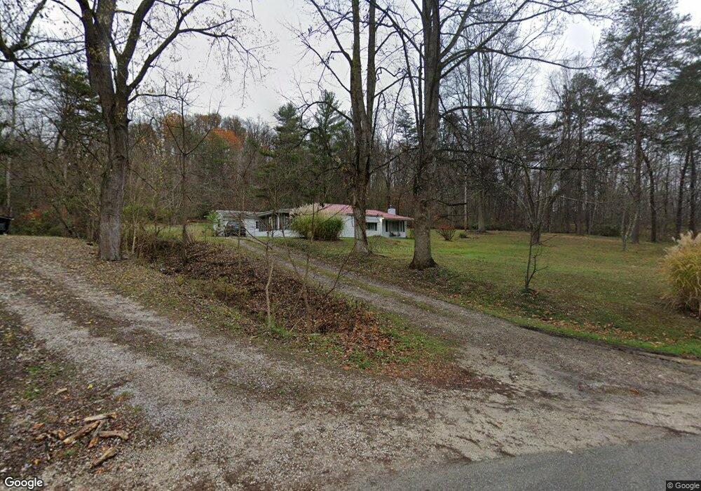
128 Twp Rd 253 E Ironton, OH 45638
Estimated Value: $97,000 - $145,000
2
Beds
1
Bath
1,097
Sq Ft
$110/Sq Ft
Est. Value
About This Home
This home is located at 128 Twp Rd 253 E, Ironton, OH 45638 and is currently estimated at $121,000, approximately $110 per square foot. 128 Twp Rd 253 E is a home with nearby schools including Dawson-Bryant Elementary School, Dawson-Bryant Middle School, and Dawson-Bryant High School.
Ownership History
Date
Name
Owned For
Owner Type
Purchase Details
Closed on
May 12, 2017
Sold by
Adams Lois
Bought by
Palmer Jeffrey and Bowman Whitney Michelle
Current Estimated Value
Purchase Details
Closed on
Oct 28, 2016
Sold by
Adams Lois Eileen Life Est
Bought by
Lois Adams
Purchase Details
Closed on
Jul 19, 2005
Sold by
Adams Lois Eileen
Bought by
Esser Sue Adams and Adams Leah Emileen
Purchase Details
Closed on
Feb 26, 2001
Sold by
Adams Emerson E and Adams Lois
Bought by
Adams Lois Eileen
Create a Home Valuation Report for This Property
The Home Valuation Report is an in-depth analysis detailing your home's value as well as a comparison with similar homes in the area
Home Values in the Area
Average Home Value in this Area
Purchase History
| Date | Buyer | Sale Price | Title Company |
|---|---|---|---|
| Palmer Jeffrey | -- | None Available | |
| Lois Adams | -- | -- | |
| Esser Sue Adams | -- | None Available | |
| Adams Lois Eileen | -- | -- |
Source: Public Records
Tax History Compared to Growth
Tax History
| Year | Tax Paid | Tax Assessment Tax Assessment Total Assessment is a certain percentage of the fair market value that is determined by local assessors to be the total taxable value of land and additions on the property. | Land | Improvement |
|---|---|---|---|---|
| 2024 | -- | $27,520 | $8,350 | $19,170 |
| 2023 | $808 | $27,520 | $8,350 | $19,170 |
| 2022 | $807 | $27,730 | $8,350 | $19,380 |
| 2021 | $709 | $24,520 | $6,660 | $17,860 |
| 2020 | $725 | $24,520 | $6,660 | $17,860 |
| 2019 | $722 | $24,520 | $6,660 | $17,860 |
| 2018 | $730 | $24,520 | $6,660 | $17,860 |
| 2017 | $465 | $24,520 | $6,660 | $17,860 |
| 2016 | $428 | $24,520 | $6,660 | $17,860 |
| 2015 | $473 | $24,900 | $6,620 | $18,280 |
| 2014 | $467 | $24,900 | $6,620 | $18,280 |
| 2013 | $467 | $24,900 | $6,620 | $18,280 |
Source: Public Records
Map
Nearby Homes
- 571 County Road 52
- 156 Township Road 181
- 2088 State Route 243
- 1122 Township Road 266
- 1122 Township Road 266
- 572 Township Road 145
- 572 Township Road 145 Unit KO-4
- 342 Township Road 296
- 103 Carrico Dr
- 119 Remy St
- 2480 County Road 181
- 859 County Road 53
- 6881 State Route 243
- 885 County Road 53
- 0 County Road 181 Unit 24215136
- 0 County Road 181 Unit 11540303
- 135 Lane St
- 309 High St
- 309 High St Unit LAO-5
- 519 Lane St
- 156 Township Road 253 E
- 68 Twp Rd 253 E
- 182 Township Road 253 E
- 157 Township Road 253 E
- 141 Township Road 253 E
- 179 Township Road 253 E
- 201 Township Road 253 E
- 208 Township Road 372
- 103 Township Road 253 E
- 530 Twp Rd 111 S
- 83 Township Road 253 E
- 213 Township Road 253 E
- 233 Township Road 253 E
- 233 Township Road 253 E
- 330 Township Road 372
- 184 Township Road 372 Unit 253
- 514 Twp Rd 111 S
- 277 Township Road 253 E
- 287 Township Road 253 E
- 650 Township Road 111