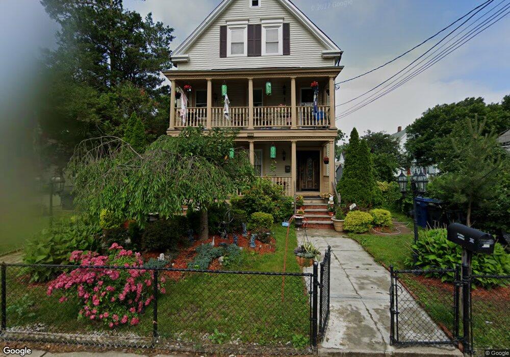
128 Walnut St Unit 1 Dorchester, MA 02122
Neponset-Port Norfolk NeighborhoodEstimated Value: $553,000 - $698,000
2
Beds
1
Bath
1,150
Sq Ft
$542/Sq Ft
Est. Value
About This Home
This home is located at 128 Walnut St Unit 1, Dorchester, MA 02122 and is currently estimated at $622,982, approximately $541 per square foot. 128 Walnut St Unit 1 is a home located in Suffolk County with nearby schools including Neighborhood House Charter School, St Brendan School, and Quincy Catholic Academy.
Ownership History
Date
Name
Owned For
Owner Type
Purchase Details
Closed on
Aug 16, 2005
Sold by
Walnut St Rt 128
Bought by
Ruggiero Joan E
Current Estimated Value
Home Financials for this Owner
Home Financials are based on the most recent Mortgage that was taken out on this home.
Original Mortgage
$355,500
Outstanding Balance
$185,307
Interest Rate
5.54%
Mortgage Type
Purchase Money Mortgage
Estimated Equity
$437,675
Create a Home Valuation Report for This Property
The Home Valuation Report is an in-depth analysis detailing your home's value as well as a comparison with similar homes in the area
Home Values in the Area
Average Home Value in this Area
Purchase History
| Date | Buyer | Sale Price | Title Company |
|---|---|---|---|
| Ruggiero Joan E | $395,000 | -- |
Source: Public Records
Mortgage History
| Date | Status | Borrower | Loan Amount |
|---|---|---|---|
| Open | Ruggiero Joan E | $355,500 |
Source: Public Records
Tax History Compared to Growth
Tax History
| Year | Tax Paid | Tax Assessment Tax Assessment Total Assessment is a certain percentage of the fair market value that is determined by local assessors to be the total taxable value of land and additions on the property. | Land | Improvement |
|---|---|---|---|---|
| 2025 | $6,369 | $550,000 | $0 | $550,000 |
| 2024 | $5,647 | $518,100 | $0 | $518,100 |
| 2023 | $5,401 | $502,900 | $0 | $502,900 |
| 2022 | $5,160 | $474,300 | $0 | $474,300 |
| 2021 | $4,914 | $460,500 | $0 | $460,500 |
| 2020 | $4,606 | $436,200 | $0 | $436,200 |
| 2019 | $4,335 | $411,300 | $0 | $411,300 |
| 2018 | $3,993 | $381,000 | $0 | $381,000 |
| 2017 | $3,702 | $349,600 | $0 | $349,600 |
| 2016 | $3,594 | $326,700 | $0 | $326,700 |
| 2015 | $3,472 | $286,700 | $0 | $286,700 |
| 2014 | $3,309 | $263,000 | $0 | $263,000 |
Source: Public Records
Map
Nearby Homes
- 169 Walnut St Unit 2
- 7 Lorenzo St
- 378 Neponset Ave
- 4 Chickatawbut St
- 7 Bloomington St
- 8 Mckone St
- 22 Chickatawbut St Unit 2
- 36 Mckone St Unit 2
- 36 Mckone St Unit 1
- 36 Mckone St
- 285 Neponset Ave Unit 3
- 49 B Coffey St Unit B
- 45 Coffey St Unit 45-1
- 51 Coffey St Unit 51C
- 56 Coffey St Unit 7
- 43 Chickatawbut St
- 48 Coffey St Unit 10D
- 45 Chickatawbut St Unit 1
- 45 Chickatawbut St Unit 2
- 158 Quincy Shore Dr Unit 78
- 128 Walnut St Unit 2
- 122 Walnut St
- 134 Walnut St
- 118 Walnut St
- 127 Walnut St Unit 1
- 127 Walnut St Unit 129
- 5 Port Norfolk St
- 23 Water St
- 23 Water St Unit 1
- 123 Walnut St
- 3 Port Norfolk St
- 11 Port Norfolk St
- 1 Port Norfolk St
- 133 Walnut St Unit 135
- 7 Walnut Ct
- 140 Walnut St
- 15 Water St
- 4 Walnut Ct
- 17 Port Norfolk St
- 11 Walnut Ct