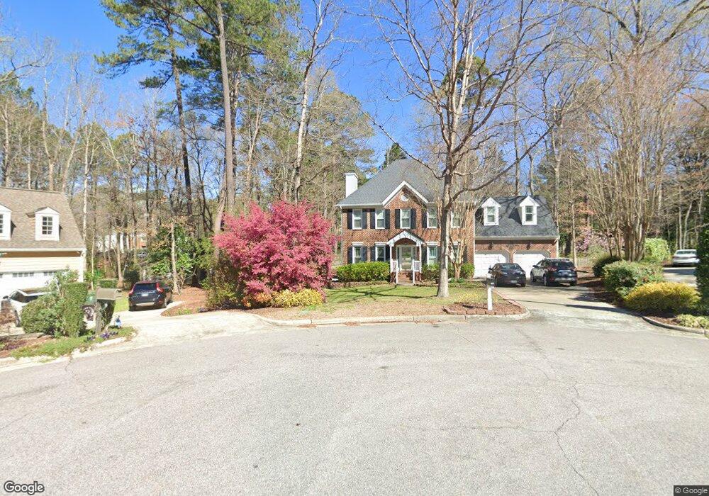
128 Wilander Dr Cary, NC 27511
South Cary NeighborhoodEstimated Value: $582,842 - $699,000
4
Beds
3
Baths
2,336
Sq Ft
$280/Sq Ft
Est. Value
About This Home
This home is located at 128 Wilander Dr, Cary, NC 27511 and is currently estimated at $654,961, approximately $280 per square foot. 128 Wilander Dr is a home located in Wake County with nearby schools including Briarcliff Elementary School, East Cary Middle School, and Cary High School.
Ownership History
Date
Name
Owned For
Owner Type
Purchase Details
Closed on
Apr 24, 2020
Sold by
Lassen Andrew and Lassen Laura Q
Bought by
Ennis Robert and Tierney Lauren
Current Estimated Value
Home Financials for this Owner
Home Financials are based on the most recent Mortgage that was taken out on this home.
Original Mortgage
$367,336
Outstanding Balance
$326,633
Interest Rate
3.6%
Mortgage Type
New Conventional
Estimated Equity
$328,328
Purchase Details
Closed on
Jul 6, 2015
Sold by
Rhodes Thomas M and Rhodes Teresa H
Bought by
Lassen Laura Q and Lassen Adrew
Home Financials for this Owner
Home Financials are based on the most recent Mortgage that was taken out on this home.
Original Mortgage
$315,400
Interest Rate
3.92%
Mortgage Type
New Conventional
Purchase Details
Closed on
May 24, 1994
Bought by
Rhodes Thomas M and Rhodes Teresa H
Create a Home Valuation Report for This Property
The Home Valuation Report is an in-depth analysis detailing your home's value as well as a comparison with similar homes in the area
Home Values in the Area
Average Home Value in this Area
Purchase History
| Date | Buyer | Sale Price | Title Company |
|---|---|---|---|
| Ennis Robert | $425,000 | None Available | |
| Lassen Laura Q | $332,000 | Attorney | |
| Rhodes Thomas M | $180,000 | -- |
Source: Public Records
Mortgage History
| Date | Status | Borrower | Loan Amount |
|---|---|---|---|
| Open | Ennis Robert | $367,336 | |
| Previous Owner | Lassen Laura Q | $315,400 |
Source: Public Records
Tax History Compared to Growth
Tax History
| Year | Tax Paid | Tax Assessment Tax Assessment Total Assessment is a certain percentage of the fair market value that is determined by local assessors to be the total taxable value of land and additions on the property. | Land | Improvement |
|---|---|---|---|---|
| 2025 | $4,625 | $537,232 | $170,000 | $367,232 |
| 2024 | $4,525 | $537,232 | $170,000 | $367,232 |
Source: Public Records
Map
Nearby Homes
- 3012 Leith Meadow Ct
- 102 Shriver Ct
- 312 Heidinger Dr
- 124 Rosewall Ln
- 1017 Thistle Briar Place
- 1424 Kildaire Farm Rd
- 137 Amesbury Ln
- 112 Queensferry Rd
- 811 New Kent Place Unit 1A
- 512 Spring Flower Ct
- 132 New Kent Place Unit 132
- 122 Clancy Cir
- 3413 Wellington Ridge Loop
- 3612 Wellington Ridge Loop
- 131 Clancy Cir
- 127 Clancy Cir
- 1641 Kildonan Place
- 1221 Renshaw Ct
- 124 Twin Oaks Place
- 114 Drummond Place
- 129 Wilander Dr
- 126 Wilander Dr
- 124 Wilander Dr
- 127 Wilander Dr
- 209 Connors Cir
- 115 Ridgepath Way
- 122 Wilander Dr
- 210 Connors Cir
- 117 Ridgepath Way
- 113 Ridgepath Way
- 125 Wilander Dr
- 101 Borotra Ct
- 111 Ridgepath Way
- 208 Connors Cir
- 103 Borotra Ct
- 116 Ridgepath Way
- 109 Ridgepath Way
- 123 Wilander Dr
- 207 Connors Cir
- 206 Connors Cir