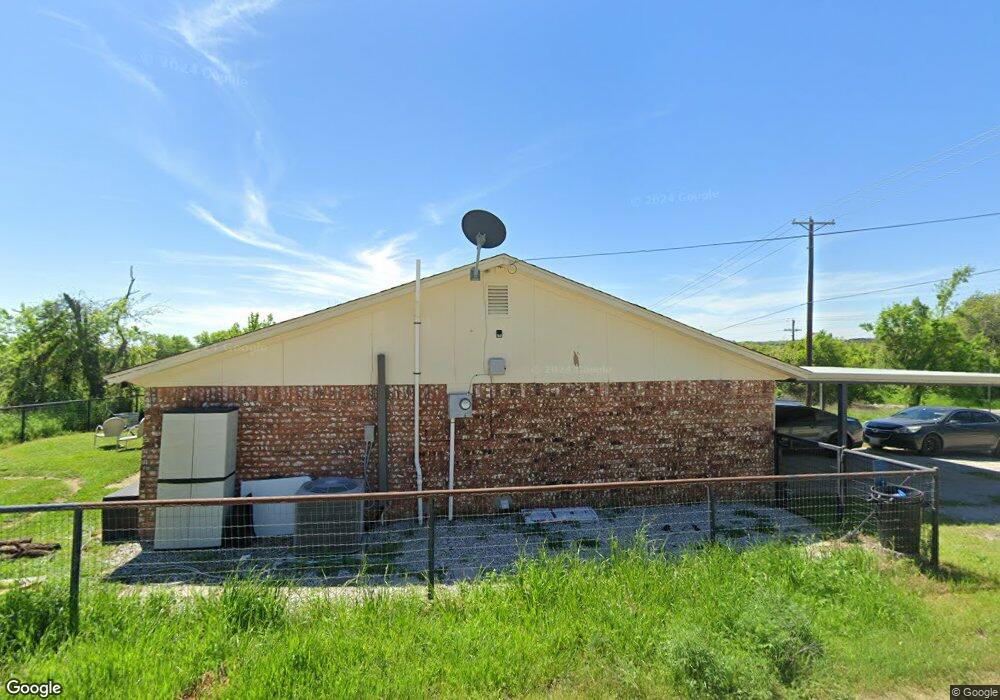
128 Zion Hill Rd Weatherford, TX 76088
Estimated Value: $183,154 - $236,000
2
Beds
1
Bath
896
Sq Ft
$245/Sq Ft
Est. Value
About This Home
This home is located at 128 Zion Hill Rd, Weatherford, TX 76088 and is currently estimated at $219,539, approximately $245 per square foot. 128 Zion Hill Rd is a home located in Parker County with nearby schools including Seguin Elementary School, Tison Middle School, and Weatherford High School.
Ownership History
Date
Name
Owned For
Owner Type
Purchase Details
Closed on
Jul 20, 2017
Sold by
Rancho Estrellita De Cobre Lp
Bought by
Mccauley Dennis M and Mccauley Donna M
Current Estimated Value
Purchase Details
Closed on
Jan 5, 2015
Sold by
Landers Laura
Bought by
Rancho Estrellita De Cobre Lp
Purchase Details
Closed on
Nov 25, 2014
Sold by
Landers Joe
Bought by
Landers Laura
Purchase Details
Closed on
Oct 17, 2012
Sold by
Nicholson Kathy A
Bought by
Rancho Estrellita De Cobre Lp
Purchase Details
Closed on
Apr 14, 2010
Sold by
Nicholson Kathy A Trustee
Bought by
Rancho Estrellita De Cobre Lp
Purchase Details
Closed on
Aug 4, 2005
Sold by
Roberson Kenneth
Bought by
Rancho Estrellita De Cobre Lp
Create a Home Valuation Report for This Property
The Home Valuation Report is an in-depth analysis detailing your home's value as well as a comparison with similar homes in the area
Home Values in the Area
Average Home Value in this Area
Purchase History
| Date | Buyer | Sale Price | Title Company |
|---|---|---|---|
| Mccauley Dennis M | -- | Providence Title Company | |
| Rancho Estrellita De Cobre Lp | -- | None Available | |
| Landers Laura | -- | None Available | |
| Cobre Rancho Estrella Llc | -- | None Available | |
| Rancho Estrellita De Cobre Lp | -- | -- | |
| Rancho Estrellita De Cobre Lp | -- | -- | |
| Nicholson Kathy Ann | -- | None Available | |
| Rancho Estrellita De Cobre Lp | -- | -- | |
| Nicholson Kathy Ann | -- | None Available |
Source: Public Records
Tax History Compared to Growth
Tax History
| Year | Tax Paid | Tax Assessment Tax Assessment Total Assessment is a certain percentage of the fair market value that is determined by local assessors to be the total taxable value of land and additions on the property. | Land | Improvement |
|---|---|---|---|---|
| 2025 | $1,960 | $169,960 | $26,390 | $143,570 |
| 2024 | $1,960 | $155,440 | $22,950 | $132,490 |
| 2023 | $1,960 | $155,440 | $22,950 | $132,490 |
| 2022 | $1,949 | $87,860 | $11,480 | $76,380 |
| 2021 | $1,743 | $72,580 | $11,480 | $61,100 |
| 2020 | $1,661 | $68,760 | $9,180 | $59,580 |
| 2019 | $1,756 | $68,760 | $9,180 | $59,580 |
| 2018 | $1,771 | $69,060 | $6,890 | $62,170 |
| 2017 | $1,817 | $69,060 | $6,890 | $62,170 |
| 2016 | $1,733 | $65,870 | $5,740 | $60,130 |
| 2015 | $1,697 | $65,870 | $5,740 | $60,130 |
| 2014 | $1,304 | $51,920 | $4,590 | $47,330 |
Source: Public Records
Map
Nearby Homes
- 1425 N Bowie Dr
- 522 W 7th St
- 1616 Oliver St
- 1613 Franklin St
- 1313 Oliver St
- 104 Lagrange Ct
- 1727 N Main St
- 1407 Franklin St
- 1301 Oliver St
- 1813 Roadrunner Dr
- 1713 N Main St
- 116 W 7th St
- 2020 Vanderbilt Dr
- 107 Hall St
- 2000 Vanderbilt Dr
- 2016 Vanderbilt Dr
- 2117 Pepperdine Dr
- Lot 11 Pepperdine Dr
- Lot 12 Pepperdine Dr
- Lot 10 Pepperdine Dr