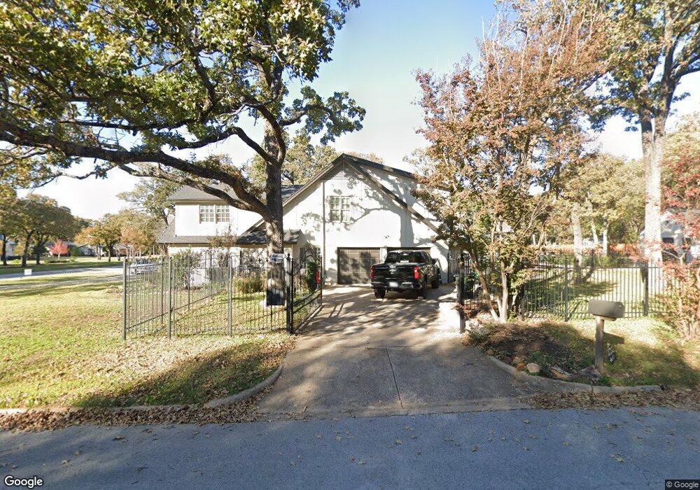
1280 Cypress Creek Cir Southlake, TX 76092
Estimated Value: $1,424,642 - $1,644,000
4
Beds
5
Baths
3,940
Sq Ft
$382/Sq Ft
Est. Value
About This Home
This home is located at 1280 Cypress Creek Cir, Southlake, TX 76092 and is currently estimated at $1,506,661, approximately $382 per square foot. 1280 Cypress Creek Cir is a home located in Tarrant County with nearby schools including Don T. Durham Intermediate School, Walnut Grove Elementary School, and Carroll Middle School.
Ownership History
Date
Name
Owned For
Owner Type
Purchase Details
Closed on
Sep 22, 2020
Sold by
White Ryan P and White Teresa
Bought by
Vannoy Jennifer Lynn
Current Estimated Value
Home Financials for this Owner
Home Financials are based on the most recent Mortgage that was taken out on this home.
Original Mortgage
$510,400
Outstanding Balance
$452,946
Interest Rate
2.9%
Mortgage Type
New Conventional
Estimated Equity
$1,053,715
Purchase Details
Closed on
Jun 1, 2007
Sold by
Thao Kou and Vang Pagnia
Bought by
White Ryan P and Kempker Teresa
Home Financials for this Owner
Home Financials are based on the most recent Mortgage that was taken out on this home.
Original Mortgage
$140,000
Interest Rate
6.17%
Mortgage Type
Purchase Money Mortgage
Purchase Details
Closed on
Sep 3, 2003
Sold by
Cendant Mobility Financial Corp
Bought by
Thao Kou and Vang Pagnia
Home Financials for this Owner
Home Financials are based on the most recent Mortgage that was taken out on this home.
Original Mortgage
$294,400
Interest Rate
4.25%
Mortgage Type
Stand Alone Second
Purchase Details
Closed on
Jul 10, 2003
Sold by
Swift Jennifer L and Swift Terry P
Bought by
Cendant Mobility Financial Corp
Home Financials for this Owner
Home Financials are based on the most recent Mortgage that was taken out on this home.
Original Mortgage
$294,400
Interest Rate
4.25%
Mortgage Type
Stand Alone Second
Purchase Details
Closed on
Sep 21, 2000
Sold by
Ingram Stephen and Bourne Gail M
Bought by
Swift Terry P and Swift Jennifer L
Home Financials for this Owner
Home Financials are based on the most recent Mortgage that was taken out on this home.
Original Mortgage
$196,100
Interest Rate
7.96%
Purchase Details
Closed on
Jun 28, 1994
Sold by
Denning Theodore Martin and Drake Mary Eleanor
Bought by
Ingram Stephen and Bourne Gail M
Home Financials for this Owner
Home Financials are based on the most recent Mortgage that was taken out on this home.
Original Mortgage
$202,500
Interest Rate
6.12%
Create a Home Valuation Report for This Property
The Home Valuation Report is an in-depth analysis detailing your home's value as well as a comparison with similar homes in the area
Home Values in the Area
Average Home Value in this Area
Purchase History
| Date | Buyer | Sale Price | Title Company |
|---|---|---|---|
| Vannoy Jennifer Lynn | -- | Alamo Title Company | |
| White Ryan P | -- | None Available | |
| Thao Kou | -- | First American Title | |
| Cendant Mobility Financial Corp | -- | First American Title | |
| Swift Terry P | -- | Lone Star Title Inc | |
| Ingram Stephen | -- | American Title Company |
Source: Public Records
Mortgage History
| Date | Status | Borrower | Loan Amount |
|---|---|---|---|
| Open | Vannoy Jennifer Lynn | $510,400 | |
| Previous Owner | White Ryan P | $140,000 | |
| Previous Owner | Thao Kou | $294,400 | |
| Previous Owner | Swift Terry P | $196,100 | |
| Previous Owner | Ingram Stephen | $202,500 |
Source: Public Records
Tax History Compared to Growth
Tax History
| Year | Tax Paid | Tax Assessment Tax Assessment Total Assessment is a certain percentage of the fair market value that is determined by local assessors to be the total taxable value of land and additions on the property. | Land | Improvement |
|---|---|---|---|---|
| 2025 | $15,611 | $1,307,306 | $595,860 | $711,446 |
| 2024 | $15,611 | $1,307,306 | $595,860 | $711,446 |
| 2023 | $24,242 | $1,330,000 | $595,860 | $734,140 |
| 2022 | $19,050 | $883,000 | $434,050 | $448,950 |
| 2021 | $17,602 | $772,022 | $434,050 | $337,972 |
| 2020 | $14,451 | $628,700 | $497,240 | $131,460 |
| 2019 | $15,224 | $628,700 | $497,240 | $131,460 |
| 2018 | $15,411 | $675,600 | $497,240 | $178,360 |
| 2017 | $16,333 | $677,825 | $297,240 | $380,585 |
| 2016 | $14,848 | $707,674 | $309,050 | $398,624 |
| 2015 | $11,967 | $515,938 | $90,000 | $425,938 |
| 2014 | $11,967 | $519,600 | $90,000 | $429,600 |
Source: Public Records
Map
Nearby Homes
- 1425 N Peytonville Ave
- 1161 La Mirada
- 914 Turnberry Ln
- 1402 Thetford Ct
- 1805 Leeds Dr
- 1371 Holland Hill
- 1900 Shady Oaks Dr
- 1275 Shady Oaks Dr
- 1633 Mockingbird Ln
- 1285 Shady Oaks Dr
- 935 W Dove Rd
- 1820 Beam Dr
- 810 Brazos Dr
- 912 Berkshire Rd
- 1052 W Dove Rd
- 1600 Enclave Ct
- 1720 Maranatha Way
- 1340 Meadow Glen
- 1567 Dove Rd
- 550 N Peytonville Ave
- 1280 Cypress Creek Ct
- 1481 Post Oak Trail
- 1281 Cypress Creek Cir
- 1281 Cypress Creek Ct
- 1501 Post Oak Trail
- 1400 Post Oak Trail
- 1450 Post Oak Trail
- 1240 Cypress Creek Ct
- 1241 Cypress Creek Ct
- 1351 Post Oak Trail
- 1350 Post Oak Trail
- 1281 Post Oak Trail
- 1500 Post Oak Trail
- 1241 Post Oak Trail
- 1200 Cypress Creek Ct
- 1201 Cypress Creek Cir
- 1201 Cypress Creek Ct
- 1540 Post Oak Trail
- 1201 Post Oak Trail
- 1330 N Peytonville Ave