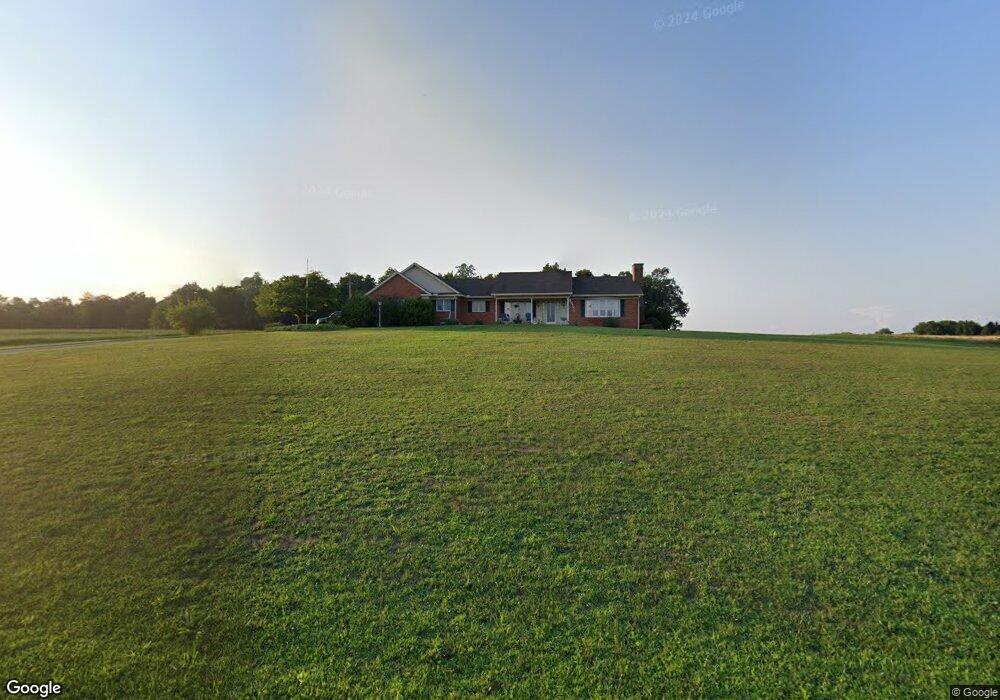
1280 Georgetown Rd Littlestown, PA 17340
Estimated Value: $381,000 - $1,064,874
3
Beds
1
Bath
1,404
Sq Ft
$515/Sq Ft
Est. Value
About This Home
This home is located at 1280 Georgetown Rd, Littlestown, PA 17340 and is currently estimated at $722,937, approximately $514 per square foot. 1280 Georgetown Rd is a home located in Adams County with nearby schools including Rolling Acres El School, Maple Avenue Middle School, and Littlestown Senior High School.
Ownership History
Date
Name
Owned For
Owner Type
Purchase Details
Closed on
Mar 15, 2023
Sold by
Beachtel Ralph M and Beachtel Darlene M
Bought by
Commonwealth Of Pennsylvania Through The Depa
Current Estimated Value
Purchase Details
Closed on
Jul 24, 2015
Sold by
Beachtel Ralph M
Bought by
Beachtel Ralph M and Beachtel Darlene M
Purchase Details
Closed on
May 3, 1988
Bought by
Beachtel Paul M and Beachtel Loretta J
Create a Home Valuation Report for This Property
The Home Valuation Report is an in-depth analysis detailing your home's value as well as a comparison with similar homes in the area
Home Values in the Area
Average Home Value in this Area
Purchase History
| Date | Buyer | Sale Price | Title Company |
|---|---|---|---|
| Commonwealth Of Pennsylvania Through The Depa | -- | None Listed On Document | |
| Beachtel Ralph M | -- | None Available | |
| Beachtel Paul M | -- | -- |
Source: Public Records
Tax History Compared to Growth
Tax History
| Year | Tax Paid | Tax Assessment Tax Assessment Total Assessment is a certain percentage of the fair market value that is determined by local assessors to be the total taxable value of land and additions on the property. | Land | Improvement |
|---|---|---|---|---|
| 2025 | $4,365 | $230,600 | $57,700 | $172,900 |
| 2024 | $4,196 | $230,600 | $57,700 | $172,900 |
| 2023 | $13,151 | $230,700 | $57,800 | $172,900 |
| 2022 | $13,055 | $230,700 | $57,800 | $172,900 |
| 2021 | $12,591 | $230,700 | $57,800 | $172,900 |
| 2020 | $12,408 | $230,700 | $57,800 | $172,900 |
| 2019 | $3,562 | $230,700 | $57,800 | $172,900 |
| 2018 | $11,781 | $230,700 | $57,800 | $172,900 |
| 2017 | $3,551 | $230,700 | $57,800 | $172,900 |
| 2016 | -- | $230,600 | $57,700 | $172,900 |
| 2015 | -- | $225,400 | $52,500 | $172,900 |
| 2014 | -- | $220,800 | $47,900 | $172,900 |
Source: Public Records
Map
Nearby Homes
- 2100 Blacks School House Rd
- 9 Darlyn Dr
- 28 Gettysburg Ct Unit 60
- 15 Yorktowne Ct Unit 97
- 630 Mehring Rd Unit 4
- 4703 Babylon Rd
- 117 Charles St
- 115 Charles St
- 61 E King St
- 129 W King St
- 211 E King St
- LOT 9 Mehring Rd
- 535 Lumber St
- 559 Lumber St
- 567 Lumber St
- 22 Rita Marie Ave
- 449 Glenwyn Dr
- 5 Manor Cir Unit 103
- 52 Stayman Way Unit 81
- 41 Smith Cir
- 1365 Georgetown Rd
- 1365 Georgetown Rd
- 1224 Georgetown Rd
- 1225 Georgetown Rd
- 1210 Georgetown Rd
- 6399 Baltimore Pike
- 6481 Baltimore Pike Unit 1
- 1134 Georgetown Rd
- 6547 Baltimore Pike
- 1105 Georgetown Rd
- 6505 Baltimore Pike Unit 2
- 6667 Baltimore Pike
- 6634 Baltimore Pike
- 6644 Baltimore Pike Unit 2
- 6479 Baltimore Pike Unit 2
- 6654 Baltimore Pike
- 6608 Baltimore Pike Unit 5
- 6630 Baltimore Pike
- 6590 Baltimore Pike Unit 6
- 6580 Baltimore Pike