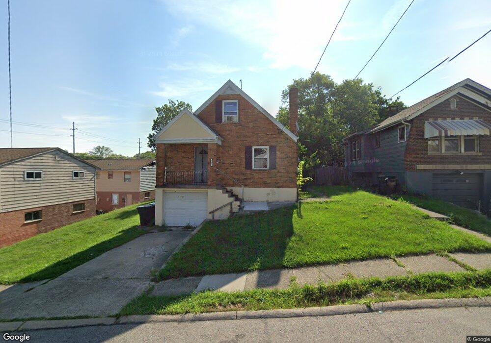
1280 Henkel Dr Cincinnati, OH 45205
West Price Hill NeighborhoodEstimated Value: $133,000 - $149,923
2
Beds
1
Bath
1,221
Sq Ft
$116/Sq Ft
Est. Value
About This Home
This home is located at 1280 Henkel Dr, Cincinnati, OH 45205 and is currently estimated at $141,231, approximately $115 per square foot. 1280 Henkel Dr is a home located in Hamilton County with nearby schools including Carson School, Gilbert A. Dater High School, and Western Hills High School.
Ownership History
Date
Name
Owned For
Owner Type
Purchase Details
Closed on
Nov 22, 2014
Sold by
David Rentals Llc
Bought by
579 Blair Llc
Current Estimated Value
Purchase Details
Closed on
Aug 7, 2014
Sold by
State Of Ohio
Bought by
David Rentals Llc
Purchase Details
Closed on
Jan 18, 2007
Sold by
Household Realty Corp
Bought by
Campbell Robert
Home Financials for this Owner
Home Financials are based on the most recent Mortgage that was taken out on this home.
Original Mortgage
$37,300
Interest Rate
8.55%
Mortgage Type
Unknown
Purchase Details
Closed on
Jun 30, 2006
Sold by
Embry Betty P
Bought by
Household Realty Corp
Purchase Details
Closed on
Oct 2, 1998
Sold by
Jetter Paul A J and Craycroft James P
Bought by
Embry Betty P
Purchase Details
Closed on
Mar 26, 1996
Sold by
Kinsey Ens Twyla Jean
Bought by
Jetter Paul A J and Craycroft James P
Home Financials for this Owner
Home Financials are based on the most recent Mortgage that was taken out on this home.
Original Mortgage
$49,119
Interest Rate
6.98%
Mortgage Type
FHA
Create a Home Valuation Report for This Property
The Home Valuation Report is an in-depth analysis detailing your home's value as well as a comparison with similar homes in the area
Home Values in the Area
Average Home Value in this Area
Purchase History
| Date | Buyer | Sale Price | Title Company |
|---|---|---|---|
| 579 Blair Llc | -- | None Available | |
| David Rentals Llc | $1,800 | Attorney | |
| Campbell Robert | $37,300 | Attorney | |
| Household Realty Corp | $40,000 | None Available | |
| Embry Betty P | $58,300 | -- | |
| Jetter Paul A J | $48,000 | -- |
Source: Public Records
Mortgage History
| Date | Status | Borrower | Loan Amount |
|---|---|---|---|
| Previous Owner | Campbell Robert | $37,300 | |
| Previous Owner | Jetter Paul A J | $49,119 |
Source: Public Records
Tax History Compared to Growth
Tax History
| Year | Tax Paid | Tax Assessment Tax Assessment Total Assessment is a certain percentage of the fair market value that is determined by local assessors to be the total taxable value of land and additions on the property. | Land | Improvement |
|---|---|---|---|---|
| 2024 | $2,421 | $38,115 | $4,557 | $33,558 |
| 2023 | $2,425 | $38,115 | $4,557 | $33,558 |
| 2022 | $799 | $11,165 | $4,529 | $6,636 |
| 2021 | $782 | $11,165 | $4,529 | $6,636 |
| 2020 | $784 | $11,165 | $4,529 | $6,636 |
| 2019 | $782 | $10,150 | $4,116 | $6,034 |
| 2018 | $783 | $10,150 | $4,116 | $6,034 |
| 2017 | $1,505 | $20,377 | $4,116 | $16,261 |
| 2016 | $773 | $3,465 | $3,045 | $420 |
| 2015 | $241 | $3,465 | $3,045 | $420 |
| 2014 | $1,445 | $21,235 | $4,400 | $16,835 |
| 2013 | $1,669 | $24,129 | $4,998 | $19,131 |
Source: Public Records
Map
Nearby Homes
- 3744 Mayfield Ave
- 3742 Mayfield Ave
- 1318 Beech Ave
- 3810 W Liberty St
- 3910 W Liberty St
- 1700 Minion Ave
- 1702 Wyoming Ave
- 1605 Ross Ave
- 4000 W Liberty St
- 1709 Wyoming Ave
- 1215 Ridlen Ave
- 1273 Iliff Ave
- 3634 W Liberty St
- 1438 Manss Ave
- 1645 Iliff Ave
- 1118 Seton Ave
- 2403 Glenway Ave
- 1634 Gilsey Ave
- 1114 Seton Ave
- 1506 Beech Ave
- 1276 Henkel Dr
- 1272 Henkel Dr
- 1268 Henkel Dr
- 3765 W Liberty St
- 3785 W Liberty St
- 1264 Henkel Dr
- 1281 Henkel Dr
- 1265 Quebec Rd
- 1273 Quebec Rd
- 1275 Henkel Dr
- 1269 Quebec Rd
- 3759 W Liberty St
- 1273 Henkel Dr
- 3774 W Liberty St
- 1261 Quebec Rd
- 1271 Henkel Dr
- 1260 Henkel Dr
- 3770 W Liberty St
- 1263 Henkel Dr
- 1259 Quebec Rd