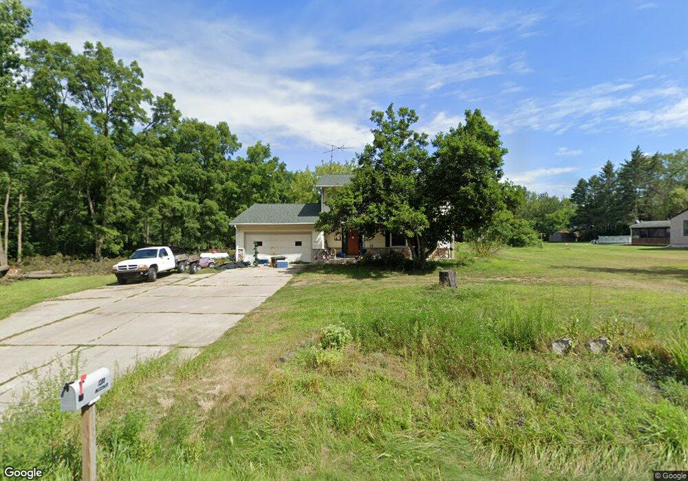
1280 Maplegrove Rd Jackson, MI 49201
Estimated Value: $278,000 - $314,000
3
Beds
2
Baths
1,944
Sq Ft
$150/Sq Ft
Est. Value
About This Home
This home is located at 1280 Maplegrove Rd, Jackson, MI 49201 and is currently estimated at $292,357, approximately $150 per square foot. 1280 Maplegrove Rd is a home located in Jackson County with nearby schools including Northwest Elementary School, Northwest Early Elementary School, and Northwest Middle School.
Ownership History
Date
Name
Owned For
Owner Type
Purchase Details
Closed on
Sep 25, 2017
Sold by
Ream Michael J
Bought by
Messner James and Messner Katrina
Current Estimated Value
Purchase Details
Closed on
May 17, 2017
Sold by
Ream Michael J
Bought by
Wells Fargo Bank Na
Purchase Details
Closed on
Jun 28, 2010
Sold by
Bac Home Loans Servicing L P
Bought by
Federal National Mortgage Association
Purchase Details
Closed on
Aug 31, 2000
Sold by
Lacroix Peter and Lacroix Marilyn
Bought by
Mann Michael G and Mann Wendy K
Home Financials for this Owner
Home Financials are based on the most recent Mortgage that was taken out on this home.
Original Mortgage
$133,000
Interest Rate
8.15%
Purchase Details
Closed on
Sep 20, 1996
Sold by
Lacroix Peter and Lacroix Marilyn
Bought by
Kurpenski Mark D
Create a Home Valuation Report for This Property
The Home Valuation Report is an in-depth analysis detailing your home's value as well as a comparison with similar homes in the area
Purchase History
| Date | Buyer | Sale Price | Title Company |
|---|---|---|---|
| Messner James | $148,000 | None Available | |
| Wells Fargo Bank Na | $105,862 | Attorney | |
| Federal National Mortgage Association | -- | None Available | |
| Mann Michael G | $140,000 | -- | |
| Kurpenski Mark D | -- | -- |
Source: Public Records
Mortgage History
| Date | Status | Borrower | Loan Amount |
|---|---|---|---|
| Previous Owner | Mann Michael G | $133,000 |
Source: Public Records
Tax History Compared to Growth
Tax History
| Year | Tax Paid | Tax Assessment Tax Assessment Total Assessment is a certain percentage of the fair market value that is determined by local assessors to be the total taxable value of land and additions on the property. | Land | Improvement |
|---|---|---|---|---|
| 2025 | $3,140 | $137,000 | $137,000 | $0 |
| 2024 | $18 | $129,700 | $129,700 | $0 |
| 2023 | $1,675 | $123,200 | $123,200 | $0 |
| 2022 | $2,848 | $111,600 | $111,600 | $0 |
| 2021 | $2,828 | $108,800 | $108,800 | $0 |
| 2020 | $2,782 | $99,000 | $0 | $0 |
| 2019 | $2,714 | $89,400 | $0 | $0 |
| 2018 | $2,798 | $91,000 | $0 | $0 |
| 2017 | $2,309 | $87,200 | $0 | $0 |
| 2016 | $1,678 | $82,100 | $82,100 | $0 |
| 2015 | $2,248 | $77,300 | $77,300 | $0 |
| 2014 | $2,248 | $77,800 | $0 | $0 |
| 2013 | -- | $77,800 | $77,800 | $0 |
Source: Public Records
Map
Nearby Homes
- 1024 Maple Grove Rd
- 6934 Lansing Ave
- VL Fosland Farms Dr
- 237 Grand River Cir
- 5177 Stone River Rd
- 5124 Emerald Rd
- 4424 Zion Rd
- 7466 Bunkerhill Rd
- 5038 Fieldstone St
- 2651 Elliott Rd
- 5123 S Granite St
- 100 Burt Ave
- 0 Burt Ave
- 8645 Lansing Ave
- 1740 W Berry Rd
- 6501 Hawkins Rd
- 4223 Aspen Way
- 8843 Bunkerhill Rd
- 135 Peacock Walk
- 156 Old Wagon Trail
- 1280 Maple Grove Rd
- 1282 Maplegrove Rd
- 1284 Maplegrove Rd
- 1287 Maplegrove Rd
- 1320 Maplegrove Rd
- 1355 Maple Grove Rd
- 1359 Maplegrove Rd
- 1359 Maplegrove Rd
- 1359 Maplegrove Rd
- 1359 Maplegrove Rd
- 1359 Maple Grove Rd
- 1100 Maple Grove Rd
- 1100 Maplegrove Rd
- 1284 Maplegrove Rd
- 1100 Maplegrove Rd
- 11313 MAYFIELD ST Maplegrove Rd
- 1190 Maplegrove Rd
- 1190 Maple Grove Rd
- 1755 Maple Grove Rd
- 1755 Maplegrove Rd