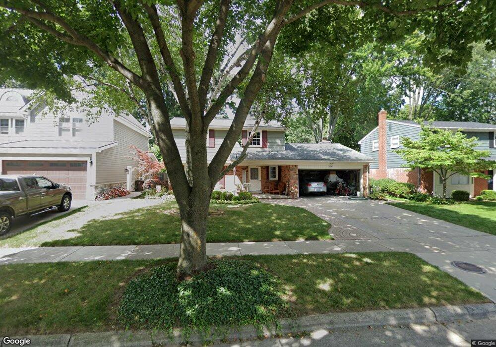
1280 Palmer St Plymouth, MI 48170
Estimated Value: $520,410 - $657,000
4
Beds
2
Baths
1,776
Sq Ft
$328/Sq Ft
Est. Value
About This Home
This home is located at 1280 Palmer St, Plymouth, MI 48170 and is currently estimated at $582,103, approximately $327 per square foot. 1280 Palmer St is a home located in Wayne County with nearby schools including Canton High School, Smith Elementary School, and West Middle School.
Ownership History
Date
Name
Owned For
Owner Type
Purchase Details
Closed on
Dec 21, 2018
Sold by
Benninger Michael G
Bought by
Benninger Michael G and Benninger Kathleen S
Current Estimated Value
Home Financials for this Owner
Home Financials are based on the most recent Mortgage that was taken out on this home.
Original Mortgage
$150,000
Outstanding Balance
$132,153
Interest Rate
4.8%
Mortgage Type
Credit Line Revolving
Estimated Equity
$449,950
Purchase Details
Closed on
Jul 23, 1996
Sold by
Benninger Michael G
Bought by
Frank A and Benages Elizabeth A
Create a Home Valuation Report for This Property
The Home Valuation Report is an in-depth analysis detailing your home's value as well as a comparison with similar homes in the area
Home Values in the Area
Average Home Value in this Area
Purchase History
| Date | Buyer | Sale Price | Title Company |
|---|---|---|---|
| Benninger Michael G | -- | Progressive Title | |
| Frank A | $180,000 | -- |
Source: Public Records
Mortgage History
| Date | Status | Borrower | Loan Amount |
|---|---|---|---|
| Open | Benninger Michael G | $150,000 |
Source: Public Records
Tax History Compared to Growth
Tax History
| Year | Tax Paid | Tax Assessment Tax Assessment Total Assessment is a certain percentage of the fair market value that is determined by local assessors to be the total taxable value of land and additions on the property. | Land | Improvement |
|---|---|---|---|---|
| 2025 | $5,607 | $232,000 | $0 | $0 |
| 2024 | $5,607 | $223,400 | $0 | $0 |
| 2023 | $6,643 | $195,000 | $0 | $0 |
| 2022 | $5,789 | $182,900 | $0 | $0 |
| 2021 | $5,609 | $179,100 | $0 | $0 |
| 2020 | $5,595 | $180,100 | $0 | $0 |
| 2019 | $4,926 | $178,300 | $0 | $0 |
| 2018 | $4,784 | $162,700 | $0 | $0 |
| 2017 | $1,013 | $159,700 | $0 | $0 |
| 2016 | $5,212 | $153,400 | $0 | $0 |
| 2015 | $11,938 | $132,980 | $0 | $0 |
| 2013 | $11,565 | $132,310 | $0 | $0 |
| 2011 | -- | $111,690 | $0 | $0 |
Source: Public Records
Map
Nearby Homes
- 1125 Sutherland St
- 1199 S Sheldon Rd Unit 77
- 1338 S Harvey St
- 638 S Harvey St
- 844 Ross St
- 44571 Clare Blvd
- 553 Jener Place
- 10839 Brookwood Dr
- 44736 Lynn Dr
- 9453 Brookline Ave
- 44750 Erin Dr Unit 40
- 685 Ross St
- 775 Deer Ct Unit 104
- 44703 Erin Dr
- 44872 Lynn Dr
- 9405 Northern Ave
- 801 W Ann Arbor Trail Unit 306
- 44877 Erin Dr Unit 2
- 543 Deer St
- 684 Harding St