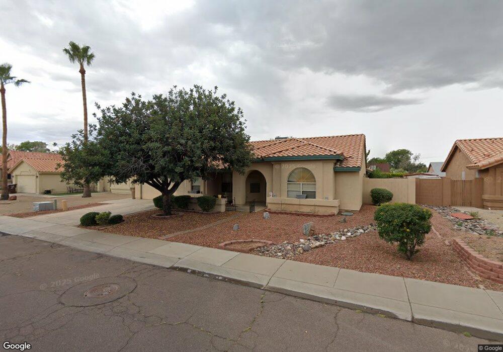
12800 N 72nd Dr Peoria, AZ 85381
Estimated Value: $413,374 - $510,000
3
Beds
2
Baths
2,154
Sq Ft
$217/Sq Ft
Est. Value
About This Home
This home is located at 12800 N 72nd Dr, Peoria, AZ 85381 and is currently estimated at $468,344, approximately $217 per square foot. 12800 N 72nd Dr is a home located in Maricopa County with nearby schools including Oakwood Elementary School, Cactus High School, and Legacy Traditional School - Glendale.
Ownership History
Date
Name
Owned For
Owner Type
Purchase Details
Closed on
Apr 28, 2004
Sold by
Gannon Kristen
Bought by
Ruthenberg Louise C
Current Estimated Value
Home Financials for this Owner
Home Financials are based on the most recent Mortgage that was taken out on this home.
Original Mortgage
$50,000
Outstanding Balance
$25,272
Interest Rate
6.62%
Mortgage Type
Purchase Money Mortgage
Estimated Equity
$443,072
Purchase Details
Closed on
Jan 15, 2002
Sold by
Kemp Stephen M and Kemp Joy L
Bought by
Gannon Kristen
Home Financials for this Owner
Home Financials are based on the most recent Mortgage that was taken out on this home.
Original Mortgage
$150,350
Interest Rate
6.84%
Mortgage Type
New Conventional
Create a Home Valuation Report for This Property
The Home Valuation Report is an in-depth analysis detailing your home's value as well as a comparison with similar homes in the area
Home Values in the Area
Average Home Value in this Area
Purchase History
| Date | Buyer | Sale Price | Title Company |
|---|---|---|---|
| Ruthenberg Louise C | $193,000 | Grand Canyon Title Agency In | |
| Gannon Kristen | $155,000 | First American Title |
Source: Public Records
Mortgage History
| Date | Status | Borrower | Loan Amount |
|---|---|---|---|
| Open | Ruthenberg Louise C | $50,000 | |
| Previous Owner | Gannon Kristen | $150,350 |
Source: Public Records
Tax History Compared to Growth
Tax History
| Year | Tax Paid | Tax Assessment Tax Assessment Total Assessment is a certain percentage of the fair market value that is determined by local assessors to be the total taxable value of land and additions on the property. | Land | Improvement |
|---|---|---|---|---|
| 2025 | $1,657 | $21,881 | -- | -- |
| 2024 | $1,678 | $20,839 | -- | -- |
| 2023 | $1,678 | $32,450 | $6,490 | $25,960 |
| 2022 | $1,643 | $25,260 | $5,050 | $20,210 |
| 2021 | $1,759 | $23,200 | $4,640 | $18,560 |
| 2020 | $1,775 | $23,510 | $4,700 | $18,810 |
| 2019 | $1,718 | $20,950 | $4,190 | $16,760 |
| 2018 | $1,661 | $19,710 | $3,940 | $15,770 |
| 2017 | $1,662 | $19,050 | $3,810 | $15,240 |
| 2016 | $1,645 | $18,420 | $3,680 | $14,740 |
| 2015 | $1,535 | $17,780 | $3,550 | $14,230 |
Source: Public Records
Map
Nearby Homes
- 7301 W Sweetwater Ave
- 12709 N 72nd Ave
- 7233 W Corrine Dr
- 7220 W Larkspur Dr
- 7418 W Corrine Dr
- 7191 W Surrey Ave
- 7214 W Columbine Dr
- 7326 W Pershing Ave
- 7126 W Columbine Dr
- 13051 N 75th Dr
- 7537 W Dreyfus Dr
- 7544 W Dreyfus Dr
- 12677 N 77th Dr
- 13629 N 71st Dr
- 13676 N 73rd Dr Unit 3
- 7725 W Dreyfus Dr
- 7138 W Rue de Lamour
- 7236 W Voltaire Ave
- 7266 W Cherry Hills Dr
- 7638 W Shaw Butte Dr
- 12810 N 72nd Dr
- 12730 N 72nd Dr
- 12857 N 73rd Ave
- 12851 N 73rd Ave
- 12863 N 73rd Ave
- 12720 N 72nd Dr
- 12820 N 72nd Dr
- 12801 N 72nd Dr
- 12811 N 72nd Dr
- 12713 N 73rd Ave
- 12731 N 72nd Dr
- 12869 N 73rd Ave
- 12821 N 72nd Dr
- 12710 N 72nd Dr
- 12900 N 72nd Dr
- 12721 N 72nd Dr
- 12707 N 73rd Ave
- 12925 N 73rd Ave
- 7302 W Aster Dr
- 12808 N 72nd Ave