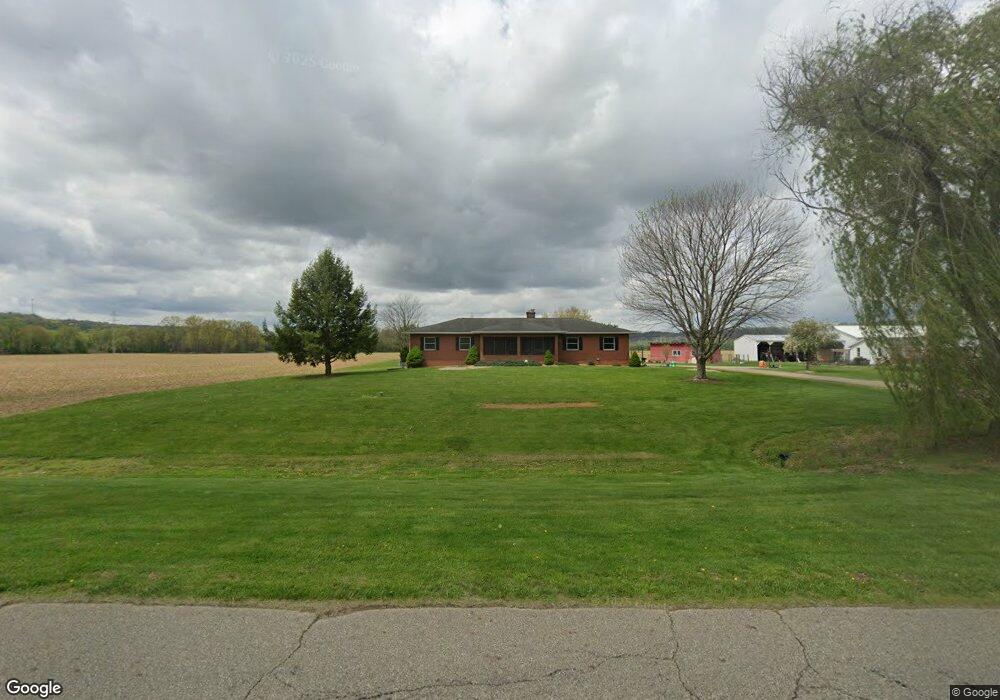
12801 Bottom Rd Dresden, OH 43821
Estimated Value: $160,000
3
Beds
2
Baths
1,480
Sq Ft
$108/Sq Ft
Est. Value
About This Home
This home is located at 12801 Bottom Rd, Dresden, OH 43821 and is currently estimated at $160,000, approximately $108 per square foot. 12801 Bottom Rd is a home located in Muskingum County with nearby schools including Tri-Valley High School.
Ownership History
Date
Name
Owned For
Owner Type
Purchase Details
Closed on
Nov 6, 2025
Sold by
Hudson Family Farms Of Dresden Llc
Bought by
Hudson Cole M and Hudson Taylor N
Current Estimated Value
Purchase Details
Closed on
Mar 8, 2016
Sold by
Hudson Lori K
Bought by
Hudson Family Farms Of Dresden Llc
Home Financials for this Owner
Home Financials are based on the most recent Mortgage that was taken out on this home.
Interest Rate
3.64%
Purchase Details
Closed on
Nov 20, 2015
Sold by
Mcbride Robert T
Bought by
Hudson Lori K
Home Financials for this Owner
Home Financials are based on the most recent Mortgage that was taken out on this home.
Interest Rate
3.97%
Purchase Details
Closed on
Nov 12, 2015
Sold by
Mcbride Robert T
Bought by
Mcbride Robert T and Mcbride Margaret A
Home Financials for this Owner
Home Financials are based on the most recent Mortgage that was taken out on this home.
Interest Rate
3.97%
Purchase Details
Closed on
Apr 19, 1993
Bought by
Mcbride Margaret A
Create a Home Valuation Report for This Property
The Home Valuation Report is an in-depth analysis detailing your home's value as well as a comparison with similar homes in the area
Purchase History
| Date | Buyer | Sale Price | Title Company |
|---|---|---|---|
| Hudson Cole M | -- | None Listed On Document | |
| Hudson Family Farms Of Dresden Llc | -- | -- | |
| Hudson Lori K | -- | -- | |
| Mcbride Robert T | -- | -- | |
| Mcbride Margaret A | -- | -- |
Source: Public Records
Mortgage History
| Date | Status | Borrower | Loan Amount |
|---|---|---|---|
| Previous Owner | Mcbride Robert T | -- | |
| Previous Owner | Mcbride Robert T | -- | |
| Previous Owner | Mcbride Robert T | -- |
Source: Public Records
Tax History
| Year | Tax Paid | Tax Assessment Tax Assessment Total Assessment is a certain percentage of the fair market value that is determined by local assessors to be the total taxable value of land and additions on the property. | Land | Improvement |
|---|---|---|---|---|
| 2025 | $318 | $18,690 | $18,690 | $0 |
| 2024 | $235 | $20,930 | $20,930 | $0 |
| 2023 | $124 | $12,215 | $12,215 | $0 |
| 2022 | $125 | $12,215 | $12,215 | $0 |
| 2021 | $123 | $12,215 | $12,215 | $0 |
| 2020 | $185 | $12,215 | $12,215 | $0 |
| 2019 | $185 | $12,215 | $12,215 | $0 |
| 2018 | $94 | $12,215 | $12,215 | $0 |
| 2017 | $1,848 | $51,002 | $8,722 | $42,280 |
| 2016 | $1,971 | $55,720 | $13,440 | $42,280 |
| 2015 | $1,644 | $55,720 | $13,440 | $42,280 |
| 2013 | $1,641 | $55,720 | $13,440 | $42,280 |
Source: Public Records
Map
Nearby Homes
- 12545 3rd Ave
- 416 High St
- 4797 Narrows Rd
- 26 W 11th St
- 1207 Chestnut St
- 1309 Main St
- 10170 N Morrison Rd
- 10200 N River Rd
- 3595 Maplecraft Dr
- 9385 N River Rd Unit 33
- 9220 N River Rd
- 13300 Mount Zion Rd
- 0 Eddleblute Dr
- 16200 County Road 436
- 0 County Road 436 Unit 5182503
- 0 County Road 436 Unit 226001996
- 11700 Scout Rd
- 10445 Shannon Rd
- 29 1/2 S Canal St
- 23 N State St
- 12865 Bottom Rd
- 12860 Bottom Rd
- 12880 Bottom Rd
- 12840 Bottom Rd
- 12900 Bottom Rd
- 12820 Bottom Rd
- 12725 Hunters Trail
- 12920 Bottom Rd
- 12755 Hunters Trail
- 12940 Bottom Rd
- 12960 Bottom Rd
- 12855 Hunters Trail
- 12750 Hunters Trail
- 12905 Hunters Trail
- 12800 Hunters Trail
- 12850 Hunters Trail
- 12945 Hunters Trail
- Lot 10 Hunters Trail
- Lot 8 Hunters Trail
- 13070 Bottom Rd
Your Personal Tour Guide
Ask me questions while you tour the home.