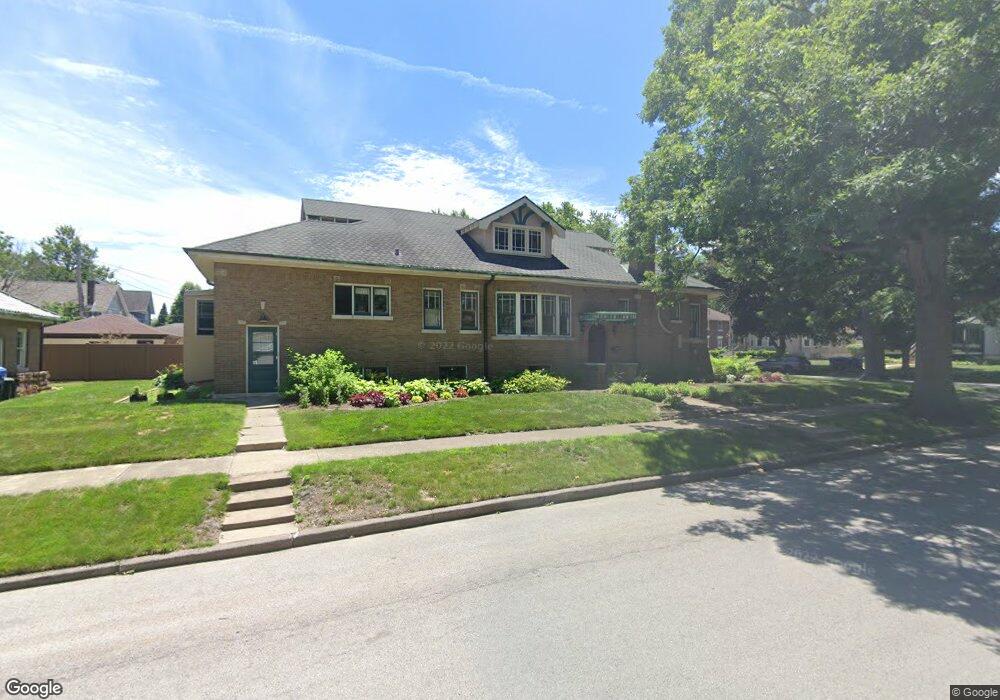
12801 Maple Ave Blue Island, IL 60406
Estimated Value: $279,294 - $327,000
4
Beds
2
Baths
2,354
Sq Ft
$127/Sq Ft
Est. Value
About This Home
This home is located at 12801 Maple Ave, Blue Island, IL 60406 and is currently estimated at $298,574, approximately $126 per square foot. 12801 Maple Ave is a home located in Cook County with nearby schools including Whittier Elementary School, Lincoln Elementary School, and Everett F Kerr Middle School.
Ownership History
Date
Name
Owned For
Owner Type
Purchase Details
Closed on
Jul 28, 1994
Sold by
Corey Prudence and Lopresti Vincent
Bought by
Nagel Betty K
Current Estimated Value
Home Financials for this Owner
Home Financials are based on the most recent Mortgage that was taken out on this home.
Original Mortgage
$90,000
Interest Rate
8.65%
Create a Home Valuation Report for This Property
The Home Valuation Report is an in-depth analysis detailing your home's value as well as a comparison with similar homes in the area
Home Values in the Area
Average Home Value in this Area
Purchase History
| Date | Buyer | Sale Price | Title Company |
|---|---|---|---|
| Nagel Betty K | $100,000 | Attorneys Natl Title Network |
Source: Public Records
Mortgage History
| Date | Status | Borrower | Loan Amount |
|---|---|---|---|
| Closed | Nagel Betty K | $90,000 |
Source: Public Records
Tax History Compared to Growth
Tax History
| Year | Tax Paid | Tax Assessment Tax Assessment Total Assessment is a certain percentage of the fair market value that is determined by local assessors to be the total taxable value of land and additions on the property. | Land | Improvement |
|---|---|---|---|---|
| 2024 | $7,410 | $22,430 | $5,245 | $17,185 |
| 2023 | $7,600 | $25,000 | $5,245 | $19,755 |
| 2022 | $7,600 | $22,076 | $4,561 | $17,515 |
| 2021 | $7,241 | $22,074 | $4,560 | $17,514 |
| 2020 | $7,675 | $23,109 | $4,560 | $18,549 |
| 2019 | $6,195 | $19,923 | $4,104 | $15,819 |
| 2018 | $6,697 | $21,735 | $4,104 | $17,631 |
| 2017 | $7,893 | $24,175 | $4,104 | $20,071 |
| 2016 | $5,509 | $16,343 | $3,420 | $12,923 |
| 2015 | $6,096 | $16,343 | $3,420 | $12,923 |
| 2014 | $6,922 | $18,448 | $3,420 | $15,028 |
| 2013 | $5,488 | $16,202 | $3,420 | $12,782 |
Source: Public Records
Map
Nearby Homes
- 12609 Maple Ave
- 2445 High St
- 2335 Walnut St
- 12602 Artesian Ave
- 2336 Union St Unit 3
- 2336 Union St Unit 4
- 2521 Lewis St
- 12552 Highland Ave
- 2824 Union St
- 12558 Fairview Ave Unit 1B
- 2638 Vermont St
- 12548 Fairview Ave Unit BLDG1
- 12548 Fairview Ave Unit 2B
- 12546 Fairview Ave Unit 3D
- 12544 Fairview Ave Unit 2G
- 2528 Cochran St
- 2529 Collins St
- 2537 Grove St
- 2853 Everett St
- 12638 Irving Ave
- 12809 Maple Ave
- 2539 Oak St
- 12813 Maple Ave
- 2540 Walnut St
- 12821 Maple Ave
- 2534 Oak St
- 12800 Maple Ave
- 2527 Oak St
- 12808 Maple Ave
- 12808 Maple Ave
- 12814 Maple Ave
- 2534 Walnut St
- 2525 Oak St
- 12754 Maple Ave Unit 58
- 12754 Maple Ave Unit 58
- 12820 Maple Ave
- 2518 Walnut St
- 2526 Oak St
- 2519 Oak St Unit 2
- 2524 Walnut St