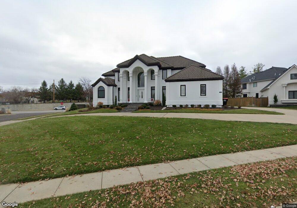
12801 Maple St Leawood, KS 66209
Deer Creek NeighborhoodEstimated Value: $787,000 - $898,000
4
Beds
5
Baths
3,788
Sq Ft
$223/Sq Ft
Est. Value
About This Home
This home is located at 12801 Maple St, Leawood, KS 66209 and is currently estimated at $844,828, approximately $223 per square foot. 12801 Maple St is a home located in Johnson County with nearby schools including Overland Trail Elementary School, Overland Trail Middle School, and Blue Valley North High School.
Ownership History
Date
Name
Owned For
Owner Type
Purchase Details
Closed on
Oct 5, 2005
Sold by
White William E and White Rhonda R
Bought by
White William E and White Ronda R
Current Estimated Value
Home Financials for this Owner
Home Financials are based on the most recent Mortgage that was taken out on this home.
Original Mortgage
$510,000
Outstanding Balance
$293,437
Interest Rate
7.49%
Mortgage Type
Adjustable Rate Mortgage/ARM
Estimated Equity
$551,391
Purchase Details
Closed on
May 11, 2004
Sold by
Blond Michael and Blond Yelena
Bought by
White William E and White Rhonda R
Home Financials for this Owner
Home Financials are based on the most recent Mortgage that was taken out on this home.
Original Mortgage
$477,900
Interest Rate
7.99%
Mortgage Type
Purchase Money Mortgage
Create a Home Valuation Report for This Property
The Home Valuation Report is an in-depth analysis detailing your home's value as well as a comparison with similar homes in the area
Home Values in the Area
Average Home Value in this Area
Purchase History
| Date | Buyer | Sale Price | Title Company |
|---|---|---|---|
| White William E | -- | Midwest Title Company Inc | |
| White William E | -- | Security Land Title Company |
Source: Public Records
Mortgage History
| Date | Status | Borrower | Loan Amount |
|---|---|---|---|
| Open | White William E | $510,000 | |
| Closed | White William E | $477,900 |
Source: Public Records
Tax History
| Year | Tax Paid | Tax Assessment Tax Assessment Total Assessment is a certain percentage of the fair market value that is determined by local assessors to be the total taxable value of land and additions on the property. | Land | Improvement |
|---|---|---|---|---|
| 2025 | $8,883 | $94,300 | $17,498 | $76,802 |
| 2024 | $8,883 | $86,066 | $17,498 | $68,568 |
| 2023 | $8,515 | $81,466 | $17,498 | $63,968 |
| 2022 | $7,563 | $71,104 | $17,498 | $53,606 |
| 2021 | $7,537 | $67,424 | $13,994 | $53,430 |
| 2020 | $7,396 | $65,700 | $11,666 | $54,034 |
| 2019 | $7,246 | $63,009 | $9,337 | $53,672 |
| 2018 | $7,128 | $63,342 | $9,337 | $54,005 |
| 2017 | $7,006 | $58,650 | $9,337 | $49,313 |
| 2016 | $6,877 | $57,523 | $9,337 | $48,186 |
| 2015 | $6,824 | $56,810 | $9,337 | $47,473 |
| 2013 | -- | $52,141 | $9,337 | $42,804 |
Source: Public Records
Map
Nearby Homes
- 5448 W 128th Terrace
- 5708 W 129th St
- 5255 W 129th Terrace
- 12711 Woodson St
- 5251 W 129th Terrace
- 5004 W 128th St
- 12635 Juniper Cir
- 5811 W 124th St
- 5420 W 132nd Terrace
- 3349 W 133rd Terrace
- 3263 W 133rd Terrace
- 3357 W 133rd Terrace
- 3345 W 133rd Terrace
- 3248 W 133rd Terrace
- 2756 W 133rd Terrace
- 2856 W 133rd Terrace
- 2846 W 133rd Terrace
- 2760 W 133rd Terrace
- 3260 W 133rd Terrace
- 2844 W 133rd Terrace
- 12805 Maple St
- 12800 Maple St
- 12725 Maple St
- 12804 Maple St
- 12809 Maple St
- 12722 Maple St
- 12812 Maple St
- 12721 Maple St
- 12808 Maple St
- 5703 W 128th St
- 12808 Birch St
- 5504 W 129th St
- 5449 W 128th Terrace
- 5702 W 128th St
- 5708 W 128th Terrace
- 12718 Maple St
- 12804 Birch St
- 5500 W 129th St
- 12717 Maple St
- 5707 W 128th St
Your Personal Tour Guide
Ask me questions while you tour the home.