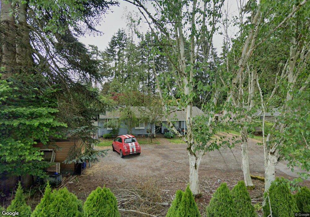
12807 NE 159th St Brush Prairie, WA 98606
Estimated Value: $527,000 - $708,000
3
Beds
2
Baths
1,598
Sq Ft
$369/Sq Ft
Est. Value
About This Home
This home is located at 12807 NE 159th St, Brush Prairie, WA 98606 and is currently estimated at $589,760, approximately $369 per square foot. 12807 NE 159th St is a home located in Clark County with nearby schools including Glenwood Heights Primary School, Laurin Middle School, and Prairie High School.
Ownership History
Date
Name
Owned For
Owner Type
Purchase Details
Closed on
Sep 20, 2005
Sold by
Cole Amy E and Cole Mark
Bought by
Derby Brett R and Derby Lindsay E
Current Estimated Value
Home Financials for this Owner
Home Financials are based on the most recent Mortgage that was taken out on this home.
Original Mortgage
$187,000
Outstanding Balance
$99,227
Interest Rate
5.72%
Mortgage Type
Fannie Mae Freddie Mac
Estimated Equity
$490,533
Purchase Details
Closed on
Mar 5, 2004
Sold by
Grove Scott A and Grove Debra D
Bought by
Grove Amy E
Purchase Details
Closed on
Jun 4, 2003
Sold by
Cole Mark L
Bought by
Cole Amy E
Purchase Details
Closed on
Jun 20, 2001
Sold by
Chapin Nancy L
Bought by
Cole Mark and Cole Amy E
Home Financials for this Owner
Home Financials are based on the most recent Mortgage that was taken out on this home.
Original Mortgage
$117,161
Interest Rate
7.15%
Mortgage Type
FHA
Create a Home Valuation Report for This Property
The Home Valuation Report is an in-depth analysis detailing your home's value as well as a comparison with similar homes in the area
Home Values in the Area
Average Home Value in this Area
Purchase History
| Date | Buyer | Sale Price | Title Company |
|---|---|---|---|
| Derby Brett R | $220,000 | Fidelity National Title | |
| Grove Amy E | -- | -- | |
| Cole Amy E | -- | -- | |
| Cole Mark | -- | First American Title Ins Co |
Source: Public Records
Mortgage History
| Date | Status | Borrower | Loan Amount |
|---|---|---|---|
| Open | Derby Brett R | $187,000 | |
| Previous Owner | Cole Mark | $117,161 |
Source: Public Records
Tax History Compared to Growth
Tax History
| Year | Tax Paid | Tax Assessment Tax Assessment Total Assessment is a certain percentage of the fair market value that is determined by local assessors to be the total taxable value of land and additions on the property. | Land | Improvement |
|---|---|---|---|---|
| 2025 | $3,765 | $450,379 | $222,309 | $228,070 |
| 2024 | $3,228 | $451,206 | $222,309 | $228,897 |
| 2023 | $3,068 | $443,021 | $213,151 | $229,870 |
| 2022 | $2,969 | $384,546 | $171,160 | $213,386 |
| 2021 | $2,955 | $324,188 | $147,190 | $176,998 |
| 2020 | $2,838 | $295,186 | $136,536 | $158,650 |
| 2019 | $2,431 | $276,405 | $126,948 | $149,457 |
| 2018 | $2,854 | $271,524 | $0 | $0 |
| 2017 | $2,402 | $243,056 | $0 | $0 |
| 2016 | $2,299 | $222,931 | $0 | $0 |
| 2015 | $2,142 | $195,601 | $0 | $0 |
| 2014 | -- | $172,050 | $0 | $0 |
| 2013 | -- | $157,483 | $0 | $0 |
Source: Public Records
Map
Nearby Homes
- 15619 NE Caples Rd Unit 95
- 15014 NE Caples Rd
- 16518 NE 142nd Ave
- 16010 NE 152nd Ave
- 3838 SE 7th Ave
- 0 NE 144th St Unit 2 23069373
- 15105 NE 152nd Ave
- 12605 NE 184th St
- 746 SE 38th St
- 714 SE 37th St
- 1610 SE 44th Cir
- 826 SE 37th St
- 18104 NE 142nd Ave
- 18004 NE 113th Ave
- 622 SE 35th St
- 626 SE 35th St
- 632 SE 35th St
- 729 SE 35th St
- 736 SE 35th St
- 812 SE 35th St
- 12801 NE 159th St
- 12815 NE 159th St
- 12711 NE 159th St
- 0 NE Sumac Dr
- 12703 NE 159th St
- 12718 NE 159th St
- 12616 NE 159th St
- 15805 NE Caples Rd
- 12812 NE Sumac Dr
- 12610 NE 159th St
- 13012 NE Sumac Dr
- 15915 NE Caples Rd
- 22800 NE 174th St Unit 1
- 15619 NE Caples Rd Unit 108
- 15619 NE Caples Rd Unit 100
- 15619 NE Caples Rd Unit 124
- 15619 NE Caples Rd Unit 28
- 15619 NE Caples Rd Unit 61
- 15619 NE Caples Rd Unit 153
- 15619 NE Caples Rd Unit 9