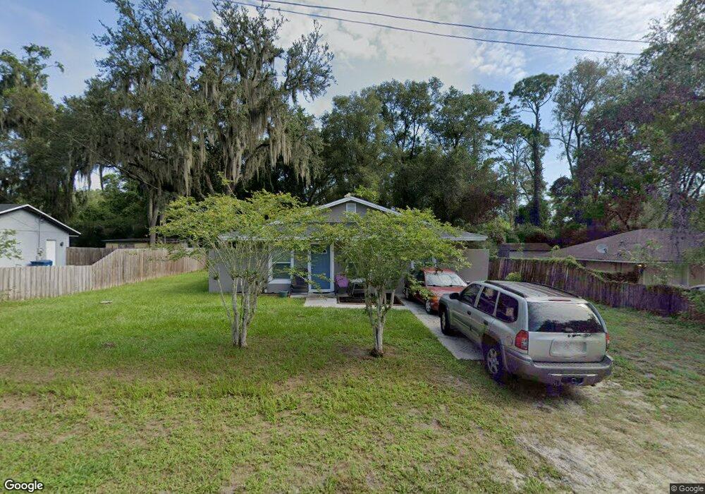
1281 9th St Orange City, FL 32763
Estimated Value: $217,931 - $270,000
3
Beds
1
Bath
1,292
Sq Ft
$192/Sq Ft
Est. Value
About This Home
This home is located at 1281 9th St, Orange City, FL 32763 and is currently estimated at $247,983, approximately $191 per square foot. 1281 9th St is a home located in Volusia County with nearby schools including Orange City Elementary School, River Springs Middle School, and University High School.
Ownership History
Date
Name
Owned For
Owner Type
Purchase Details
Closed on
Feb 26, 2020
Sold by
Markey Sandra
Bought by
Zagers Terence
Current Estimated Value
Purchase Details
Closed on
Aug 16, 2018
Sold by
Markey Michael and Markey Sandra
Bought by
Markey Sandra
Purchase Details
Closed on
Sep 8, 2011
Sold by
Luff Thomas and Rees Robin
Bought by
Markey Michael W
Purchase Details
Closed on
Nov 15, 1975
Bought by
Markey Michael W
Create a Home Valuation Report for This Property
The Home Valuation Report is an in-depth analysis detailing your home's value as well as a comparison with similar homes in the area
Home Values in the Area
Average Home Value in this Area
Purchase History
| Date | Buyer | Sale Price | Title Company |
|---|---|---|---|
| Zagers Terence | -- | None Available | |
| Markey Sandra | -- | Attorney | |
| Markey Michael W | $10,000 | None Available | |
| Markey Michael W | $21,000 | -- |
Source: Public Records
Tax History Compared to Growth
Tax History
| Year | Tax Paid | Tax Assessment Tax Assessment Total Assessment is a certain percentage of the fair market value that is determined by local assessors to be the total taxable value of land and additions on the property. | Land | Improvement |
|---|---|---|---|---|
| 2025 | $2,403 | $136,847 | $43,875 | $92,972 |
| 2024 | $2,403 | $139,571 | $43,875 | $95,696 |
| 2023 | $2,403 | $134,579 | $34,125 | $100,454 |
| 2022 | $2,155 | $107,469 | $27,000 | $80,469 |
| 2021 | $2,066 | $87,881 | $19,125 | $68,756 |
| 2020 | $496 | $33,529 | $0 | $0 |
| 2019 | $491 | $32,775 | $0 | $0 |
| 2018 | $466 | $32,164 | $0 | $0 |
| 2017 | $429 | $31,502 | $0 | $0 |
| 2016 | $392 | $30,854 | $0 | $0 |
| 2015 | $391 | $30,640 | $0 | $0 |
| 2014 | $385 | $30,397 | $0 | $0 |
Source: Public Records
Map
Nearby Homes
- 0 10th St Unit MFRV4941473
- 1275 10th St
- 1261 10th St
- 0 9th St
- 1171 9th St
- 00 7th St
- 1425 13th St
- 1410 5th St
- 0 12th St Unit MFRO6299359
- 1450 14th St
- 1490 14th St
- 1545 12th St
- 1145 15th St
- 1550 12th St
- 1395 Deland Ave
- 0 Schaub Ave Unit MFRO6311639
- 1344 18th St
- 0 14th St Unit 11570263
- 0 14th St Unit MFRS5133079
- 1094 Lolita St
- 1291 9th St
- 1271 9th St
- 1260 9th St
- 1261 9th St
- 1250 9th St
- 1252 10th St
- 1251 9th St
- 0 10th St Unit V4928436
- 0 10th St Unit V4922195
- 0 10th St Unit V4921346
- 0 10th St Unit V4921344
- 0 10th St Unit O5077349
- 0 10th St Unit O5110454
- 0 10th St Unit V4914676
- 0 10th St Unit V4913920
- 1310 10th St
- 1315 9th St
- 1240 9th St
- 1310 9th St
- 966 Central Ave