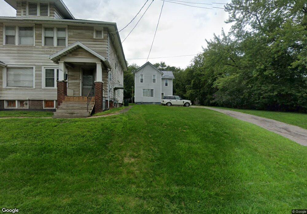
1281 S Mahoning Ave Alliance, OH 44601
Estimated Value: $95,000 - $117,000
3
Beds
1
Bath
1,504
Sq Ft
$70/Sq Ft
Est. Value
About This Home
This home is located at 1281 S Mahoning Ave, Alliance, OH 44601 and is currently estimated at $104,577, approximately $69 per square foot. 1281 S Mahoning Ave is a home located in Stark County with nearby schools including Alliance Elementary School at Rockhill, Alliance Intermediate School at Northside, and Alliance Middle School.
Ownership History
Date
Name
Owned For
Owner Type
Purchase Details
Closed on
Sep 13, 2013
Sold by
Harris Lucas and Harris Loraine
Bought by
Harris Lucas and Harris Loraine
Current Estimated Value
Home Financials for this Owner
Home Financials are based on the most recent Mortgage that was taken out on this home.
Original Mortgage
$22,233
Interest Rate
4.39%
Mortgage Type
New Conventional
Purchase Details
Closed on
Sep 24, 2003
Sold by
Kuoskouris Holly A and Kouskouris Roderick
Bought by
Harris Lucas and Augustine Loraine
Purchase Details
Closed on
Nov 8, 2002
Sold by
Kouskouris Holly Ann and Kouskouris Roderick J
Bought by
Kouskouris Holly A and Courtney Sandra M
Create a Home Valuation Report for This Property
The Home Valuation Report is an in-depth analysis detailing your home's value as well as a comparison with similar homes in the area
Home Values in the Area
Average Home Value in this Area
Purchase History
| Date | Buyer | Sale Price | Title Company |
|---|---|---|---|
| Harris Lucas | -- | None Available | |
| Harris Lucas | $40,000 | Americas Choice Title Agency | |
| Kouskouris Holly A | $19,200 | -- |
Source: Public Records
Mortgage History
| Date | Status | Borrower | Loan Amount |
|---|---|---|---|
| Closed | Harris Lucas | $22,233 |
Source: Public Records
Tax History Compared to Growth
Tax History
| Year | Tax Paid | Tax Assessment Tax Assessment Total Assessment is a certain percentage of the fair market value that is determined by local assessors to be the total taxable value of land and additions on the property. | Land | Improvement |
|---|---|---|---|---|
| 2025 | -- | $29,830 | $6,060 | $23,770 |
| 2024 | -- | $29,830 | $6,060 | $23,770 |
| 2023 | $841 | $20,940 | $6,200 | $14,740 |
| 2022 | $847 | $20,940 | $6,200 | $14,740 |
| 2021 | $848 | $20,940 | $6,200 | $14,740 |
| 2020 | $765 | $17,650 | $5,430 | $12,220 |
| 2019 | $754 | $17,650 | $5,430 | $12,220 |
| 2018 | $758 | $17,650 | $5,430 | $12,220 |
| 2017 | $688 | $15,760 | $4,520 | $11,240 |
| 2016 | $693 | $15,760 | $4,520 | $11,240 |
| 2015 | $695 | $15,660 | $6,240 | $9,420 |
| 2014 | $953 | $14,320 | $5,710 | $8,610 |
| 2013 | $343 | $14,320 | $5,710 | $8,610 |
Source: Public Records
Map
Nearby Homes
- 1233 Woodland Ave
- 815 Grace St
- 729 Waugh St
- 814 Milner St
- 831 Wade Ave
- 1044 S Liberty Ave
- 551 South St
- 1005 S Freedom Ave
- 1437 S Linden Ave
- 1846 S Freedom Ave
- 390 E College St
- 452 E Summit St
- 442 S Liberty Ave
- 2218 S Freedom Ave
- 167 11th St
- 317 E State St
- 1475 Chatauqua Ct
- 2376 S Seneca Ave
- 548 E High St
- 853 Fairway Dr
- 1293 S Mahoning Ave
- 1291 S Mahoning Ave
- 1236 Willow Ave
- 1239 Willow Ave
- 1237 S Mahoning Ave
- 1226 Willow Ave
- 1229 Willow Ave
- 1234 Meadow Ave
- 1310 S Mahoning Ave
- 1403 South St
- 1415 South St
- 1347 South St
- 1212 S Mahoning Ave
- 1326 S Mahoning Ave
- 1318 S Mahoning Ave
- 1345 1347 South St
- 1205 S Mahoning Ave
- 1345 South St
- 1315 South St
- 1342 S Mahoning Ave