Estimated Value: $150,000 - $262,786
Studio
2
Baths
2,028
Sq Ft
$105/Sq Ft
Est. Value
About This Home
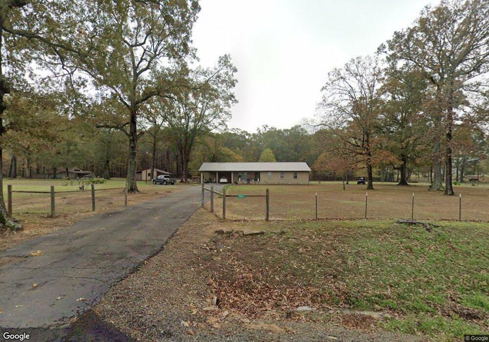
This home is located at 12811 Highway 38, Ward, AR 72176 and is currently estimated at $212,947, approximately $105 per square foot. 12811 Highway 38 is a home located in Lonoke County with nearby schools including Ward Central Elementary School, Cabot Middle School North, and Cabot Junior High North.
Ownership History
Date
Name
Owned For
Owner Type
Purchase Details
Closed on
Jan 16, 2016
Sold by
Yarberry Charles H and Yarberry Linda K
Bought by
Cook Linda Sue and Ward Linda Sue
Current Estimated Value
Purchase Details
Closed on
Jul 24, 2015
Sold by
Honeywell Angela S and Honeywell Steven J
Bought by
Yarberry Charles H and Yarberry Linda K
Home Financials for this Owner
Home Financials are based on the most recent Mortgage that was taken out on this home.
Original Mortgage
$79,000
Interest Rate
4.07%
Mortgage Type
New Conventional
Purchase Details
Closed on
Feb 4, 2005
Bought by
Honeywell
Purchase Details
Closed on
Jan 31, 2005
Bought by
Honeywell
Purchase Details
Closed on
Jul 1, 1996
Bought by
Sparks and Sparks Wife
Purchase Details
Closed on
Mar 16, 1995
Bought by
Patterson
Purchase Details
Closed on
Dec 10, 1991
Bought by
Phillips
Create a Home Valuation Report for This Property
The Home Valuation Report is an in-depth analysis detailing your home's value as well as a comparison with similar homes in the area
Purchase History
| Date | Buyer | Sale Price | Title Company |
|---|---|---|---|
| Cook Linda Sue | -- | None Available | |
| Yarberry Charles H | -- | Liberty Title & Escrow Co | |
| Honeywell | $88,000 | -- | |
| Honeywell | $88,000 | -- | |
| Sparks | $76,000 | -- | |
| Patterson | -- | -- | |
| Phillips | $1,000 | -- |
Source: Public Records
Mortgage History
| Date | Status | Borrower | Loan Amount |
|---|---|---|---|
| Previous Owner | Yarberry Charles H | $79,000 |
Source: Public Records
Tax History
| Year | Tax Paid | Tax Assessment Tax Assessment Total Assessment is a certain percentage of the fair market value that is determined by local assessors to be the total taxable value of land and additions on the property. | Land | Improvement |
|---|---|---|---|---|
| 2025 | $641 | $30,470 | $6,440 | $24,030 |
| 2024 | $641 | $30,470 | $6,440 | $24,030 |
| 2023 | $641 | $30,470 | $6,440 | $24,030 |
| 2022 | $691 | $30,470 | $6,440 | $24,030 |
| 2021 | $691 | $30,470 | $6,440 | $24,030 |
| 2020 | $691 | $22,130 | $6,440 | $15,690 |
| 2019 | $691 | $22,130 | $6,440 | $15,690 |
| 2018 | $716 | $22,130 | $6,440 | $15,690 |
| 2017 | $938 | $22,130 | $6,440 | $15,690 |
| 2016 | $716 | $22,130 | $6,440 | $15,690 |
| 2015 | $1,071 | $25,270 | $6,440 | $18,830 |
| 2014 | $1,160 | $25,270 | $6,440 | $18,830 |
Source: Public Records
Map
Nearby Homes
- 790 Black Jack Rd
- 572 Butlerville Rd
- 1226 Pigeon Rd
- 1174 Pigeon Rd
- 84 E Green Tree Rd
- 9565 Highway 38
- 1524 Bland Chapel Rd
- 00 Bland Chapel Rd
- 0000 Clay Hill Rd
- 115 Princeton Place
- 45 Willow Tree Rd
- 10220 Arkansas 38
- 3451 Tippitt Rd
- 000 Crypress Lake
- 102 Bethlehem Rd
- 419 Robert Young Rd
- 00 Bethlehem Rd
- 00 Timber Creek Dr
- 0 Timber Creek Dr
- 24 White's Cut
- 12811 Arkansas 38
- 4000 Highway 38
- 12765 Highway 38
- 12765 Arkansas 38
- E Hwy 38
- 12836 Highway 38
- 38 Highway
- 12695 Highway 38
- W Hwy 38
- 184 Deer Meadow Rd
- 184 Deer Meadow Rd
- 12664 Highway 38
- 12664 Highway 38
- 222 Salem Cemetery Rd
- 12948 Highway 38
- 13000 Highway 38
- Lot 17 Deer Meadows Ln
- 81 Sims Ln
- 12965 Highway 38
- 12965 Highway 38
Your Personal Tour Guide
Ask me questions while you tour the home.