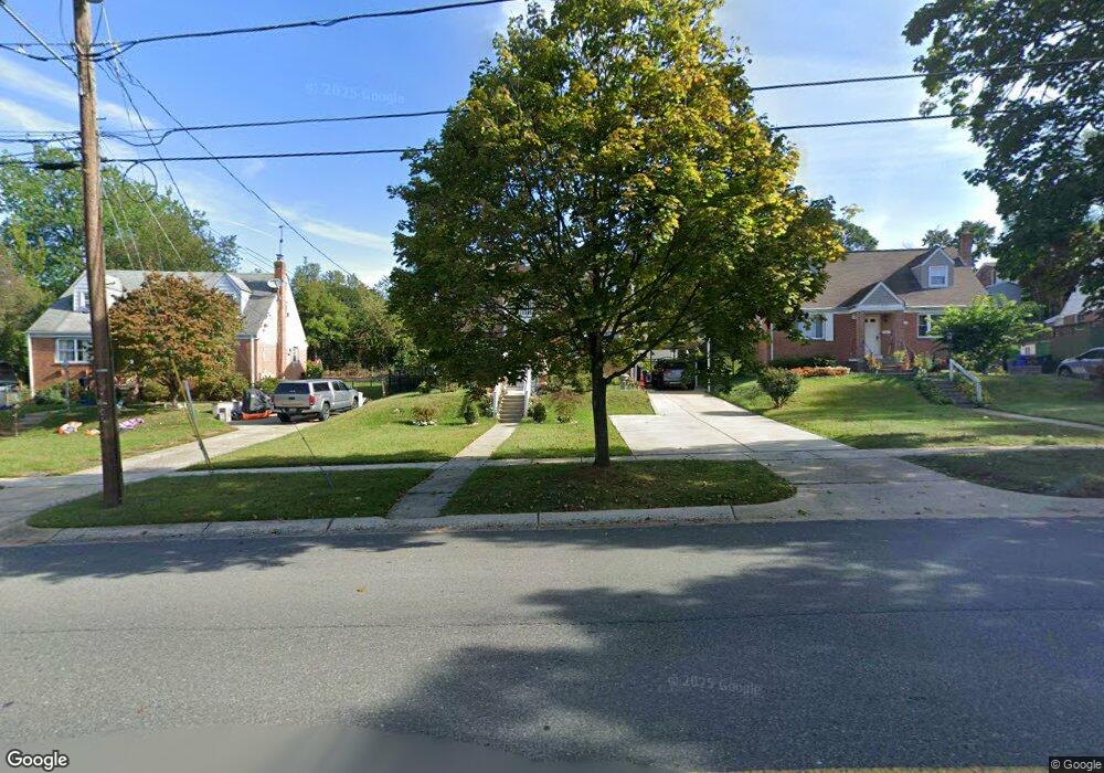
12815 Dean Rd Silver Spring, MD 20906
Connecticut Avenue Park NeighborhoodEstimated Value: $475,140 - $548,000
Studio
2
Baths
1,800
Sq Ft
$285/Sq Ft
Est. Value
About This Home
This home is located at 12815 Dean Rd, Silver Spring, MD 20906 and is currently estimated at $512,785, approximately $284 per square foot. 12815 Dean Rd is a home located in Montgomery County with nearby schools including Weller Road Elementary School, A. Mario Loiederman Middle School, and Wheaton High School.
Ownership History
Date
Name
Owned For
Owner Type
Purchase Details
Closed on
May 17, 2001
Sold by
Rivera Carlos A
Bought by
Rivera Carlos A
Current Estimated Value
Purchase Details
Closed on
Jul 28, 1995
Sold by
Kotter Kurt J
Bought by
Rivera Carlos A
Home Financials for this Owner
Home Financials are based on the most recent Mortgage that was taken out on this home.
Original Mortgage
$151,300
Interest Rate
7.56%
Create a Home Valuation Report for This Property
The Home Valuation Report is an in-depth analysis detailing your home's value as well as a comparison with similar homes in the area
Home Values in the Area
Average Home Value in this Area
Purchase History
| Date | Buyer | Sale Price | Title Company |
|---|---|---|---|
| Rivera Carlos A | -- | -- | |
| Rivera Carlos A | $156,000 | -- |
Source: Public Records
Mortgage History
| Date | Status | Borrower | Loan Amount |
|---|---|---|---|
| Previous Owner | Rivera Carlos A | $151,300 |
Source: Public Records
Tax History
| Year | Tax Paid | Tax Assessment Tax Assessment Total Assessment is a certain percentage of the fair market value that is determined by local assessors to be the total taxable value of land and additions on the property. | Land | Improvement |
|---|---|---|---|---|
| 2025 | $5,779 | $460,600 | $200,100 | $260,500 |
| 2024 | $5,779 | $438,500 | -- | -- |
| 2023 | $4,809 | $416,400 | $0 | $0 |
| 2022 | $4,312 | $394,300 | $178,100 | $216,200 |
| 2021 | $4,080 | $388,333 | $0 | $0 |
| 2020 | $4,080 | $382,367 | $0 | $0 |
| 2019 | $3,979 | $376,400 | $162,900 | $213,500 |
| 2018 | $3,753 | $358,100 | $0 | $0 |
| 2017 | $3,608 | $339,800 | $0 | $0 |
| 2016 | -- | $321,500 | $0 | $0 |
| 2015 | $2,855 | $310,933 | $0 | $0 |
| 2014 | $2,855 | $300,367 | $0 | $0 |
Source: Public Records
Map
Nearby Homes
- 3409 Janet Rd
- 12929 Valleywood Dr
- 12816 Valleywood Dr
- 12800 Connecticut Ave
- 3701 Kenway St
- 13116 Estelle Rd
- 13130 Valleywood Dr
- 12605 Bluhill Rd
- 12420 Feldon St
- 2829 Vixen Ln
- 12828 Littleton St
- 13316 Foxhall Dr
- 13216 Turkey Branch Pkwy
- 12220 Centerhill St
- 3234 Hewitt Ave Unit 24
- 12300 Downer Dr
- 12106 Bluhill Rd
- 2715 Randolph Rd
- 3301 Hewitt Ave Unit 501
- 3301 Hewitt Ave Unit 403
- 12813 Dean Rd
- 12817 Dean Rd
- 3514 Kayson St
- 12816 Crisfield Rd
- 12818 Crisfield Rd
- 12814 Crisfield Rd
- 12820 Crisfield Rd
- 12809 Dean Rd
- 12810 Crisfield Rd
- 3521 Kayson St
- 12807 Dean Rd
- 12808 Crisfield Rd
- 3519 Kayson St
- 3517 Kayson St
- 12819 Crisfield Rd
- 12817 Crisfield Rd
- 12815 Crisfield Rd
- 12806 Crisfield Rd
- 12821 Crisfield Rd
- 12805 Dean Rd
Your Personal Tour Guide
Ask me questions while you tour the home.