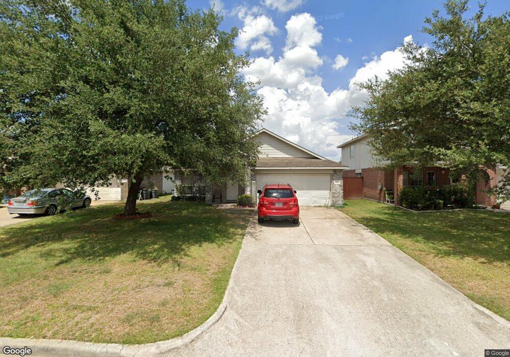
12818 Saibaba Dr Houston, TX 77038
North Houston NeighborhoodEstimated Value: $233,409 - $255,000
4
Beds
2
Baths
1,896
Sq Ft
$128/Sq Ft
Est. Value
About This Home
This home is located at 12818 Saibaba Dr, Houston, TX 77038 and is currently estimated at $241,852, approximately $127 per square foot. 12818 Saibaba Dr is a home located in Harris County with nearby schools including Gloria B. Sammons Elementary School, Stovall School, and Dr. Viola K. Garcia Middle School.
Ownership History
Date
Name
Owned For
Owner Type
Purchase Details
Closed on
Oct 9, 2009
Sold by
Chicas Flor L
Bought by
Timot Investments Incorporated
Current Estimated Value
Purchase Details
Closed on
Apr 26, 2006
Sold by
Royce Homes Lp
Bought by
Chicas Flor L
Home Financials for this Owner
Home Financials are based on the most recent Mortgage that was taken out on this home.
Original Mortgage
$107,600
Interest Rate
6.33%
Mortgage Type
Stand Alone First
Create a Home Valuation Report for This Property
The Home Valuation Report is an in-depth analysis detailing your home's value as well as a comparison with similar homes in the area
Home Values in the Area
Average Home Value in this Area
Purchase History
| Date | Buyer | Sale Price | Title Company |
|---|---|---|---|
| Timot Investments Incorporated | -- | Fidelity National Title | |
| Chicas Flor L | -- | Stewart Title Houston Div |
Source: Public Records
Mortgage History
| Date | Status | Borrower | Loan Amount |
|---|---|---|---|
| Previous Owner | Chicas Flor L | $107,600 |
Source: Public Records
Tax History Compared to Growth
Tax History
| Year | Tax Paid | Tax Assessment Tax Assessment Total Assessment is a certain percentage of the fair market value that is determined by local assessors to be the total taxable value of land and additions on the property. | Land | Improvement |
|---|---|---|---|---|
| 2025 | $6,439 | $245,544 | $32,811 | $212,733 |
| 2024 | $6,439 | $228,761 | $32,811 | $195,950 |
| 2023 | $6,439 | $228,312 | $35,692 | $192,620 |
| 2022 | $6,335 | $200,000 | $35,692 | $164,308 |
| 2021 | $5,736 | $185,314 | $35,692 | $149,622 |
| 2020 | $5,210 | $159,263 | $23,795 | $135,468 |
| 2019 | $5,418 | $158,486 | $23,795 | $134,691 |
| 2018 | $1,996 | $139,000 | $23,795 | $115,205 |
| 2017 | $4,679 | $139,000 | $23,795 | $115,205 |
| 2016 | $4,247 | $126,153 | $23,795 | $102,358 |
| 2015 | $3,167 | $90,997 | $15,142 | $75,855 |
| 2014 | $3,167 | $94,326 | $15,142 | $79,184 |
Source: Public Records
Map
Nearby Homes
- 12718 Sai Baba Dr
- 2203 Chalet Rd
- Whitetail Plan at Forestwood
- Kitson Plan at Forestwood
- Pinehollow Plan at Forestwood
- at Forestwood
- 12530 Wild Strawberry Rd
- at Forestwood
- Idlewood Plan at Forestwood
- at Forestwood
- at Forestwood
- Oakridge Plan at Forestwood
- at Forestwood
- 12518 Pelican Bay Dr
- 2115 Havencrest Dr
- 2614 Lemonwood Ln
- 0 W Mt Houston Rd Unit 90464120
- 2610 Cabin Cove Ln
- 2702 Urban Glen Ct
- 2811 Oakland Brook St
- 12814 Sai Baba Dr
- 12822 Saibaba Dr
- 12814 Saibaba Dr
- 12810 Saibaba Dr
- 12826 Saibaba Dr
- 12806 Saibaba Dr
- 12830 Saibaba Dr
- 12802 Saibaba Dr
- 2603 Fallen Oak Rd
- 2602 Dylans Crossing Dr
- 2606 Dylans Crossing Dr
- 12746 Saibaba Dr
- 2607 Fallen Oak Rd
- 2610 Dylans Crossing Dr
- 12838 Saibaba Dr
- 2611 Fallen Oak Rd
- 12742 Saibaba Dr
- 12833 Edgewood Park Dr
- 12831 Edgewood Park Dr
- 12835 Edgewood Park Dr