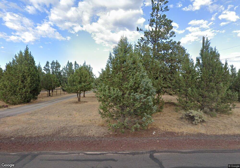
12819 SW Cinder Dr Terrebonne, OR 97760
Estimated Value: $244,673 - $460,000
4
Beds
2
Baths
1,404
Sq Ft
$267/Sq Ft
Est. Value
About This Home
This home is located at 12819 SW Cinder Dr, Terrebonne, OR 97760 and is currently estimated at $374,918, approximately $267 per square foot. 12819 SW Cinder Dr is a home located in Jefferson County with nearby schools including Culver Elementary School, Culver Middle School, and Culver High School.
Ownership History
Date
Name
Owned For
Owner Type
Purchase Details
Closed on
May 25, 2012
Sold by
Shawver Kenneth E
Bought by
Shawver Kenneth E and Shawver Delores A
Current Estimated Value
Purchase Details
Closed on
Sep 21, 2011
Sold by
Craig E Wesley and Craig Alana L
Bought by
Shawver Kenneth E
Home Financials for this Owner
Home Financials are based on the most recent Mortgage that was taken out on this home.
Original Mortgage
$91,800
Interest Rate
4.09%
Mortgage Type
VA
Purchase Details
Closed on
May 5, 2006
Sold by
Craig Earl Weslty
Bought by
Craig Alana L and Craig Ii E Welsey
Create a Home Valuation Report for This Property
The Home Valuation Report is an in-depth analysis detailing your home's value as well as a comparison with similar homes in the area
Home Values in the Area
Average Home Value in this Area
Purchase History
| Date | Buyer | Sale Price | Title Company |
|---|---|---|---|
| Shawver Kenneth E | -- | None Available | |
| Shawver Kenneth E | $89,900 | Amerititle | |
| Craig Alana L | -- | Ameititle |
Source: Public Records
Mortgage History
| Date | Status | Borrower | Loan Amount |
|---|---|---|---|
| Previous Owner | Shawver Kenneth E | $91,800 |
Source: Public Records
Tax History Compared to Growth
Tax History
| Year | Tax Paid | Tax Assessment Tax Assessment Total Assessment is a certain percentage of the fair market value that is determined by local assessors to be the total taxable value of land and additions on the property. | Land | Improvement |
|---|---|---|---|---|
| 2024 | $1,694 | $95,360 | -- | -- |
| 2023 | $1,616 | $92,590 | $0 | $0 |
| 2022 | $1,571 | $89,900 | $0 | $0 |
| 2021 | $1,517 | $87,290 | $0 | $0 |
| 2020 | $1,454 | $84,750 | $0 | $0 |
| 2019 | $1,413 | $82,290 | $0 | $0 |
| 2018 | $1,350 | $79,900 | $0 | $0 |
| 2017 | $1,313 | $77,580 | $0 | $0 |
| 2016 | $1,321 | $75,330 | $0 | $0 |
| 2015 | $1,226 | $73,140 | $0 | $0 |
| 2014 | $1,226 | $71,010 | $0 | $0 |
| 2013 | $1,059 | $68,950 | $0 | $0 |
Source: Public Records
Map
Nearby Homes
- 12629 SW Cinder Dr
- 13344 SW Peninsula Dr
- 13942 SW Peninsula Dr
- 14007 SW Peninsula Dr
- 8111 SW High Cone Dr
- 8095 SW High Cone Dr
- 8403 SW Homestead Place
- 8409 SW Homestead Place
- 13260 SW Chipmunk Rd
- 12844 SW Upper Ridge Rd
- 11438 SW Horny Hollow Trail
- 13406 SW Oasis Ct
- 13595 SW Gono Place
- 10570 SW Shad Rd
- 13618 SW Gono Place
- 11218 SW Horny Hollow Trail
- 12771 SW Deer Crossing Place
- 8562 SW Crater Loop Rd
- 13568 SW Cinder Dr
- 13587 SW Cinder Dr
- 12851 SW Cinder Dr
- 12811 SW Cinder Dr
- 12805 SW Cinder Dr
- 12793 SW Cinder Dr
- 12875 SW Cinder Dr
- 12881 SW Cinder Dr
- 12913 SW Cinder Dr
- 13648 SW Peninsula Dr
- 12925 SW Cinder Dr
- 12880 SW Cinder Dr
- 12882 SW Cinder Dr
- 12820 SW Cinder Dr
- 12757 SW Cinder Dr
- 13670 SW Peninsula Dr
- 12860 SW Cinder Dr
- 12770 SW Cinder Dr
- 12745 SW Cinder Dr
- 13508 SW Peninsula Dr
- 12941 SW Cinder Dr
