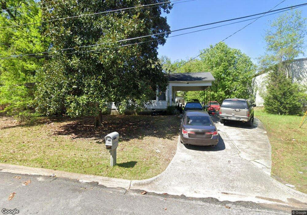
1282 Baker Dr Unit 92 Macon, GA 31206
Estimated Value: $90,000 - $107,000
3
Beds
2
Baths
1,740
Sq Ft
$57/Sq Ft
Est. Value
About This Home
This home is located at 1282 Baker Dr Unit 92, Macon, GA 31206 and is currently estimated at $98,895, approximately $56 per square foot. 1282 Baker Dr Unit 92 is a home located in Bibb County with nearby schools including Bruce Elementary School, Rutland Middle School, and Rutland High School.
Ownership History
Date
Name
Owned For
Owner Type
Purchase Details
Closed on
May 23, 2022
Sold by
Anj Properties Llc
Bought by
Lunsford Family Properties Llc
Current Estimated Value
Purchase Details
Closed on
Dec 6, 2019
Sold by
Coggins Vicki J and Jones Bobbie T
Bought by
Anj Properties Llc
Purchase Details
Closed on
Oct 21, 2008
Sold by
Jones Bobbie T and Jones Clifford E
Bought by
Jones Bobbie T
Create a Home Valuation Report for This Property
The Home Valuation Report is an in-depth analysis detailing your home's value as well as a comparison with similar homes in the area
Purchase History
| Date | Buyer | Sale Price | Title Company |
|---|---|---|---|
| Lunsford Family Properties Llc | $611,600 | Wessels & Gerber Pc | |
| Anj Properties Llc | $43,000 | None Available | |
| Jones Bobbie T | -- | None Available |
Source: Public Records
Tax History
| Year | Tax Paid | Tax Assessment Tax Assessment Total Assessment is a certain percentage of the fair market value that is determined by local assessors to be the total taxable value of land and additions on the property. | Land | Improvement |
|---|---|---|---|---|
| 2025 | $897 | $36,514 | $2,112 | $34,402 |
| 2024 | $874 | $34,394 | $2,112 | $32,282 |
| 2023 | $753 | $29,661 | $1,920 | $27,741 |
| 2022 | $675 | $19,502 | $1,776 | $17,726 |
| 2021 | $741 | $19,502 | $1,776 | $17,726 |
| 2020 | $715 | $18,405 | $1,776 | $16,629 |
| 2019 | $184 | $18,581 | $1,776 | $16,805 |
| 2018 | $461 | $18,581 | $1,776 | $16,805 |
| 2017 | $165 | $18,581 | $1,776 | $16,805 |
| 2016 | $143 | $18,581 | $1,776 | $16,805 |
| 2015 | $209 | $18,581 | $1,776 | $16,805 |
| 2014 | $278 | $27,560 | $3,553 | $24,007 |
Source: Public Records
Map
Nearby Homes
- 1254 W Grenada Terrace
- 1290 Pio Nono Cir
- 3391 Pio Nono Cir
- 3403 Tamplin Terrace
- 3446 Tamplin Terrace
- 1124 N Beddingfield Dr
- 3480 Travis Blvd
- 3445 Travis Blvd
- 3811 Lyons St
- 3751 Travis Blvd
- 3828 Lyons St
- 982 Ponce de Leon Cir S
- 3064 Margaret Dr
- 999 Ponce de Leon Cir N
- 3930 Mathis St
- 4006 Emory Dr
- 3861 Myrtle Ct
- 1748 Timark Dr
- 1748 Timark Dr
- 968 Quinlan Dr
- 1282 Baker Dr
- 1280 Baker Dr
- 1286 Baker Dr
- 1274 Baker Dr
- 1283 Baker Dr
- 3366 Pio Nono Ave
- 1220 Newberg Ave
- 1267 Baker Dr
- 1268 Baker Dr
- 1212 Newberg Ave
- 1262 Baker Dr
- 1253 Baker Dr
- 1254 Baker Dr
- 1243 Baker Dr
- 1196 Newberg Ave
- 3297 Marlies Cir
- 1244 Baker Dr
- 1271 W Grenada Terrace
- 1271 W Grenada Terrace Unit 51
- 1233 Baker Dr
Your Personal Tour Guide
Ask me questions while you tour the home.