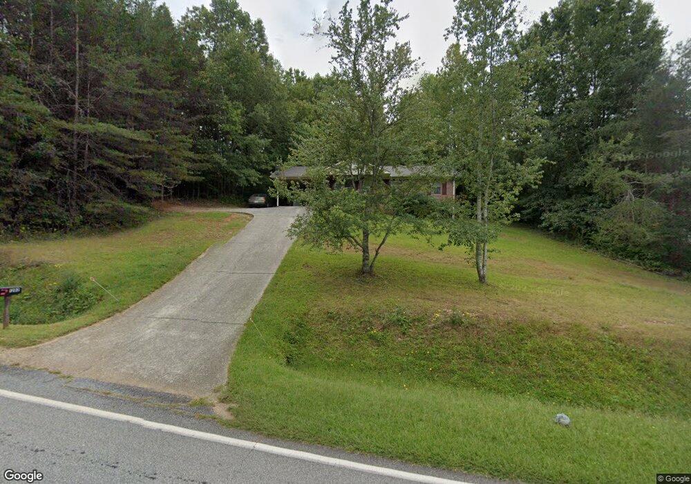
1282 Black Rd Cleveland, GA 30528
Estimated Value: $265,000 - $283,000
3
Beds
1
Bath
1,081
Sq Ft
$251/Sq Ft
Est. Value
About This Home
This home is located at 1282 Black Rd, Cleveland, GA 30528 and is currently estimated at $271,227, approximately $250 per square foot. 1282 Black Rd is a home located in White County with nearby schools including White County 9th Grade Academy, Tesnatee Gap Elementary (Old White County Intermediate), and Jack P. Nix Elementary School.
Ownership History
Date
Name
Owned For
Owner Type
Purchase Details
Closed on
May 1, 2007
Sold by
Not Provided
Bought by
Karn Michael C
Current Estimated Value
Home Financials for this Owner
Home Financials are based on the most recent Mortgage that was taken out on this home.
Original Mortgage
$94,500
Outstanding Balance
$57,043
Interest Rate
6.12%
Mortgage Type
New Conventional
Estimated Equity
$214,184
Purchase Details
Closed on
Jul 5, 2005
Sold by
Bank Of New York Trustee
Bought by
Sec Of Housing & Urban
Create a Home Valuation Report for This Property
The Home Valuation Report is an in-depth analysis detailing your home's value as well as a comparison with similar homes in the area
Home Values in the Area
Average Home Value in this Area
Purchase History
| Date | Buyer | Sale Price | Title Company |
|---|---|---|---|
| Karn Michael C | -- | -- | |
| Sec Of Housing & Urban | -- | -- | |
| Bank Of New York Trustee | -- | -- |
Source: Public Records
Mortgage History
| Date | Status | Borrower | Loan Amount |
|---|---|---|---|
| Open | Karn Michael C | $94,500 |
Source: Public Records
Tax History Compared to Growth
Tax History
| Year | Tax Paid | Tax Assessment Tax Assessment Total Assessment is a certain percentage of the fair market value that is determined by local assessors to be the total taxable value of land and additions on the property. | Land | Improvement |
|---|---|---|---|---|
| 2025 | $1,298 | $63,620 | $12,932 | $50,688 |
| 2024 | $1,298 | $62,328 | $11,640 | $50,688 |
| 2023 | $1,237 | $54,536 | $10,344 | $44,192 |
| 2022 | $1,120 | $47,220 | $9,052 | $38,168 |
| 2021 | $1,004 | $37,444 | $7,124 | $30,320 |
| 2020 | $964 | $34,236 | $6,616 | $27,620 |
| 2019 | $967 | $34,236 | $6,616 | $27,620 |
| 2018 | $967 | $34,236 | $6,616 | $27,620 |
| 2017 | $896 | $32,044 | $6,616 | $25,428 |
| 2016 | $897 | $32,044 | $6,616 | $25,428 |
| 2015 | $856 | $80,110 | $6,616 | $25,428 |
| 2014 | $796 | $74,360 | $0 | $0 |
Source: Public Records
Map
Nearby Homes
- 0 Black Rd Unit 7662078
- 0 Black Rd Unit 10620540
- 1021 Black Rd
- 79 Hampton Hills Ln
- 22 Laurel Park Dr
- 0 Highland Forest Rd Unit TRACT "2" 10559371
- 0 Highway 115 E Unit 10627896
- 841 Yonah Meadow Dr
- 338 Black Rd
- 164 Leatherford Rd
- 141 Willows Ct
- 675 Washboard Rd
- 31 Willows Ct
- 0 College View Dr Unit LOT 3 10541620
- 77 N Shore Dr
- 267 Pointe Willow Dr
- 171 Pointe Willow Dr
- 37 Stone Hearth Dr
- 96 Joyce Dr Unit (OFF AIRPORT ROAD)
- # 47 Chimney Ln
- 1304 Black Rd
- 1234 Black Rd
- 14 Canada Ln Unit D
- 0 Black Rd Unit 7063460
- 0 Black Rd Unit 7134344
- 0 Black Rd Unit 8188435
- 0 Black Rd Unit 8192218
- 0 Black Rd Unit 8267073
- 0 Black Rd Unit 8287965
- 0 Black Rd Unit 8648769
- 0 Black Rd Unit 8655379
- 0 Black Rd Unit 8539188
- 1208 Black Rd
- 798 Dock Dorsey Rd
- 1404 Black Rd
- 1217 Black Rd
- 79 Canada Ln
- 1193 Black Rd
- 47 Canada Ln Unit 10D
- 50 Canada Ln Unit D20