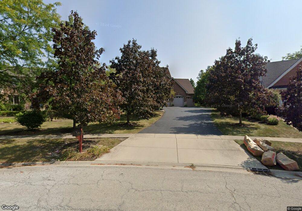
1282 Camelot Ln Lemont, IL 60439
Southeast Lemont NeighborhoodEstimated Value: $739,917 - $790,000
4
Beds
3
Baths
3,063
Sq Ft
$249/Sq Ft
Est. Value
About This Home
This home is located at 1282 Camelot Ln, Lemont, IL 60439 and is currently estimated at $761,639, approximately $248 per square foot. 1282 Camelot Ln is a home located in Cook County with nearby schools including Oakwood School, River Valley School, and Old Quarry Middle School.
Ownership History
Date
Name
Owned For
Owner Type
Purchase Details
Closed on
Apr 13, 1998
Sold by
Sabuda Henry and Sabuda Linda
Bought by
Konicki P John and Konicki Angela M
Current Estimated Value
Home Financials for this Owner
Home Financials are based on the most recent Mortgage that was taken out on this home.
Original Mortgage
$75,000
Interest Rate
7.27%
Create a Home Valuation Report for This Property
The Home Valuation Report is an in-depth analysis detailing your home's value as well as a comparison with similar homes in the area
Home Values in the Area
Average Home Value in this Area
Purchase History
| Date | Buyer | Sale Price | Title Company |
|---|---|---|---|
| Konicki P John | $100,500 | -- |
Source: Public Records
Mortgage History
| Date | Status | Borrower | Loan Amount |
|---|---|---|---|
| Closed | Konicki P John | $75,000 |
Source: Public Records
Tax History Compared to Growth
Tax History
| Year | Tax Paid | Tax Assessment Tax Assessment Total Assessment is a certain percentage of the fair market value that is determined by local assessors to be the total taxable value of land and additions on the property. | Land | Improvement |
|---|---|---|---|---|
| 2024 | $11,654 | $59,394 | $12,285 | $47,109 |
| 2023 | $10,190 | $65,000 | $12,285 | $52,715 |
| 2022 | $10,190 | $45,392 | $10,868 | $34,524 |
| 2021 | $9,899 | $45,391 | $10,867 | $34,524 |
| 2020 | $10,057 | $45,391 | $10,867 | $34,524 |
| 2019 | $8,734 | $41,191 | $10,867 | $30,324 |
| 2018 | $8,589 | $41,191 | $10,867 | $30,324 |
| 2017 | $9,647 | $46,425 | $10,867 | $35,558 |
| 2016 | $9,712 | $43,634 | $8,977 | $34,657 |
| 2015 | $9,827 | $43,634 | $8,977 | $34,657 |
| 2014 | $9,935 | $43,634 | $8,977 | $34,657 |
| 2013 | $10,100 | $47,062 | $8,977 | $38,085 |
Source: Public Records
Map
Nearby Homes
- 1249 Cronin Ct
- 14318 Mccarthy Rd
- 1297 Mccarthy Rd
- 1369 Notre Dame Dr
- 14517 Albany Ave
- 12652 Derby Rd
- 1216 Country Ln
- 12203 Walker Rd
- 1156 Covington Dr
- 12723 Caruso Ct
- 12744 Caruso Ct
- 12 Woodland Dr
- 13204 Derby Rd
- Fremont Plan at Covington Knolls
- Eden Plan at Covington Knolls
- Danbury Plan at Covington Knolls
- Calysta Plan at Covington Knolls
- Briarcliffe Plan at Covington Knolls
- Amberwood Plan at Covington Knolls
- 14151 131st St
- 1284 Camelot Ln
- 1280 Camelot Ln
- 1360 Castlewood Dr
- 1284 Drawbridge Ln
- 1356 Castlewood Dr
- 1288 Drawbridge Ln
- 1276 Camelot Ln
- 1277 Camelot Ln
- 1292 Drawbridge Ln
- 1273 Camelot Ln
- 1272 Camelot Ln
- 1287 Camelot Ln
- 1455 Castlewood Dr
- 1301 Castlewood Ct
- 1285 Drawbridge Ln
- 1289 Drawbridge Ln
- 1268 Camelot Ln
- 1269 Camelot Ln
- 1353 Castlewood Dr
- 1293 Drawbridge Ln