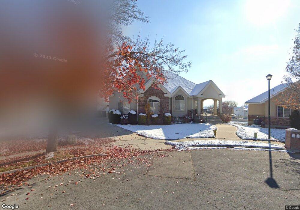
1282 E 530 N American Fork, UT 84003
Estimated Value: $673,000 - $993,000
5
Beds
4
Baths
4,468
Sq Ft
$187/Sq Ft
Est. Value
About This Home
This home is located at 1282 E 530 N, American Fork, UT 84003 and is currently estimated at $834,864, approximately $186 per square foot. 1282 E 530 N is a home located in Utah County with nearby schools including Barratt Elementary School, American Fork Junior High School, and American Fork High School.
Ownership History
Date
Name
Owned For
Owner Type
Purchase Details
Closed on
Oct 26, 2015
Sold by
Rollins Randy and Rollins Daryl
Bought by
Rollins Randy C and Revo Daryl O Rollins
Current Estimated Value
Purchase Details
Closed on
Sep 26, 2014
Sold by
Rollins Randy and Rollins Daryl
Bought by
Rollins Randy and Rollins Daryl
Home Financials for this Owner
Home Financials are based on the most recent Mortgage that was taken out on this home.
Original Mortgage
$297,430
Outstanding Balance
$227,939
Interest Rate
4.09%
Mortgage Type
Purchase Money Mortgage
Estimated Equity
$606,925
Purchase Details
Closed on
Jan 16, 2002
Sold by
Royce Worthington Homes Llc
Bought by
Metcalf M Frank and Metcalf Deanna
Home Financials for this Owner
Home Financials are based on the most recent Mortgage that was taken out on this home.
Original Mortgage
$190,000
Interest Rate
6.84%
Create a Home Valuation Report for This Property
The Home Valuation Report is an in-depth analysis detailing your home's value as well as a comparison with similar homes in the area
Home Values in the Area
Average Home Value in this Area
Purchase History
| Date | Buyer | Sale Price | Title Company |
|---|---|---|---|
| Rollins Randy C | -- | None Available | |
| Rollins Randy | -- | Richland Title Ins Agency | |
| Rollins Andy | -- | North American Title | |
| Metcalf M Frank | -- | -- |
Source: Public Records
Mortgage History
| Date | Status | Borrower | Loan Amount |
|---|---|---|---|
| Open | Rollins Andy | $297,430 | |
| Previous Owner | Metcalf M Frank | $190,000 |
Source: Public Records
Tax History
| Year | Tax Paid | Tax Assessment Tax Assessment Total Assessment is a certain percentage of the fair market value that is determined by local assessors to be the total taxable value of land and additions on the property. | Land | Improvement |
|---|---|---|---|---|
| 2025 | $3,618 | $419,100 | -- | -- |
| 2024 | $3,618 | $402,050 | $0 | $0 |
| 2023 | $3,419 | $402,710 | $0 | $0 |
| 2022 | $3,374 | $392,260 | $0 | $0 |
| 2021 | $2,963 | $538,000 | $192,100 | $345,900 |
| 2020 | $2,881 | $507,300 | $177,900 | $329,400 |
| 2019 | $2,743 | $499,700 | $170,300 | $329,400 |
| 2018 | $2,636 | $459,100 | $155,200 | $303,900 |
| 2017 | $2,642 | $248,325 | $0 | $0 |
| 2016 | $2,623 | $229,075 | $0 | $0 |
| 2015 | -- | $226,985 | $0 | $0 |
| 2014 | $2,649 | $216,535 | $0 | $0 |
Source: Public Records
Map
Nearby Homes
- 1121 E 580 N
- 462 N 950 E Unit 5
- 912 E Ellens St Unit 1
- 1289 W 1670 N
- 322 N 900 E
- 1897 N 900 W
- 980 W 1800 N
- 837 E 475 N
- 1427 Narra Place
- 1045 N 930 E Unit 58
- 1609 N 900 W
- 1125 N 1270 E
- 1058 N 930 E Unit 64
- 681 W 2760 N
- 1077 N 950 E
- 1089 N 950 E
- 1365 N 990 W
- 674 W 1590 N Unit 11
- 1578 N 750 W Unit 15
- 1434 N 840 W
Your Personal Tour Guide
Ask me questions while you tour the home.