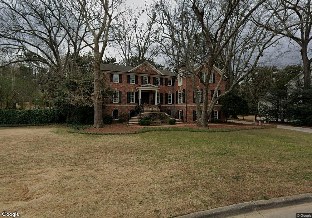
1282 Hanover West Dr NW Unit 1 Atlanta, GA 30327
Cross Creek NeighborhoodEstimated Value: $1,496,000 - $2,009,000
4
Beds
2
Baths
4,552
Sq Ft
$394/Sq Ft
Est. Value
About This Home
This home is located at 1282 Hanover West Dr NW Unit 1, Atlanta, GA 30327 and is currently estimated at $1,792,307, approximately $393 per square foot. 1282 Hanover West Dr NW Unit 1 is a home located in Fulton County with nearby schools including Brandon Elementary School, Sutton Middle School, and North Atlanta High School.
Ownership History
Date
Name
Owned For
Owner Type
Purchase Details
Closed on
Sep 26, 2000
Sold by
Kelly David R and Kelly Barbara M
Bought by
Nolen Richard M and Nolen Alice M
Current Estimated Value
Home Financials for this Owner
Home Financials are based on the most recent Mortgage that was taken out on this home.
Original Mortgage
$550,000
Outstanding Balance
$201,152
Interest Rate
7.96%
Mortgage Type
New Conventional
Estimated Equity
$1,591,155
Purchase Details
Closed on
Aug 6, 1997
Sold by
Mattingly George A and Mattingly Constance
Bought by
Kelly David R
Home Financials for this Owner
Home Financials are based on the most recent Mortgage that was taken out on this home.
Original Mortgage
$227,500
Interest Rate
7%
Mortgage Type
New Conventional
Create a Home Valuation Report for This Property
The Home Valuation Report is an in-depth analysis detailing your home's value as well as a comparison with similar homes in the area
Home Values in the Area
Average Home Value in this Area
Purchase History
| Date | Buyer | Sale Price | Title Company |
|---|---|---|---|
| Nolen Richard M | $650,000 | -- | |
| Kelly David R | $386,800 | -- |
Source: Public Records
Mortgage History
| Date | Status | Borrower | Loan Amount |
|---|---|---|---|
| Open | Nolen Richard M | $550,000 | |
| Previous Owner | Kelly David R | $227,500 |
Source: Public Records
Tax History Compared to Growth
Tax History
| Year | Tax Paid | Tax Assessment Tax Assessment Total Assessment is a certain percentage of the fair market value that is determined by local assessors to be the total taxable value of land and additions on the property. | Land | Improvement |
|---|---|---|---|---|
| 2025 | $13,104 | $604,400 | $158,960 | $445,440 |
| 2023 | $19,625 | $474,040 | $101,280 | $372,760 |
| 2022 | $16,624 | $474,040 | $101,280 | $372,760 |
| 2021 | $12,097 | $474,040 | $101,280 | $372,760 |
| 2020 | $12,238 | $337,320 | $66,040 | $271,280 |
| 2019 | $506 | $337,320 | $66,040 | $271,280 |
| 2018 | $12,786 | $549,440 | $66,040 | $483,400 |
| 2017 | $13,325 | $337,320 | $50,760 | $286,560 |
| 2016 | $12,769 | $334,400 | $50,760 | $283,640 |
| 2015 | $13,353 | $334,400 | $50,760 | $283,640 |
| 2014 | $13,271 | $334,400 | $50,760 | $283,640 |
Source: Public Records
Map
Nearby Homes
- 13 Chaumont Square NW
- 94 Rosaire Place NW
- 115 Rosaire Place NW
- 143 Amherst Place NW
- 61 Lamsden Ln NW
- 73 Montre Square NW
- 28 Glenald Way NW
- 5 Cantey Place NW
- 29 Chaumont Square NW
- 27 Chaumont Square NW Unit 27
- 30 Chaumont Square NW Unit 30
- 8 Cantey Place NW
- 68 Montre Square NW
- 2316 Defoors Ferry Rd NW
- 1356 Peachtree Battle Ave NW
- 45 Glenald Way NW
- 2412 Bohler Rd NW
- 1294 Hanover West Dr NW
- 0 Bohler Rd NW Unit 7328620
- 0 Bohler Rd NW Unit 7058223
- 0 Bohler Rd NW Unit 7020560
- 0 Bohler Rd NW Unit 3285473
- 0 Bohler Rd NW Unit 7003808
- 0 Bohler Rd NW Unit 3248310
- 0 Bohler Rd NW Unit 3150480
- 0 Bohler Rd NW Unit 7411717
- 0 Bohler Rd NW Unit 7174793
- 0 Bohler Rd NW Unit 8586953
- 0 Bohler Rd NW Unit 8576713
- 0 Bohler Rd NW Unit 8325999
- 0 Bohler Rd NW Unit 8770313
- 0 Bohler Rd NW Unit 7539591
- 0 Bohler Rd NW Unit 7060050
- 0 Bohler Rd NW Unit 8270865
- 0 Bohler Rd NW Unit 8085364
- 0 Bohler Rd NW Unit 3245678