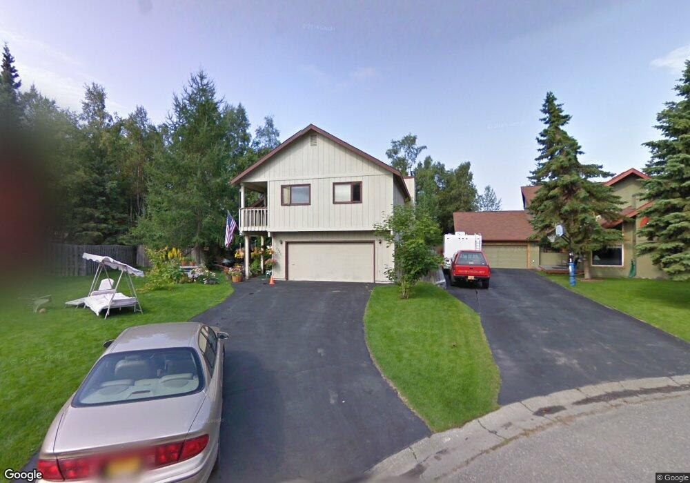
12820 Huffman Cir Anchorage, AK 99516
Huffman-O'Malley NeighborhoodEstimated Value: $403,000 - $547,000
4
Beds
3
Baths
2,082
Sq Ft
$235/Sq Ft
Est. Value
About This Home
This home is located at 12820 Huffman Cir, Anchorage, AK 99516 and is currently estimated at $488,402, approximately $234 per square foot. 12820 Huffman Cir is a home located in Anchorage Municipality with nearby schools including Huffman Elementary School, Goldenview Middle School, and South Anchorage High School.
Ownership History
Date
Name
Owned For
Owner Type
Purchase Details
Closed on
Nov 26, 2012
Sold by
Elkins Craig J and Forrest Elkins Cynthia L
Bought by
Elkins Craig J and Forrest Elkins Cynthia L
Current Estimated Value
Home Financials for this Owner
Home Financials are based on the most recent Mortgage that was taken out on this home.
Original Mortgage
$216,500
Outstanding Balance
$149,716
Interest Rate
3.33%
Mortgage Type
New Conventional
Estimated Equity
$338,686
Purchase Details
Closed on
Oct 19, 1992
Sold by
Westhoff Stephen P and Westhoff Elaine A
Bought by
Elkins Craig J and Elkins Cynthia L
Home Financials for this Owner
Home Financials are based on the most recent Mortgage that was taken out on this home.
Original Mortgage
$147,100
Interest Rate
7.93%
Mortgage Type
New Conventional
Create a Home Valuation Report for This Property
The Home Valuation Report is an in-depth analysis detailing your home's value as well as a comparison with similar homes in the area
Home Values in the Area
Average Home Value in this Area
Purchase History
| Date | Buyer | Sale Price | Title Company |
|---|---|---|---|
| Elkins Craig J | -- | Auta | |
| Elkins Craig J | -- | -- |
Source: Public Records
Mortgage History
| Date | Status | Borrower | Loan Amount |
|---|---|---|---|
| Open | Elkins Craig J | $216,500 | |
| Closed | Elkins Craig J | $147,100 |
Source: Public Records
Tax History Compared to Growth
Tax History
| Year | Tax Paid | Tax Assessment Tax Assessment Total Assessment is a certain percentage of the fair market value that is determined by local assessors to be the total taxable value of land and additions on the property. | Land | Improvement |
|---|---|---|---|---|
| 2025 | $3,395 | $460,800 | $125,100 | $335,700 |
| 2024 | $3,395 | $435,300 | $125,100 | $310,200 |
| 2023 | $6,887 | $404,400 | $125,100 | $279,300 |
| 2022 | $3,006 | $378,500 | $125,100 | $253,400 |
| 2021 | $6,523 | $362,000 | $125,100 | $236,900 |
| 2020 | $5,313 | $362,800 | $125,100 | $237,700 |
| 2019 | $5,054 | $358,900 | $125,100 | $233,800 |
| 2018 | $4,930 | $350,600 | $125,100 | $225,500 |
| 2017 | $5,110 | $346,300 | $125,100 | $221,200 |
| 2016 | $4,523 | $362,700 | $125,100 | $237,600 |
| 2015 | $4,523 | $347,700 | $125,100 | $222,600 |
| 2014 | $4,523 | $325,400 | $119,900 | $205,500 |
Source: Public Records
Map
Nearby Homes
- 2020 Steeple Dr
- 2048 Meander Dr
- 2701 Kempton Hills Dr
- 13105 Stephenson St
- 2521 Winterchase Cir
- 12283 Timberwood Cir
- 13322 Diggins Dr
- 13530 Westwind Dr
- 13481 Baywind Dr
- 2000 Jarvis Ave
- 1677 Circlewood Dr
- 3040 Chesapeake Cir
- 3025 Huffman Rd
- 12241 Gander St
- 13103 Brandon St Unit 14
- 13351 Venus Way
- 13540 Seachant Cir
- 12496 Silver Fox Ln Unit 6
- 12101 Wagner St
- 000 Wagner St
- 12830 Huffman Cir
- 12810 Huffman Cir
- 12821 Silver Spruce Dr
- 12800 Huffman Cir
- 12831 Silver Spruce Dr
- 12811 Silver Spruce Dr
- 2201 Steeple Dr
- 12840 Huffman Cir
- 12841 Silver Spruce Dr
- 12801 Silver Spruce Dr
- 12801 Huffman Cir
- 12831 Huffman Cir
- 12821 Huffman Cir
- 2101 Steeple Dr
- 12751 Silver Spruce Dr
- 12841 Huffman Cir
- 12811 Huffman Cir
- 2330 Loren Cir
- 2241 Steeple Dr
- 2320 Loren Cir