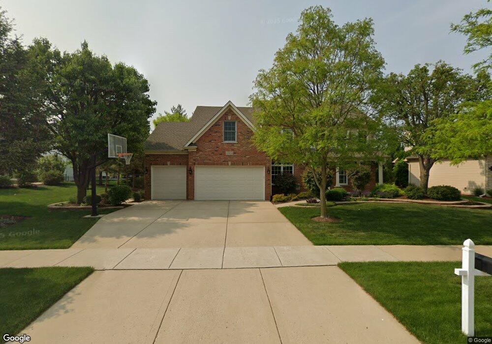
12828 Waterford Blvd Unit 1 Plainfield, IL 60585
North Plainfield NeighborhoodEstimated Value: $631,964 - $771,000
--
Bed
--
Bath
3,597
Sq Ft
$192/Sq Ft
Est. Value
About This Home
This home is located at 12828 Waterford Blvd Unit 1, Plainfield, IL 60585 and is currently estimated at $690,491, approximately $191 per square foot. 12828 Waterford Blvd Unit 1 is a home located in Will County with nearby schools including Eagle Pointe Elementary School, Heritage Grove Middle School, and Plainfield North High School.
Ownership History
Date
Name
Owned For
Owner Type
Purchase Details
Closed on
Aug 13, 2004
Sold by
Checkmate Custom Homes Inc
Bought by
Abbott Michael J and Abbott Robin A
Current Estimated Value
Home Financials for this Owner
Home Financials are based on the most recent Mortgage that was taken out on this home.
Original Mortgage
$160,000
Interest Rate
6.35%
Mortgage Type
Purchase Money Mortgage
Create a Home Valuation Report for This Property
The Home Valuation Report is an in-depth analysis detailing your home's value as well as a comparison with similar homes in the area
Home Values in the Area
Average Home Value in this Area
Purchase History
| Date | Buyer | Sale Price | Title Company |
|---|---|---|---|
| Abbott Michael J | $400,500 | Chicago Title Insurance Co |
Source: Public Records
Mortgage History
| Date | Status | Borrower | Loan Amount |
|---|---|---|---|
| Previous Owner | Abbott Michael J | $160,000 |
Source: Public Records
Tax History Compared to Growth
Tax History
| Year | Tax Paid | Tax Assessment Tax Assessment Total Assessment is a certain percentage of the fair market value that is determined by local assessors to be the total taxable value of land and additions on the property. | Land | Improvement |
|---|---|---|---|---|
| 2024 | $14,635 | $217,091 | $40,920 | $176,171 |
| 2023 | $14,635 | $191,776 | $36,148 | $155,628 |
| 2022 | $13,647 | $154,493 | $34,194 | $120,299 |
| 2021 | $11,466 | $147,136 | $32,566 | $114,570 |
| 2020 | $11,460 | $144,805 | $32,050 | $112,755 |
| 2019 | $11,290 | $140,724 | $31,147 | $109,577 |
| 2018 | $12,079 | $147,253 | $30,462 | $116,791 |
| 2017 | $12,022 | $143,452 | $29,676 | $113,776 |
| 2016 | $12,054 | $140,364 | $29,037 | $111,327 |
| 2015 | $11,182 | $134,965 | $27,920 | $107,045 |
| 2014 | $11,182 | $126,095 | $27,920 | $98,175 |
| 2013 | $11,182 | $126,095 | $27,920 | $98,175 |
Source: Public Records
Map
Nearby Homes
- 12820 Tipperary Ln
- 12805 Tipperary Ln
- 12929 Tipperary Ln Unit 1
- 12946 S Sydney Cir
- 12942 S Sydney Cir
- 24708 W Owen Ct
- 12850 S Harry Cir
- 12962 S Sydney Cir
- 24638 W Alexis Ln
- 24634 W Alexis Ln
- 12854 S Sydney Cir
- 12938 S Beckham Dr
- 12942 S Beckham Dr
- 24618 W Alexis Ln
- 24725 Hanover Ct
- 12906 S Sydney Cir
- 24558 W Alexis Ln
- Duncan Plan at Bronk Farm - Townes Series
- Bowman Plan at Bronk Farm - Townes Series
- Ashton Plan at Bronk Farm - Townes Series
- 12822 Waterford Blvd Unit 1
- 12837 Tipperary Ln
- 12833 Tipperary Ln
- 12816 Waterford Blvd
- 12826 Wexford Dr Unit 1
- 12829 Tipperary Ln
- 12822 Wexford Dr Unit 1
- 12833 Waterford Blvd
- 12827 Waterford Blvd Unit 1
- 12808 Waterford Blvd
- 12823 Waterford Blvd Unit 1
- 12825 Tipperary Ln
- 12818 Wexford Dr
- 12819 Waterford Blvd
- 12832 Tipperary Ln
- 12905 Tipperary Ln
- 12828 Tipperary Ln
- 12821 Tipperary Ln
- 12814 Wexford Dr
- 12910 Waterford Ct Unit 1