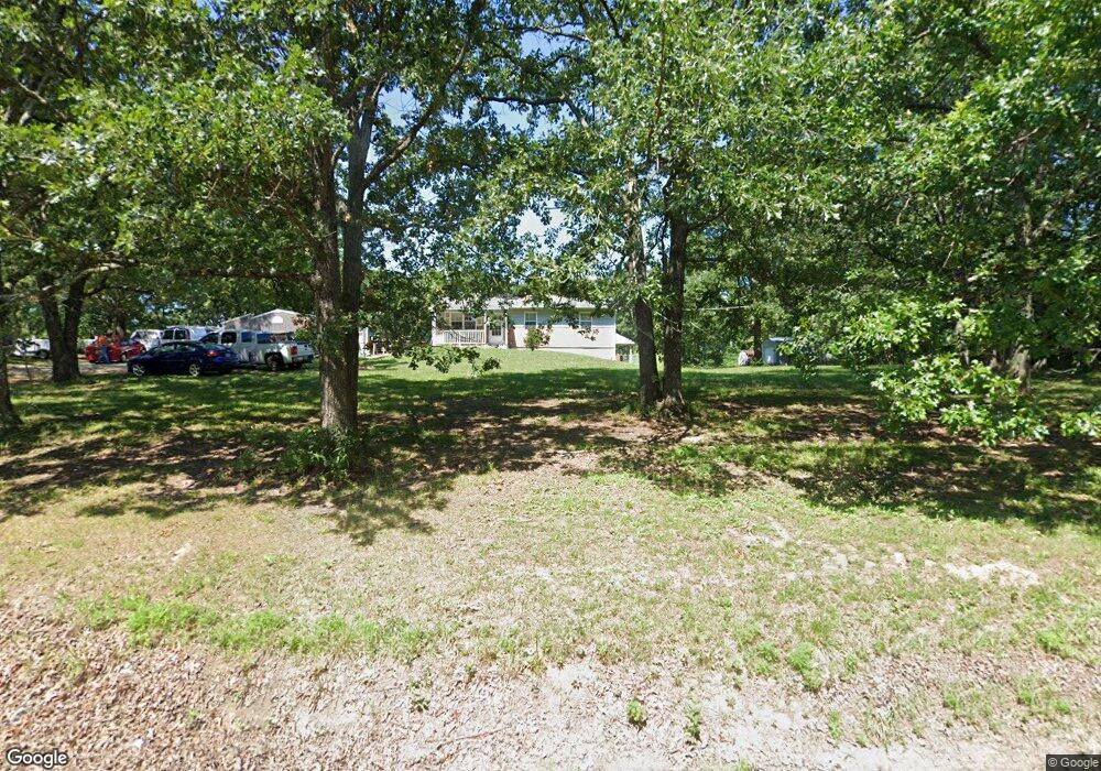
12829 Maness Rd de Soto, MO 63020
Estimated Value: $182,000 - $266,000
--
Bed
--
Bath
2,400
Sq Ft
$97/Sq Ft
Est. Value
About This Home
This home is located at 12829 Maness Rd, de Soto, MO 63020 and is currently estimated at $232,114, approximately $96 per square foot. 12829 Maness Rd is a home located in Jefferson County with nearby schools including De Soto Senior High School.
Ownership History
Date
Name
Owned For
Owner Type
Purchase Details
Closed on
Feb 14, 2007
Sold by
Ferguson Robert A and Ferguson Rosetta
Bought by
Buckner Mark S and Buckner Jennifer J
Current Estimated Value
Home Financials for this Owner
Home Financials are based on the most recent Mortgage that was taken out on this home.
Original Mortgage
$139,000
Outstanding Balance
$83,301
Interest Rate
6.17%
Mortgage Type
Purchase Money Mortgage
Estimated Equity
$148,813
Purchase Details
Closed on
Nov 15, 2002
Sold by
Craig Scott J and Craig Julie M
Bought by
Ferguson Robert A and Ferguson Rosetta
Home Financials for this Owner
Home Financials are based on the most recent Mortgage that was taken out on this home.
Original Mortgage
$95,000
Interest Rate
5.89%
Create a Home Valuation Report for This Property
The Home Valuation Report is an in-depth analysis detailing your home's value as well as a comparison with similar homes in the area
Home Values in the Area
Average Home Value in this Area
Purchase History
| Date | Buyer | Sale Price | Title Company |
|---|---|---|---|
| Buckner Mark S | -- | Commonwealth Land Title | |
| Ferguson Robert A | -- | Commonwealth Land Title |
Source: Public Records
Mortgage History
| Date | Status | Borrower | Loan Amount |
|---|---|---|---|
| Open | Buckner Mark S | $139,000 | |
| Previous Owner | Ferguson Robert A | $95,000 |
Source: Public Records
Tax History Compared to Growth
Tax History
| Year | Tax Paid | Tax Assessment Tax Assessment Total Assessment is a certain percentage of the fair market value that is determined by local assessors to be the total taxable value of land and additions on the property. | Land | Improvement |
|---|---|---|---|---|
| 2025 | $1,067 | $17,700 | $1,600 | $16,100 |
| 2024 | $1,067 | $15,400 | $1,600 | $13,800 |
| 2023 | $1,067 | $15,400 | $1,600 | $13,800 |
| 2022 | $1,063 | $15,400 | $1,600 | $13,800 |
| 2021 | $1,062 | $15,400 | $1,600 | $13,800 |
| 2020 | $981 | $13,800 | $1,400 | $12,400 |
| 2019 | $902 | $12,700 | $1,400 | $11,300 |
| 2018 | $901 | $12,700 | $1,400 | $11,300 |
| 2017 | $856 | $12,700 | $1,400 | $11,300 |
| 2016 | $802 | $11,700 | $1,400 | $10,300 |
| 2015 | $719 | $11,700 | $1,400 | $10,300 |
| 2013 | $719 | $11,300 | $1,200 | $10,100 |
Source: Public Records
Map
Nearby Homes
- 12658 Dry Creek Rd
- 13160 Mammoth Rd
- 430 Dodson Ln
- 6471 State Road H
- 12219 Peter Moore Ln
- 1805 Greg Dr
- 1645 Brandywine Dr
- 1650 Brandywine Dr
- 609 Devonshire Ln
- 613 Devonshire Ln
- 12711 Dude Ln
- 6230 Big River Heights Rd
- 6734 Breckenridge Farms Rd
- 176 Briarwood Terrace
- 150 Dubuque Ln
- 109 Lakeshore Dr
- 121 Briarwood Terrace
- 1444 Yellow Rock Rd
- 1601 Hawkwood Trail
- 1600 Hawkwood Trail
- 12841 Maness Rd
- 12817 Maness Rd
- 12853 Maness Rd
- 12816 Maness Rd
- 12865 Maness Rd
- 12901 Maness Rd
- 12852 Maness Rd
- 12805 Maness Rd
- 12931 Maness Rd
- 12768 Maness Rd
- 12918 Maness Rd
- 12740 Maness Rd
- 12943 Maness Rd
- 5781 State Road H
- 5769 State Road H
- 12961 Maness Rd
- 5780 State Road H
- 5763 State Road H
- 12733 Maness Rd
- 5751 State Road H