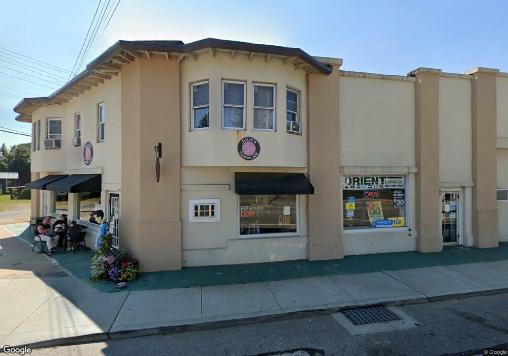
1283 Boston Post Rd Westbrook, CT 06498
Estimated Value: $644,897
--
Bed
1
Bath
7,375
Sq Ft
$87/Sq Ft
Est. Value
About This Home
This home is located at 1283 Boston Post Rd, Westbrook, CT 06498 and is currently estimated at $644,897, approximately $87 per square foot. 1283 Boston Post Rd is a home located in Middlesex County with nearby schools including Daisy Ingraham School, Westbrook Middle School, and Westbrook High School.
Ownership History
Date
Name
Owned For
Owner Type
Purchase Details
Closed on
Jul 17, 2020
Sold by
Pettis Valerie E
Bought by
1283 Boston Post Rd Llc
Current Estimated Value
Purchase Details
Closed on
Apr 20, 2006
Sold by
S & S Hldgs Llc
Bought by
Pettis Valerie
Purchase Details
Closed on
Dec 13, 1995
Sold by
New Haven Sb
Bought by
Sowamco Xx Ltd
Create a Home Valuation Report for This Property
The Home Valuation Report is an in-depth analysis detailing your home's value as well as a comparison with similar homes in the area
Home Values in the Area
Average Home Value in this Area
Purchase History
| Date | Buyer | Sale Price | Title Company |
|---|---|---|---|
| 1283 Boston Post Rd Llc | -- | None Available | |
| Pettis Valerie | $410,000 | -- | |
| Sowamco Xx Ltd | $104,000 | -- |
Source: Public Records
Tax History Compared to Growth
Tax History
| Year | Tax Paid | Tax Assessment Tax Assessment Total Assessment is a certain percentage of the fair market value that is determined by local assessors to be the total taxable value of land and additions on the property. | Land | Improvement |
|---|---|---|---|---|
| 2025 | $5,627 | $250,075 | $141,540 | $108,535 |
| 2024 | $5,427 | $250,075 | $141,540 | $108,535 |
| 2023 | $5,332 | $250,075 | $141,540 | $108,535 |
| 2022 | $6,061 | $291,950 | $141,540 | $150,410 |
| 2021 | $5,207 | $208,280 | $110,890 | $97,390 |
| 2020 | $5,207 | $208,280 | $110,890 | $97,390 |
| 2019 | $5,138 | $208,280 | $110,890 | $97,390 |
| 2018 | $5,076 | $208,280 | $110,890 | $97,390 |
| 2017 | $5,076 | $208,280 | $110,890 | $97,390 |
| 2016 | $5,314 | $229,650 | $111,830 | $117,820 |
| 2015 | $5,169 | $229,650 | $111,830 | $117,820 |
| 2014 | $5,004 | $229,650 | $111,830 | $117,820 |
Source: Public Records
Map
Nearby Homes
- 41 Trolley Rd
- 29 Salt Island Rd
- 166 Fiske Ln
- 155 Fawn Hill Dr
- 49 Seaside Ave
- 912 Boston Post Rd
- 1110 Old Clinton Rd
- 11a/11b Pond Circle Rd
- 30 Dowd Rd
- 610 Marina Way Landing Unit 610
- 951 Old Clinton Rd Unit 15
- 8 Cook Terrace
- 87 McVeagh Rd
- 0 Boston Post Rd Unit 24080344
- 254 Hidden Cove Rd
- 821 Essex Rd
- 118 Sandy Point Rd
- 14 Denmore Ln
- 96 Chalker Beach Rd
- 1 Clark Ave
- 1285 Boston Post Rd
- 7 Trolley Rd
- 1280 Boston Post Rd
- 13 Salt Island Rd
- 27 Salt Island Rd
- 1257 Boston Post Rd
- 1306 Boston Post Rd Unit 3
- 1306 Boston Post Rd Unit 2
- 1306 Boston Post Rd
- 1296 Boston Post Rd
- 1306 Boston Post Rd Unit 1296
- 40 Trolley Rd
- 21 Salt Island Rd
- 1266 Boston Post Rd
- 1266 Boston Post Rd Unit 3
- 1266 Boston Post Rd Unit 5
- 1266 Boston Post Rd Unit 5 & 6
- 1260 Boston Post Rd
- 51 Trolley Rd
- 33 Salt Island Rd