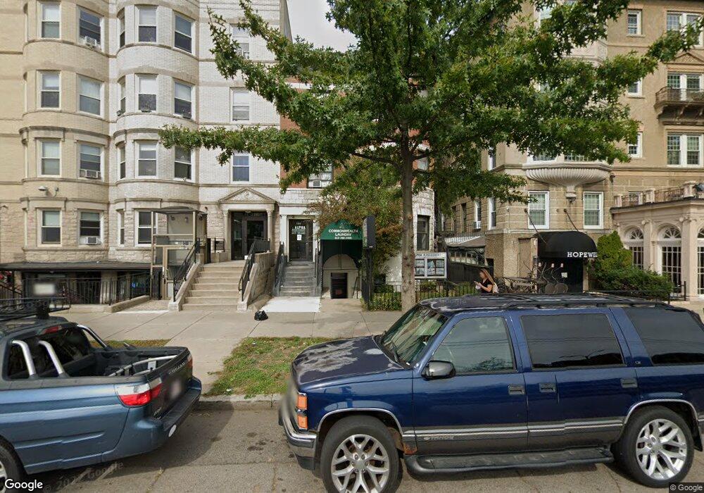
1283 Commonwealth Ave Allston, MA 02134
Commonwealth NeighborhoodEstimated Value: $2,617,695
2
Beds
--
Bath
9,999
Sq Ft
$262/Sq Ft
Est. Value
About This Home
This home is located at 1283 Commonwealth Ave, Allston, MA 02134 and is currently estimated at $2,617,695, approximately $261 per square foot. 1283 Commonwealth Ave is a home located in Suffolk County with nearby schools including Match Charter Public School and Boston Green Academy Horace Mann Charter School.
Ownership History
Date
Name
Owned For
Owner Type
Purchase Details
Closed on
Dec 13, 2004
Sold by
Mass Phoenix T
Bought by
Nora Llc
Current Estimated Value
Create a Home Valuation Report for This Property
The Home Valuation Report is an in-depth analysis detailing your home's value as well as a comparison with similar homes in the area
Home Values in the Area
Average Home Value in this Area
Purchase History
| Date | Buyer | Sale Price | Title Company |
|---|---|---|---|
| Nora Llc | $1,185,000 | -- |
Source: Public Records
Mortgage History
| Date | Status | Borrower | Loan Amount |
|---|---|---|---|
| Previous Owner | Nora Llc | $35,000 |
Source: Public Records
Property History
| Date | Event | Price | List to Sale | Price per Sq Ft |
|---|---|---|---|---|
| 02/10/2025 02/10/25 | Off Market | $3,200 | -- | -- |
| 01/14/2025 01/14/25 | For Rent | -- | -- | -- |
| 11/01/2024 11/01/24 | For Rent | $1,875 | -41.4% | -- |
| 10/08/2024 10/08/24 | Off Market | $3,200 | -- | -- |
| 10/08/2024 10/08/24 | Off Market | $1,875 | -- | -- |
| 10/08/2024 10/08/24 | Off Market | $3,200 | -- | -- |
| 10/08/2024 10/08/24 | Off Market | $3,200 | -- | -- |
| 09/01/2024 09/01/24 | For Rent | $3,200 | 0.0% | -- |
| 09/01/2024 09/01/24 | For Rent | $3,200 | 0.0% | -- |
| 08/31/2024 08/31/24 | For Rent | $3,200 | -- | -- |
Tax History Compared to Growth
Tax History
| Year | Tax Paid | Tax Assessment Tax Assessment Total Assessment is a certain percentage of the fair market value that is determined by local assessors to be the total taxable value of land and additions on the property. | Land | Improvement |
|---|---|---|---|---|
| 2025 | -- | $1,569,400 | $372,800 | $1,196,600 |
| 2024 | -- | $1,590,800 | $372,800 | $1,218,000 |
| 2023 | $0 | $1,638,000 | $372,800 | $1,265,200 |
| 2022 | $0 | $1,456,900 | $372,800 | $1,084,100 |
| 2021 | $0 | $1,440,900 | $295,600 | $1,145,300 |
| 2020 | $0 | $1,366,000 | $295,600 | $1,070,400 |
| 2019 | $0 | $1,314,000 | $295,600 | $1,018,400 |
| 2018 | $0 | $1,254,500 | $283,200 | $971,300 |
| 2017 | $0 | $1,203,000 | $271,000 | $932,000 |
| 2016 | -- | $1,073,000 | $250,400 | $822,600 |
| 2015 | -- | $910,500 | $328,400 | $582,100 |
| 2014 | -- | $832,000 | $279,100 | $552,900 |
Source: Public Records
Map
Nearby Homes
- 69 Quint Ave Unit 7
- 14 Radcliffe Rd Unit 1
- 30 Glenville Ave Unit 1
- 1269 Commonwealth Ave Unit 5
- 53 Quint Ave
- 20 Radcliffe Rd Unit 209
- 86 Glenville Ave Unit 2
- 21 Park Vale Ave Unit 2
- 16 Royce Rd Unit 4
- 130 Glenville Ave
- 15 Walbridge St Unit 3
- 1411 Commonwealth Ave Unit 303
- 1411 Commonwealth Ave Unit 504
- 28 Verndale St
- 1404 Commonwealth Ave Unit 4-8
- 1408 Commonwealth Ave Unit 20
- 140 Columbia St Unit 1
- 88 Gordon St Unit 305
- 152-156 Kelton St
- 194 Allston St Unit 2
- 1283 Commonwealth Ave Unit 1
- 1283 Commonwealth Ave Unit 711
- 1283 Commonwealth Ave Unit 7B
- 1283 Commonwealth Ave
- 1283 Commonwealth Ave Unit 8B
- 1283 Commonwealth Ave Unit 6B
- 1283 Commonwealth Ave Unit 1283
- 1283 Commonwealth Ave Unit 5
- 1283 Commonwealth Ave Unit 3
- 1283 Commonwealth Ave Unit 2
- 1283 Commonwealth Ave Unit 4
- 1285 Commonwealth Ave
- 1287 Commonwealth Ave
- 1277 Commonwealth Ave
- 1277 Commonwealth Ave Unit 302
- 1277 Commonwealth Ave Unit 412
- 1277 Commonwealth Ave Unit 112
- 1277 Commonwealth Ave Unit 307
- 1277 Commonwealth Ave Unit 110
- 1277 Commonwealth Ave Unit 201